Old maps of Southeast Asia
Southeast Asia
Title: India Orientalis
Artist: Ptolemaeus, Claudius
Published: Galignani, P & F., Padua
Date: 1621
Size: [ca. 31 x 21 (text sheet) cm]
Technic: Copper-engraving / Uncolored
Description: Fine copper-engraved map, printed into the full text page, published in 'Geografia ... Universale de la Terra', which was translated by Cernoti and published 1621 in Padua.
Notes: A very good impression, in excellent condition.
Condition: Excellent

| East Indies Title: India Orientalis Artist: Mercator, Gerard Published: Amsterdam, I.E. Cloppenburgh, Date: 1632 Size: [19 x 26 cm] Technic: Copper engraving / Uncolored Description: Copper engraving, uncolored as published. A fine copy in a dark impression, full margins as published. This is the first so-called Cloppenburgh editions which was a competive edition with new engraved maps in a larger format. Most of the maps were engraved by Pieter van den Keere. The Cloppenburgh edition was continued for a couple of years but seems to have been suppressed after 1636 ... . This is another Cloppenburgh edition, now with Latin text. The maps from the Appendix have been incorporated. The title-page is followed by a dedication to Prince Frederik Hendrik, dated 1632 and signed by Johannes Cloppenburgh. (Koeman Atlantes Neerlandici). Notes: In excellent condition. Condition: Excellent Reference: Koeman, ME 200 |
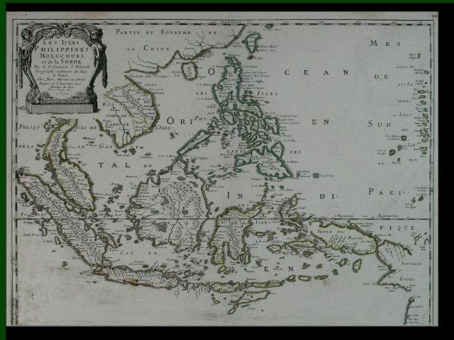
Title: Isole Dell' Indie, divise in Filippine, Molucche, e della Sonda, Descritte, e Dedicate Dal P. Coronelli ...
Artist: Coronelli, Vincenzo Maria
Published: Venice, V. Coronelli
Date: 1689
Size: [45 x 60 cm]
Technic: Copper-engraving / Uncolored
Description: Fine copper-engraving, uncolored as published. Large and detailled engraved map showing Southeast Asia from the Andaman Sea with Thailand in the northwest towards the northwestern coast of Australia (Nuova Hollanda) in the southeast. The map itself covers Sumatra, Borneo, the Philipines and other places in Southeast Asia very accurately. The map was published in Coronelli's 'Atlante Veneto'. It is ornated with a decorative title cartouche showing (sea)-cherubs holding a coat of arm. The title cartouche contains as well the dedication to the Venice royal house. In the upper right corner we find another decorative cartouche with a mileage scale. The engraving contains many details like small villages or cities, rivers, mountains and details on the coast line with its small islands and its bays.
Notes: A strong impression in excellent condition.

Southeast Asia
Title: Isole Dell' Indie, divise in Filippine, Molucche, e della Sonda, Descritte, e Dedicate Dal P. Coronelli ...
Artist: Coronelli, Vincenzo Maria
Published: Venice, V. Coronelli
Date: 1689
Size: [45 x 60 cm]
Technic: Copper-engraving / Uncolored
Description: Fine copper-engraving, uncolored as published. Large and detailled engraved map showing Southeast Asia from the Andaman Sea with Thailand in the northwest towards the northwestern coast of Australia (Nuova Hollanda) in the southeast. The map itself covers Sumatra, Borneo, the Philipines and other places in Southeast Asia very accurately. The map was published in Coronelli's 'Atlante Veneto'. It is ornated with a decorative title cartouche showing (sea)-cherubs holding a coat of arm. The title cartouche contains as well the dedication to the Venice royal house. In the upper right corner we find another decorative cartouche with a mileage scale. The engraving contains many details like small villages or cities, rivers, mountains and details on the coast line with its small islands and its bays.
Notes: A strong impression in excellent condition.

| Title: D'Oost-Indize landschappen, zeen en eylanden, door de Portugysen en anderen ontdekt en bevaren. Artist: Van der Aa, Pieter Published: Leiden, Van der Aa Date: 1706-08 Size: [15,5 x 28 cm] Technic: Copper-engraving / Uncolored Description: Original copper-engraving, uncoloured as published. The famous Dutch publisher and mapmaker Pieter Van der Aa (1659 Leiden - 1733 Leiden) published 'during the period 1882-1733, an enormous quantity of printed matter' (Koeman). This map was actually published in the first edition of his travelbooks 'Naauwkeurige versameling der gedenk-waardigste zee en landreysen na Oost en West-Indien', in Leiden 1706-08. Notes: 2nd state of this map, with the engraved 'Privilege' below the lower borderline. Still a good and acceptable copy. On the full sheet as published, however minor cut within the upper engraved borderline. The map was originally folded in this series, so that old folds are more or less visable. Condition: Excellent |

|

Sunda Islands
Title: Die Inselen von Sont gegen Orient. - Isles dela Sonde vers l'Orient.
Artist: Mallet, Allain Manesson
Published: Frankfurt,
Date: 1719
Size: [ca. 15 x 11 cm]
Technic: Copper engraving / later handcolor
Description: Copper-engraving, handcolored in wash and outline. Small and decorative map of the Sunda Islands (Celebes, Timor, Banda, Ceran, etc.) with the neighbouring Borneo, Phillipines and Papua seen again East.
Notes: In excellent condition.
Condition: Excellent

East Indies
Title: Charte von Ostindien Diesseits und Jenseits des Ganges nach den neuesten astronom. Beobachtungen auch andern sichern Huelfsmitteln neu entworfen und nach der lezten Zertheilung des Mysorischen Reichs berichtiget von I.C.M. Reinecke. Weimar im Verlage des Geograph. Instituts. revidirt im Aug. 1804.
Artist: Reinecke, I.C.M.
Published: Weimar, Geographisches Institut
Date: 1804
Size: [47,1 x 86 cm]
Technic: Copper engraving / Original color.
Description: Copper engraving, hand colored in outline and wash when published.
Notes: In excellent condition.
Condition: Excellent

East Indies, Thailand & Cambodja
Title: Karte von Hinter Indien. Maasstab 1: 9,000,000.
Artist: Meyer, Joseph
Published: Hildburghausen, Bibliograph. Institut
Date: 1867
Size: [37 x 29,4 cm]
Technic: Steel engraving, original color
Description: Steel engraving, hand colored in outline when published. Detailed engraved map of the East Indies published in Meyer's Zeitungsatlas in 1867. In the upper right side an explanation of the various colors with the different political possessions. Interesting map on this area showing Birma, Siam and Annam. With many engraved place names of cities and villages, rivers, mountains, lakes, names of the various countries and regions with its detailed political borders.
Notes: In excellent condition.
Condition: Excellent

Asia
Title: Asiae Nova Descriptio.
Artist: Ortelius, Abraham
Published: Antwerp, Christopher Platin
Date: 1580
Size: [37,6 x 48,9 cm]
Technic: Copper engraving / Original color.
Description: Original copper engraving, oldcolored, published 1582 in Antwerpen in the atlas 'Theatrum Orbis Terrarum'. This is the 2nd plate of Ortelius's 'Asia Nova Descriptio'. It has the lower case 'Farfana' and the town 'Ara' has disapeared. The map is finely hand-colored in wash and outline, when published. A colored title cartouche is in the lower left corner. Villages and towns are shown as miniature views, moreover the map is ornated with sea monsters. A highly decorative 16th century map of Asia.
Notes: A very good example in excellent condition and original colors.
Condition: Excellent

Asia
Title: Asiae Nova Descriptio.
Artist: Ortelius, Abraham
Published: Antwerp, Christopher Platin
Date: 1598
Size: [37,4 x 48,8 cm]
Technic: Copper engraving / handcolored.
Description: Original copper engraving, published 1598 in Antwerp in the atlas 'Theatrum Orbis Terrarum'. Second plate of Ortelius's 'Asiae Nova Descriptio', which was published from 1575 onwards towards 1612. From the first plate only approximately 1575 copies were printed. This is the 2nd plate of Ortelius's 'Asia Nova Descriptio'. It has the lower case 'farfana' and the town 'Ara' above 'Aden' has disapeared.
Notes: A very good example in excellent condition and decorative handcolor. The map is printed on the full sheet as published.
Condition: Excellent
AsiaTitle: L' Asia Nuovamente corretta, et accresciuta, secondo le relationi pi� moderne da Gugliel Mo Sansone Geografo die S.M.Christ ma. E data in luce, da Gio Giacomo De Rossi in Roma, nella sua Stamperia alla Pace, l`Anno 1687.
Artist: Rossi, Giovanni Iacomo
Published: Roma, Gio. Iacomo Rossi
Date: 1687
Size: [40 x 56 cm]
Technic: Copper engraving / Uncolored
Description: Copper engraving, uncolored as published.
Notes: In very good to excellent condition. In the centerfold are some creases slightly visible.
Condition: VG/Excellent

Asia
Title: Nova Asiae Tabula e majori in minorem hanc formam reducta a Ioh. Bapt. Homann excudente Christophero Weigelio Boribergae.
Artist: Weigel, Christoph
Published: Nuernberg,
Date: 1719.
Size: [27,5 x 34,5 cm]
Technic: Copper engraving / Original color.
Description: Handcolored copper-engraving, throughout in very good condition. Original color in outline and wash.
Notes:
Condition: VG

| modern Asia Title: Das itzige Asien - Asie Moderne Artist: Mallet, Allain Manesson Published: Frankfurt, Date: 1719 Size: [ca. 15 x 11 cm] Technic: Copper engraving / later handcolor Description: Copper engraving, hand colored in wash and outline. This antique map shows the 'modern Asia with its neighbouring continents. Notes: In excellent condition. Condition: Excellent |

Asia
Title: Asia Vetus.
Artist: Weigel, Christoph
Published: Nuernberg, C. Weigel,
Date: 1719
Size: [33 x 41,2 cm]
Technic: Copper engraving / Original color.
Description: Copper engraving, original colored in outline and wash. This antique map shows the 'antique Asia'. Inside the map are many historical place names, rivers, mountains, etc. engraved. In the lower left corner we find the title cartouche decorated with twelve historical ancient coins.
Notes: In excellent condition.
Condition: Excellent

Asia
Title: L'Asie.Par M. Bonne, Ingenieur-Hydrographe de la Marine.
Artist: Bonne, M.
Published: Paris, M. Bonne
Date: 1780-88
Size: [21,4 x 32,5 cm]
Technic: Copper engraving / later hand color
Description: Copper engraving, hand colored in outline and wash. Decorative map of the Asian continent, political borders decorative hand colored in outline and wash. With engraved directions and months of the monsoom in India and Southeast Asia. The map is extending towards northeastern Australia and New Guinea.
Notes: The map was originally published folded, so that the old folds are still slightly visible. In very good to excellent condition. Repaired tears.
Condition: VG/Excellent

Asia
Title: Asien nach F.M. Fr. Schmitz
Artist: Mollo, Tranquillo
Published: Vienna, Mollo
Date: 1807.
Size: [32,5 x 44,7 cm]
Technic: Copper engraving / Original color.
Description: Copper engraving after Fr. Schmitz, in contemporary original color in outline. Detailled map of the entire Asia with Arabia and the Middle East, Southeast Asia and the neighbouring continent Australia. A good and clear map, showing very well the political divisions of the various states, as well European posessions are marked in colors, too. In the lower left corner an engraved key with explanations on it.
Notes: In excellent condition.
Condition: Excellent

Asia
Title: Asia. By T. Starling.
Artist: Starling, Thomas
Published: London, Perkins & Bacon
Date: 1833
Size: [ca. 9 x 14 cm]
Technic: Steelengraving, original color
Description: Steel engraving, hand colored in outline and wash when published. The map shows detailed Asia divided up into its regions. Inside the map are many place names, rivers, etc. Fine designed and engraved small map by the London engraver Thomas Starling published in his 'Geographical Annual' 1833 showing a fair amount of place names, rivers and political borders of the different countries and territories.
Notes: In excellent condition.
Condition: Excellent

Asia
Title: Asien
Artist: [Anonymous]
Published:
Date: 1840
Size: [11,9 x 13,3 cm]
Technic: Lithograph / Original color.
Description: Lithograph, original hand color in outline when published.
Notes: In excellent condition.
Condition: Excellent

Asia
Title: Johnson's Asia by Johnson and Ward.
Artist: Johnson and Ward
Published: New York, Johnson & Ward
Date: 1865
Size: [32 x 40 cm]
Technic: Lithograph / Original color.
Description: Lithograph, original color in outline and wash.
Notes: In very good condition.
Condition: VG

Southeast Asia
Title: Indiae Orientalis Insularumque Adiacientium Typus.
Cartographer: Ortelius, Abraham
Published: Antwerp, Christopher Platin, |
Date: 1598 |
Size: [34,7 x 49,6 cm] |
Technique: Copper engraving probably later handcolor |
Description: Original copper
engraving, hand colored, published 1598 in the Atlas 'Theatrum Orbis
Terrarum' at Christopher Platin in Antwerp. Finely hand-colored in wash
and outline. The map is ornated with a title cartouche in the lower
left corner, a coat of arms with crown in the upper left corner. The
'privilegium' is found in the lower right corner. Moreover the map is
ornated with ships, sea monsters and animals. A very decorative hand
colored example in very good condition.
A very good to excellent example of this highly sought after map of Southeast Asia.


| Robert de Vaugondy, G. | |
| Archipel des Indes Orientales . . ., (1750) 1757 | |
| 19 x 23.5 in. | |
| Original outline color. | |
| Very Good, with moderate but even age toning. | |
Map of the Indonesian and Philippine archipelagos and
areas adjacent, with a small inset of the Marianas. The Philippines are
well described, but peculiar prominence is given to the oversized
Caroline Islands (Nouvelles Philippines.) Most of New Guinea is
uncharted and the eastern portion remains completely unknown. An
interesting curiosity is a triangular island group off Indochina called
�St. Anthony�s String or the Eyeglasses". The map is taken from Robert
de Vaugondy's very popular Atlas Unviersel.
Pedley, #413. | |

| Covens and Mortier/ de l'Isle, G. | |
| Carte d'Asie, dressée sur les Memoires envoyéz par le Czar, c.1757 | |
| 16.5 x 23.25 in. | |
| Original outline color. | |
| Almost Fine, with a few light spots and a short closed tear in the lower margin. | |
An updated version of Guillaume de l�Isle�s 1723 map of
Asia from the Dutch publishing firm of Covens and Mortier. The
coastlines of the Yellow Sea and of Japan are notably improved, and as a
result of Vitus Bering�s second expedition (1734-49), there is now
accurate detail for the northeast part of the continent. The plotting of
many islands of the Philippines and Melanesia has also improved, and
the tip of Australia is identified. In the interior many inaccuracies
remain, but there is a thorough representation of the continents many
regions, kingdoms, and territories. An excellent overview of European
knowledge of the continent at mid-century, based on the work of one of
France�s greatest cartographers.
Ref.: Yeo, #149 |
|
 | |
| Danckerts, J. | |
| Exactissima Asiae Delineatio . . ., c. 1696 | |
| 19.5 x 23 in. | |
| Original outline color. | |
| Very Good, with some minor spotting. | |
A scarce and attractive map showing the state of
European knowledge of Asia at the end of the 17th century. There is
little interior detail and a speculative coastline for northeast Asia, a
semi-defined land of Yedso north of Japan, and a greatly exaggerated
Maldives. In contrast, we see detailed knowledge of China as a result
of activities by the Jesuits and well-defined East Indies as a result of
surveys by the VOC (Dutch East India Company). There is a fine full
color cartouche of an eastern caravan. A very good example of Dutch
cartography from the end of its Golden Age.
| |

| Homann Heirs / Haas | |
| Asia secundum legitimas Projectionis . . ., 1744 | |
| 19.25 in. x 21 in. | |
| Original outline and wash color. | |
| Better than Very Good, with a few marginal tears. | |
Map of Asia drawn by the mathematician Johann Haas and
published by one of the most prolific and successful 18th century map
publishers. This map is reasonably up to date for its time. The outline
of Russia is particularly accurate, with Kamchatka sized correctly and
an improved outline of Siberia based on Russian surveys published in the
1730s. However, Novaya Zemlya is shown as a peninsula. Farther east,
Yedso (Hokkaido) is also shown as a peninsula and the outline of the
Malayan peninsula is somewhat crude.
This is one of several variants of this map, with a dedication to Christian Gottlieb, count of Holzendorf. The dedicatory cartouche features an Eastern potentate surrounded by costumed figures, native fauna, and oriental wares. Reference: Yeo, #132 | |

| Purchas - Hondius | |
| Asia, 1625 | |
| 6 x 7.5 | |
| hand color | |
| Condition is good, with attractive hand color and some old repairs to the right edge. | |
A rich engraving for the continent that includes major
nations and some people groups as well as major cities, rivers and
terrain. Spans from the eastern portions of Europe and Africa, south to
the East Indies, and east to include the western coast of North America.
Notably this map includes Korea shown as an island, floating just off
the coast in between the continent and Japan, noted as "Corea".
| |

speed_southeast_asia-a-new-map-of-east-india_1500

Insulae Moluccae Celeberrimae,” drawn by Petrus Plancius in 1598 and published in Linschoten’s “Itinerario,”considered the most important documents in the history of the mapping of Southeast Asia, was the top lot of an Old World Auctions sale that closed May 20

| Artist |
|
||||
| Title | India. | ||||
| Description |
English:
This is Karl von Spruner’s 1865 map of India and Southeast Asia in
antiquity. This map covers the entire subcontinent as well as Southeast
Asia, Sumatra, and Ceylon. In addition to the main map, there are five
insets. The upper left inset offers a general view of the region from
Arabia to Sumatra including the Indian Ocean. The lower left inset maps
reveal India as it was depicted in antiquity by the Alexandrian
cartographer Ptolemy and in the ancient Roman map known as the Peutinger
Table. The upper right hand map is an early Renaissance take on Ptolemy
in which India has been reduced and Taprobane, or Ceylon, is increased
to vast proportions. In general this map labels important cities,
rivers, mountain ranges and some other topographical details.
Territories and countries outlined in color. The whole is rendered in
finely engraved detail exhibiting throughout the fine craftsmanship of
the Perthes firm.
|
||||
| Date | 1865 (undated) | ||||
| Dimensions | Height: 13 in (33 cm). Width: 16 in (40.6 cm). | ||||
| Accession number | Geographicus code: India-spruner-1865 | ||||
| Source/Photographer | Spruner, Karl von, Spruner-Menke Atlas Antiquus,, (Gotha: Justus Perthes), 1865. | ||||

| Artist |
|
||||
| Title | Hindoustan ou Inde en deca du Gange et Inde Transgangetique par V. Levasseur Geographe. | ||||
| Description |
English:
A beautiful 1852 map of India and Southeast Asia by Victor Levasseur.
Features the entire sub-continent as well as all of Southeast Asia.
Includes the modern day nations of India, Pakistan, Bangladesh, Nepal,
Thailand, Vietnam, Cambodia, Laos, Burma, and Malaysia. Identifies major
cities, rivers, mountains and various other topographical features.
Features a neoclassical decorative border. Prepared by V. Levasseur for
publication as plate no. 23 in Maison Basset’s 1852 edition of the Atlas
Illustre .
|
||||
| Date | 1852 (undated) | ||||
| Dimensions | Height: 10 in (25.4 cm). Width: 13 in (33 cm). | ||||
| Accession number | Geographicus code: India-levassuer-1852 | ||||
| Source/Photographer | Duvotenay, T., Atlas Illustre (Maison Basset), 1852. | ||||

| Artist |
|
||||
| Title | Johnson's Hindostan or British India. | ||||
| Description |
English:
A very nice example of A. J. Johnson’s 1862 map of India and Southeast
Asia. Covers from the Mouths of the Indus River eastward to include all
of India, Burma, Siam (Thailand), Laos, Cambodia, Malaysia (Malacca) and
Vietnam (Tonquin and Chochin). Also includes parts of Nepal, China,
Bhutan, Sumatra and Ceylon (Sri Lanka). Offers color coding according to
country and region as well as notations regarding roadways, cities,
towns, and river systems. Three inset maps focus on the Island of Bombay
(Mumbai), Madras, and Calcutta. An view of the Government House and
Treasury in Calcutta adorns the upper left corner. Features the
strapwork style border common to Johnson’s atlas work from 1860 to 1863.
Published by A. J. Johnson and Ward as plate number 90 in the 1862
edition of Johnson’s New Illustrated Family Atlas . This is the first
edition of the Family Atlas to bear the Johnson and Ward imprint.
|
||||
| Date | 1862 (undated) | ||||
| Dimensions | Height: 12.5 in (31.8 cm). Width: 16.5 in (41.9 cm). | ||||
| Accession number | Geographicus code: India-johnson-1862 | ||||
| Source/Photographer | Johnson, A. J., Johnson's New Illustrated (Steel Plate) Family Atlas with Descriptions, Geographical, Statistical, and Historical. (1862 A. J. Johnson & Ward edition) | ||||

maps-south_asia_1914

asia_1808

Map of the mainland in 1886.

Historical Map of Asia (1914)

| Artist |
|
||||
| Title | India and Southeast Asian in Ancient Times. | ||||
| Description |
English:
This fine hand colored map is a steel plate lithograph depicting India
and Southeast Asia in Ancient Time. This area was all but mythical
during the period that that map claims to depict. There are a number of
supposed jungle cities simply marked with a “?”. An altogether
fascinating depiction. It was published in 1855 by the legendary German
cartographer Justus Perthes. Issued as part of the “Spruneri Atlas
Antiquarie”.
|
||||
| Date | |||||
| Dimensions | Height: 13 in (33 cm). Width: 16 in (40.6 cm). | ||||
| Accession number | Geographicus code: India-spruneri-1855 | ||||

indochina-c1885

asia_mediaeval_commerce

Antique Maps of the World
Map of South East Asia
Abraham Ortelius
c 1590

Southeast Asia
Title: India Orientalis
Cartographer: Mercator, Gerard
Published: Amsterdam, G. Mercator |
Date: 1619 |
Size: [35,8 x 49 cm] |
Technique: Copper engraving Original color. |
Price: SOLD |
Condition: Excellent |
[Stock No: 19801] |
Description: Copper engraving,
hand colored in outline and wash when published. French text edition
1619. This early map of the East Indies by Gerhard Mercator shows us the
Maldives, India with Sri Lanka, the Gulf of Siam, Cambodscha and China
with the Philippines and in the very South East Borneo.
In excellent condition.

Map of South East Asia
Willem Blaeu
c 1650

london-geographical-institute_the-peoples-atlas_1920_the-world-commercially-developed-regions

| Artist |
|
||||
| Title | East India Isles. | ||||
| Description |
English:
Truly a masterwork of copperplate engraving, this is Pinkerton's
extraordinary 1818 map of the East Indies. Covers from Burma south to
Java and from the Andaman Islands eastward as far as the Philippines and
New Guinea. Includes the entire Malay Peninsula, much of Southeast Asia
(Thailand, Cambodia, Vietnam), Sumatra, Java, Borneo and the
Philippines. Pinkerton offers impressive detail throughout noting
indigenous groups, forts, towns and cities, swamps, mountains, and river
systems. Known regions such as Java and Sumatra are full of interesting
notes and commentary, such as the sites of various gold mines,
plantations, notes on river navigation, and comments on the terrain.
Lesser known areas, such as New Guinea and the interior of Borneo, often
feature simpler comments suchas Fresh Water or Lava. The island of
Singapore, spelled Sincapoor is identified. The island of Rakata,
spelled Rakama, where Krakatoa famously erupted in 1883, destroying the
island in its entirety, is also identified. Further identifies the
important centers of Siam, Bangkok, Malacca, Pegu, Rangoon, Manila, etc.
Possibly the finest mapping of the region to appear in the 19th
century. Drawn by L. Herbert and engraved by Samuel Neele under the
direction of John Pinkerton. This map comes from the scarce American
edition of Pinkerton’s Modern Atlas, published by Thomas Dobson &
Co. of Philadelphia in 1818.
|
||||
| Date | 1818 (undated) | ||||
| Dimensions | Height: 20.5 in (52.1 cm). Width: 27.5 in (69.9 cm). | ||||
| Accession number | Geographicus code: EastIndiaIslands-pinkerton-1818 | ||||
| Source/Photographer | Pinkerton, J., A Modern Atlas, from the Lates and Best Authorities, Exhibiting the Various Divisions of the World with its chief Empires, Kingdoms, and States; in Sixty Maps, carefully reduced from the Larges and Most Authentic Sources. 1818, Philadelphia, Thomas Dobson Edition. | ||||


Antique Maps of the World
Map of South East Asia
Pierre Duval
c 1680

| Artist | http://www.geographicus.com/mm5/cartographers/tardieu.txt |
| Title | Oceanique Occidentale. |
| Description |
English:
A highly desirable c. 1810 mapping of Southeast Asia and the East
Indies by the French cartographer Ambrose Tardieu. Covers from Burma to
Australia and from Sumatra to New Guinea. Includes Siam (Thailand),
Cambodia (Cambodge), Vietnam (Tonquin and ChochinCHine), Taiwan
(Tai-ouan or Formose), Singapore (shown but not labeled), Sumatra, Java,
Borneo ,the Philippines, and New Guinea. Offers limited inland detail
throughout, but does identify a number of major cities including Pegu
(near Rangoon), Siam (Bangkok), Batavia, and Manila. As this map was
being made, the southern and western shores of New Guinea, had yet to be
explored. Australia is identified as Nouvelle Hollande. A decorative
title cartouche in the lower left quadrant depicts various traditional
adornment and costume items supposedly common to the region.
|
| Date | 1810 (undated) |
| Dimensions | Height: 9 in (22.9 cm). Width: 12 in (30.5 cm). |
| Accession number | Geographicus code: EastIndies-tardieu-1810 |
| Source/Photographer | Malte-Brun, C., Atlas Complet Du Precis De la Geographie Universelle De M. Malte Brun dressee par M. Lapie Capitaine Ingenieur Geographie, c. 1812. |

| Artist |
|
||||
| Title | A New Map of the East India Isles, from the Latest Authorities. | ||||
| Description |
English:
An exceptionally beautiful example of John Cary’s important 1801 Map of
the East Indies. Covers all of Southeast Asia and the Malay Peninsula,
including Singapore, as well as the Philippines, Borneo, Sumatra, java,
the Celebes, and parts of Papua New Guinea. One of the few maps of this
region to label the volcanic island of Krakatoa between Java and
Sumatra, which famously erupted, obliterating the entire island in 1883.
Notes the Straits of Singapore at the southern tip of the Malay
Peninsula. Offers wonderful detail regarding the mountain ranges of the
region. Also shows some off shore details, especially the shoals near
Borneo and the Philippines. In Southeast Asia this map notes the
kingdoms of Siam (Thailand), Tonkin (North Vietnam), Cochin (South
Vietnam), Cambodia, and Pegu (Burma). Includes part of the Island of
Formosa. All in all, one of the most interesting and attractive atlas
maps of the East Indies to appear in first years of the 19th century.
Prepared in 1801 by John Cary for issue in his magnificent 1808 New
Universal Atlas .
|
||||
| Date | 1801 (dated) | ||||
| Dimensions | Height: 18.5 in (47 cm). Width: 20.5 in (52.1 cm). | ||||
| Accession number | Geographicus code: EastIndies-cary-1801 | ||||
| Source/Photographer | Cary, John, Cary's New Universal Atlas, containing distinct maps of all the principal states and kingdoms throughout the World. From the latest and best authorities extant. London: Printed for J. Cary, Engraver and Map-seller, No. 181, near Norfolk Street, Strand, 1808. | ||||

| Artist |
|
||||
| Title | Map of Hindoostan, Farther India, China, and Tibet. | ||||
| Description |
English:
A beautiful example of S. A. Mitchell Jr.’s 1864 map of the India,
Tibet, China and Southeast Asia, including Burma, Thailand, Cambodia,
and Vietnam. Covers the region in considerable detail with parts of
Malaysia, Sumatra, and Borneo included. One of the most attractive
American atlas maps of this region to appear in the mid 19th century.
Features the floral border typical of Mitchell maps from the 1860-65
period. Prepared by W. Williams for inclusion as plate 80 in the 1864
issue of Mitchell’s New General Atlas . Dated and copyrighted, “Entered
according to Act of Congress in the Year 1860 by S. Augustus Mitchell in
the Clerk’s Office of the District Court of the U.S. for the Eastern
District of Pennsylvania.
|
||||
| Date | 1860 (dated) | ||||
| Dimensions | Height: 11.5 in (29.2 cm). Width: 13.75 in (34.9 cm). | ||||
| Accession number | Geographicus code: India-mitchell-1864 | ||||
| Source/Photographer | Mitchell's New General Atlas, containing Maps of the Various Countries of the World, Plans of Cities, Etc., Embraced in Fifty-three Quarto Maps, forming a series of Eighty-Four Map and Plans, together with Valuable Statistical Tables. (1864 Edition) | ||||

| Artist |
|
||||
| Title | Les Isles Philippines | ||||
| Description |
English:
A fine example of Rigobert Bonne and G. Raynal’s 1780 map of the
Southeast Asia and the Philippines. Map corresponds to modern day
countries of the Philippines, Vietnam (Tonquin and Chochin), Cambodia
(Camboge), Thailand (Siam), Malaysia (Malaca), Taiwan (Formosa) and
Laos. Identifies the cities of Tayoun (Taiwan), Manila, Macao, Siam and
Bangkok. Wind currents and some undersea dangers in the South China Sea.
Drawn by R. Bonne for G. Raynal’s Atlas de Toutes les Parties Connues
du Globe Terrestre, Dressé pour l'Histoire Philosophique et Politique
des Établissemens et du Commerce des Européens dans les Deux Indes .
|
||||
| Date | 1780 (undated) | ||||
| Dimensions | Height: 9 in (22.9 cm). Width: 13 in (33 cm). | ||||
| Accession number | Geographicus code: Philippines-bonne-1780 | ||||
| Source/Photographer | Raynal, G., Atlas de Toutes les Parties Connues du Globe Terrestre, Dressé pour l'Histoire Philosophique et Politique des Établissemens et du Commerce des Européens dans les Deux Indes, 1780. | ||||

| Artist | http://www.geographicus.com/mm5/cartographers/cruttwell.txt |
| Title | Asia |
| Description |
English:
A fine 1799 map of Asia by the English map publisher Clement Cruttwell.
Cruttwell's map covers the entire continent from Turkey to Japan and
from the Arctic to the East Indies. Our survey of this remarkable
continental map begins in the northern regions, which exhibit a
primitive yet ephemeral understanding of Arctic geography particularly
in Siberia and the extreme northeast where traces of Tschirikow and
Vitus Bering’s explorations are in evidence. The map centers on the vast
stretch of land between the Sea of Korea and Kamchatka and the Caspian
Sea, known for most of the 18th century as Tartary. This area was once
part of the vast Mongol Empire consolidated under Genghis Khan around
1206 AD. Although the empire of the Great Khan had long since
disintegrated into constituent states by the time this map was made,
this little known and largely inaccessible region held a special
fascination for western Europeans who were reared on legends of the
dreaded Mongols or Tartars and their leader, the terrifying Scourge of
God. Consequently, much of the geography of Central Asia represented
here references these early conquests. Genghis Khan’s largly abondoned
capital at Kara Koram is noted, as are the silk route trading centers of
Samarkand, Bokara, and Kashgar (Cashgar). Further south, the better
known regions of Arabia, Persia, India, Tibet, Southeast Asia, the East
Indies, Japan and Korea are relatively well mapped. Between Japan and
Korea the “Sea of Korea” or Sea of Japan is noted. Today scholars in
both countries are arguing over this sea’s proper name, making it an
issue of national pride, with each insisting it be named after their own
country. Japan itself is only roughly mapped according to a very
ancient convention orienting the main island on an east-west rather than
north south axis. Hokkaido, here called Yesso, is not attached to Japan
but is rather joined to Eastern Tartary or Mongolia. Tibet its worth
noting as it includes a much larger area than typically seen on maps of
this period, with its northern borders extending well into the Gobi. In
Southeast Asia and the East Indies the Straits of Sincapor (Singapore)
are noted as is the empire of Siam or Thailand – which is shown to
incorporate Laos and Cambodia. Vietnam is divided between the northern
and southern kingdoms of Tonkin and Cochin, respectively. India is well
mapped reflecting the work of Rennell and others in the region. The
entire subcontinent is here shown to be attached to the vast Mogol
Empire, which ruled from Delhi. This curiosity suggests that Cruttwell
referenced outdated sources, for by the late 18th century the British
had conquered most of the region. Outline color and fine copper plate
engraving in the minimalist English style prevalent in the late 18th and
early 19th centuries. Mountains and topographical other detail shown by
profile. Drawn by G. G. and J. Robinson of Paternoster Row, London, for
Clement Cruttwell's 1799 Atlas to Cruttwell's Gazetteer.
|
| Date | 1799 (dated) |
| Dimensions | Height: 14 in (35.6 cm). Width: 16.5 in (41.9 cm). |
| Accession number | Geographicus code: Asia-cruttwell-1799 |
| Source/Photographer | Cruttwell, C., Atlas to Cruttwell's Gazetteer, 1799. |


1200

The Mongol Dominions, 1227-1405

1300 Eastern Asia under the Mongols

1300 Central Asia under the Mongols


Southeast Asia 1684

Map-1836

1804 Mentelle 21 asia

Hand colored world map circa 1590-1620.

sseasia1606

South and Southeast Asia from "Atlas Minor" by *Gerard Mercator* and Jan Hondius, 1609 (with later hand color)

sseasia1610se

india1609

mercatorc1600

1895


1799

indochina-1942


East India Islands Indonesia Southeast Asia Philippines 1816 Thomson antique map

Frederick DeWit. "Tabula Tartariae et Majoris partis Regni China." Amsterdam, circa. 1680

japan_world_map_1914


Map title
India orientalis
Mapmakers
Fries
Location
Southeast Asia
Edition date
1535
Edition place
Lyon
Editor

Title: [Antique map of Indochina] Carte des Royaumes de Siam, de Tunquin, Pegu, Ava, Aracan &c.
Author: Bellin, J.N.
PlaceAndYear: Paris, c. 1760.
Description: Jaques Nicolas Bellin (1702-720) was the most important French hydrographer of the 18th century. Sea-atlas 'Hydrographique Fran�ais' , 1756-65, atlas to accompany Pr�vost d' Exile's ' Histoire. des Voyages', 1738-75.Nicolas Bellin's attractive map of Indochina.Nicolas Bellin's map of Indochina.

Map-Colonialism-Growth_Dominions-Japan_after_1801AD

1730_C._Homann_Map_of_Asia_-_Geographicus_-_Asiae-homann-1730

A New Map of East India
Region: Asia
Cartographer: John Speed
Date: ca 1676
Inventory Number: 1212
Bassett & Chiswell – Coloured map of South East
Asia from John Speed’s “A Prospect of the Most Famous Parts of the
World” that was included only in the 1676 edition. The map, which was
engraved by Francis Lamb, is a very decorative depiction of the area
between India and the islands of southeast Asia and contains a
description of the region on the verso in English. A strong dark
impression with some very minor marginal edge toning, the condition is
excellent. 50 cm x 38 cm
Map title
India que orientalis dicitur et insulae adiacentis
Mapmakers
Blaeu
Location
Southest Asia
Edition date
1635
Edition place
Amsterdam
Editor
Map title
Suite de l'Ocean Oriental
Mapmakers
Bellin
Location
Inde
Edition date
1757
Edition place
Paris
Editor

Map title
India orientalis
Mapmakers
Magini
Location
Southest Asia
Edition date
1598
Edition place
Venice
Editor
Battista & Giorgio Galignani
Atlas
Geografia di Claudio Tolomeo -- Giovanni Antonio Magini
Price
Please ask: info@thetreasuremaps.com
State
[MINT/excellent/very good/good/fair/mediocre/poor]
Color
Black/white
Verso
Italian text pag.183
Size
Plate inches 5 x 7 cm 12.5 x 17.5 Paper inches 8 x 12 cm 20 x 30
Technique
Copper engraving
Note
The Far East.
Reference

Map title
Indiae orientalis insularunque adiacentium Thpus
Mapmakers
Ortelius
Location
Southeast Asia
Edition date
1598
Edition place
Brescia
Editor

Map title
India orientalis
Mapmakers
Fries
Location
Southeast Asia
Edition date
1535
Edition place
Lyon
Editor

Map title
India tercera nova tabula
Mapmakers
Ruscelli
Location
Southeast Asia
Edition date
1574
Edition place
Venice
Editor

Map title
Carte Des Isles De Java, Sumatra Borneo
Mapmakers
Bellin
Location
--
Edition date
1757
Edition place
Paris
Editor

Map title
Carte des royaumes de Siam de Tunquin, Pegu, Ava, Aracan
Mapmakers
Bellin
Location
--
Edition date
1757
Edition place
Paris
Editor

Map title
Carte des royaumes de Siam de Tunquin, Pegu, Ava, Aracan
Mapmakers
Bellin
Location
--
Edition date
1773
Edition place
Amsterdam
Editor

Map title
Carte Des Isles De Java, Sumatra Borneo
Mapmakers
Bellin
Location
--
Edition date
1773
Edition place
Amsterdam
Editor

Alexander Keith Johnston’s Map of World Diseases – A Detailed Review (1856)

Old Map of the Philippines 1654 -Palmas or Miangas Island as part of the country
Old Maps of the Philippines year 1628 in Map House London - Showing the Reed Bank as part of the Philippines

1861 usuel 20 se asia

Andriveau map of Southeast Asia (c. 1861)
1869 johnson 24 india

Mitchell, Samuel Augustus, W …
Hindoostan, Farther India, C …
1880

johnson-map-of-india-1869


Diogo Homem (1521–1576) was a Portuguese cartographer who worked in London and Venice. His 1554 map Lopo Homen Mapa Mundi shows Korea as a peninsula-shaped collection of islands. It is perhaps the first European map to represent Korea although it does not name it

portuguese_dutch_english_east_1650

Johannes Isaksen Ponta
nus, Amsterdam, 1611
Tabula Geograph in qua Europe, Africae, Asia et circujacentium...
.
Original copperplate printed map : 280 x 427mm

1627 Carte de l'Asie Bertius

1598

Map of the World by Porro, from Magini's Ptolemy of 1596-98.

1636


Không có nhận xét nào:
Đăng nhận xét
Lưu ý: Chỉ thành viên của blog này mới được đăng nhận xét.