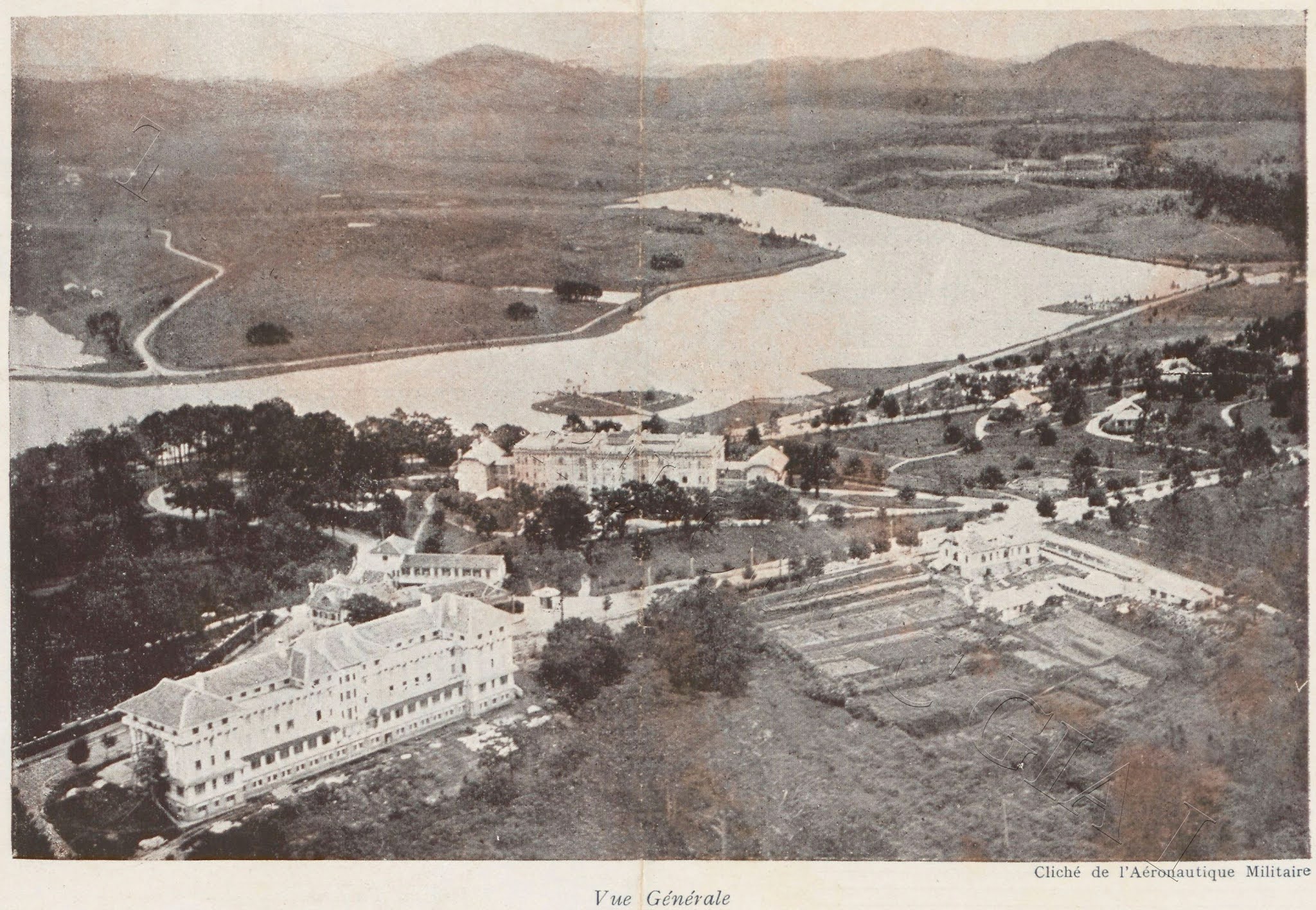
http://saigon-vietnam.fr/dalat_en.php


Dalat (Đà Lạt)
The little Paris


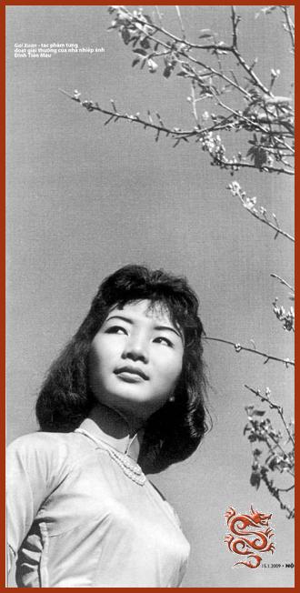
Left: Spend the winet in Dalat.
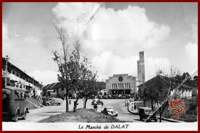
Right: The Dalat Market in the mid-1950s.
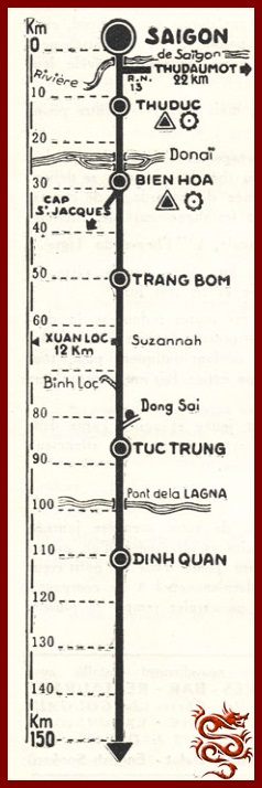
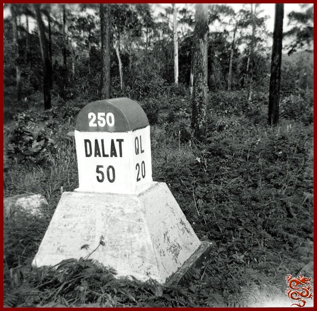

It’s possible to leave Saigon toward National Road (R.N.) 20 by way of Albert the 1st Boulevard through Dakao.
The 30 Km. between Saigon and Bien Hoa, where traffic is heavy, are pretty slow-going.
The Binh Loi bridge over the Saigon River, and the two Bien Hoa bridges over the Donaï, which are one-way, slow traffic down considerably.

After Bien Hoa, between the rubber tree plantations, villages of North Vietnamese refugees have been established. We really can’t recommend driving through these towns because numerous children play along the side of the road.
If you drive at night, slow down when you meet an oncoming vehicle – many tractors transporting logs make the Saigon-Dinh Quan run and back, more often than not without any taillight.
At Dinh Quan there are some strange rounded rocks which erosion has rendered quite unstable.
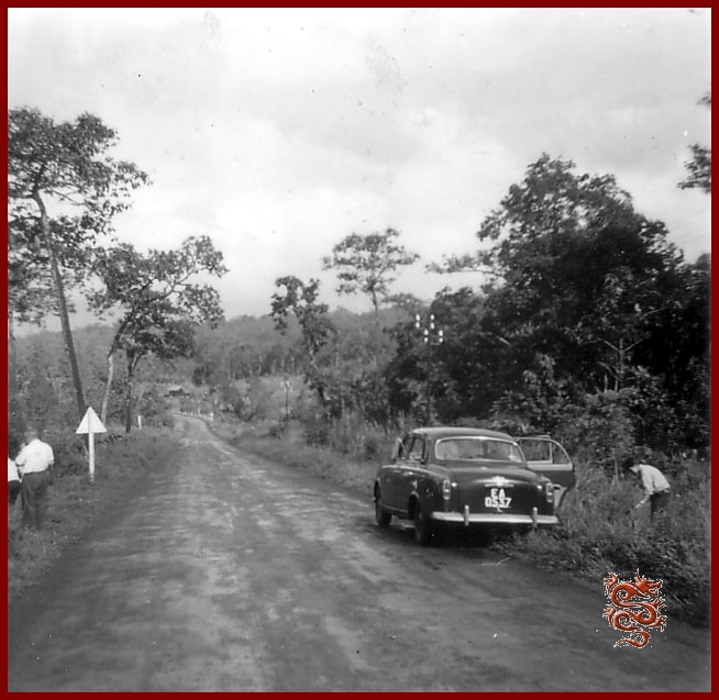
Then the jungle reclaims its rights over dozens of kilometers.
During the rainy season, the road is flanked by swamps hidden by luxuriant vegetation quite close to that of equatorial regions.
The Blao Pass (10 Km. of winding road) is within earshot of springs coming right out of the side of the mountain.

The first tea and coffee plantations of the P.M.S. (Southern Mountain Region), start at Blao.
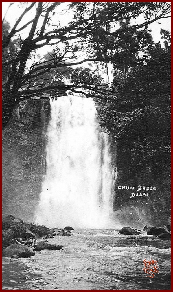
The Boble falls, generally unknown, are accessible by way of a small path where unfortunately leeches are numerous during the rainy season.
Djiring (Di Linh) is the town of Monsegnor Jean Cassaigne, the lepers’ priest.

After Djiring, Ban-Me-Thuot is the next most popular hunting area. Here is where the first pine-forests begin with clear streams running in sandy beds. It’s also where the first waterfalls, the Pangour Falls are located, 7 Km. from the R. N. 7, reachable by a vehicle track. The Gougah Falls are about 300 m. from the road.
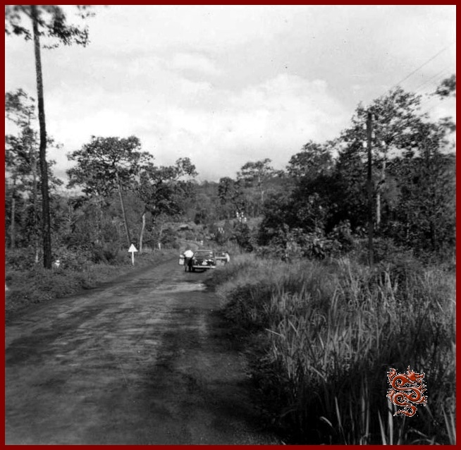

Lien Khan is difficult to reach, but in going over the Prenn Pass one can enjoy a view which transports the tourist into a landscape in the south of France, toward a city, Dalat, designed for the relaxation of body and soul.

Savoisienne Inn on the Prenn Road, Dalat. Tel. 155.
Article published on September 12th, 1955, by the Publia-Asia Agency
which published all kinds of advertising, press releases, cinema, posters, calendars, window-displays – Creator of the “7 Days in Saigon” and of the “Planimeters of Saigon-Cholon”
Publisher of the official Phone Book
61/b Pierre Street, Tel : 21.481 Saigon
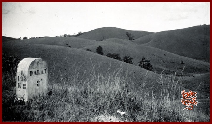
The airplane was a reliable connection in the war years


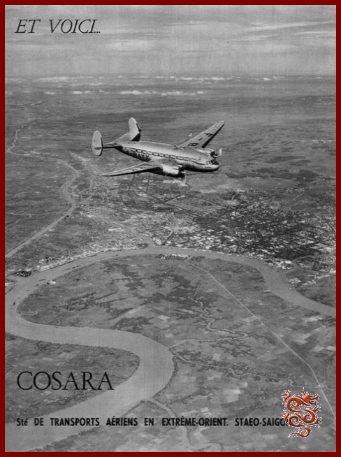
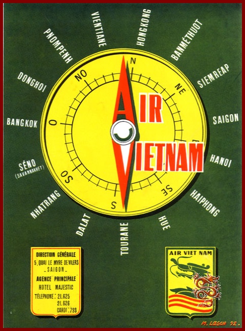
During the war only the airplane could link Saigon and Dalat in a reliable way, and it was for this reason that two airfields were built in this city:
- the Camly field, accessible to small aircrafts.
- and at Liên-Khang two airlines, "Cosara" and "Air Vietnam" provided regular connections, notably with Saigon.
Dinh Quán : Km 113

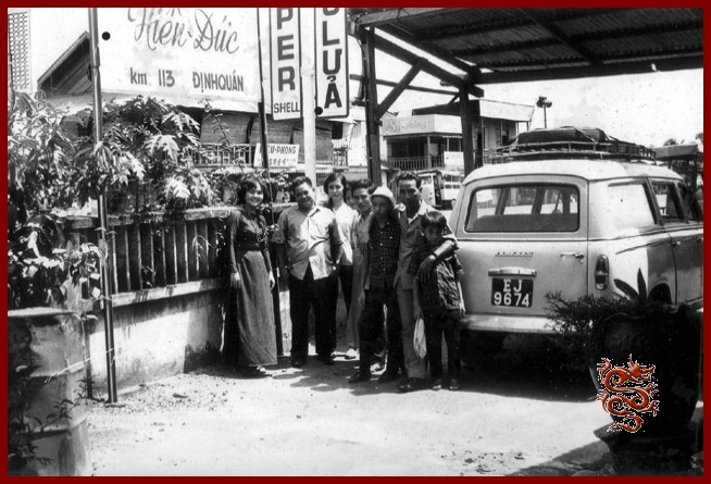
The village of Dinh Quán, located at Km 113, is known for its unusual rock formations. Also, unfortunately, for the bloody ambush on March 1st, 1948, when Lt. Col. Brunet de Sairigné, Companion of the Liberation and commander of the 13th DBLE was killed.
Today the rocks are barely visible from the road, as they are unfortunately hidden by houses.
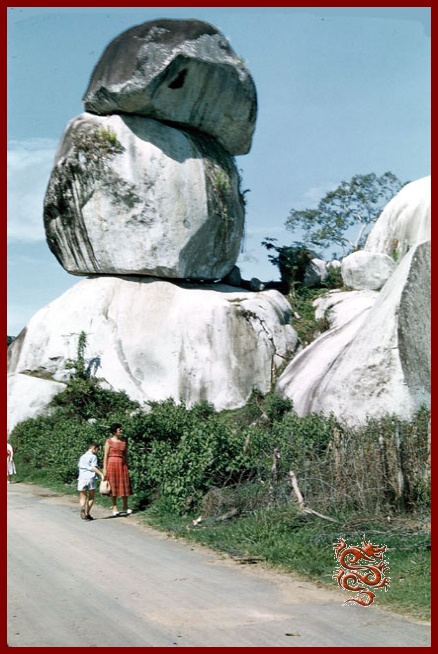
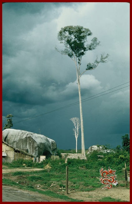
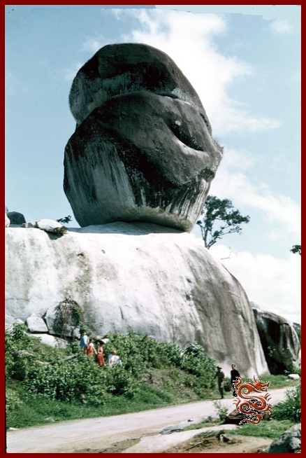
© The color slides were taken by Mr. Emile Poizat in 1955.
The Moi People on the road to Dalat
(The Highlands)
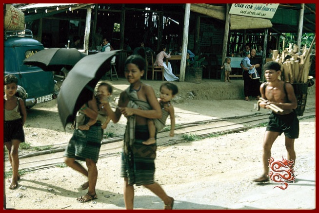
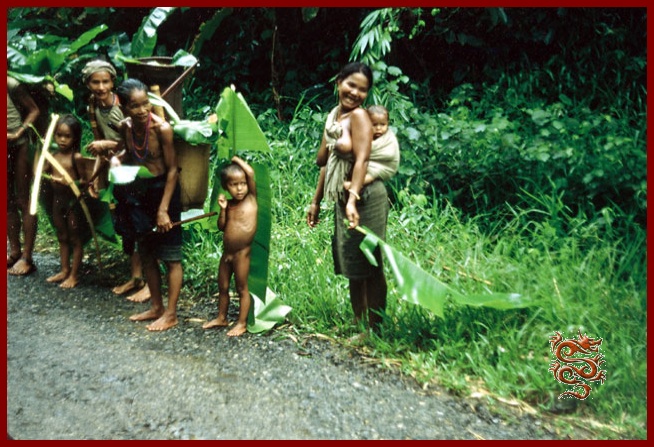
Vietnam has about fifty indigenous peoples. They were pushed back into the mountains and forest regions. In Vietnam they were called the Moi, which means wild.
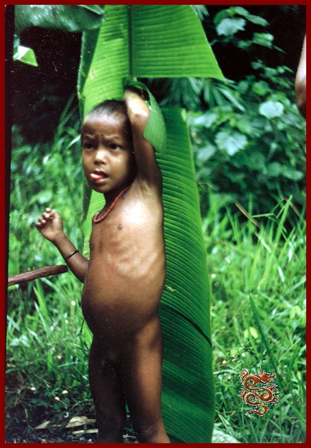
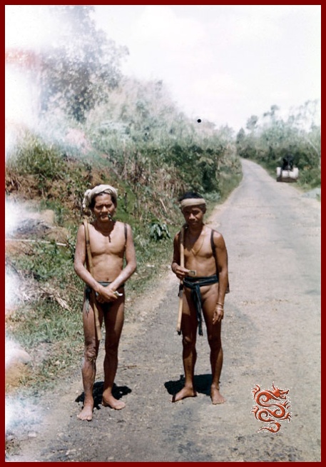
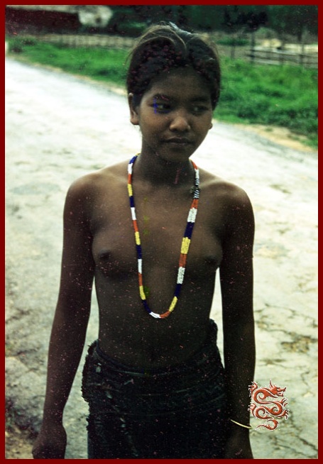
A little over 800,000 Mois lived in the Highlands in 1954, there would be only 200,000 in 1966.
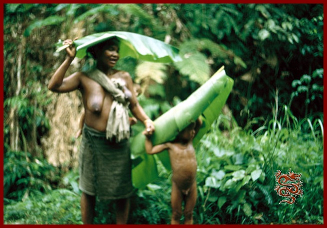
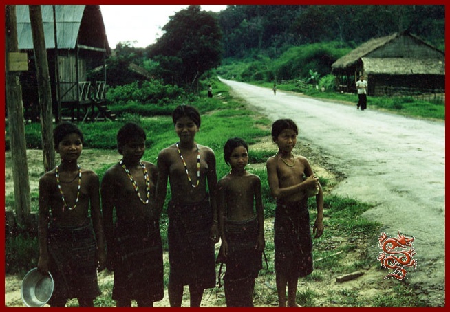
© The color slides were taken by Mr. Emile Poizat in 1955.
Dalat
The city of eternal spring
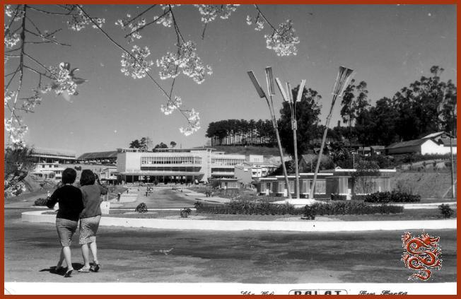
Dat Aliis Laetitiam Aliis Temperiem
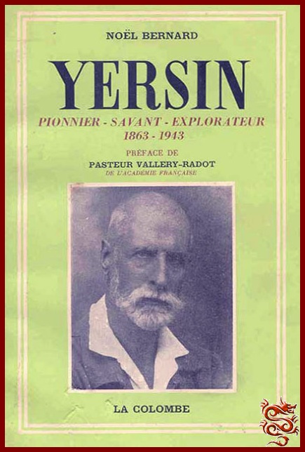

Its Latin motto is: "Dat Aliis Laetitiam Aliis Temperiem", (It forms the initials of the town), which means: “She gives joy to some and good times to others”. The site was discovered in 1893 by the famous French medical doctor Alexandre Yersin (French physician and biologist at the Pasteur Institute, of Swiss origin) during one of his first expeditions. Under his initiative a sanatorium was built, with the help of Governor Paul Doumer, thus allowing French officials to recover from the tropical climate and to enjoy the invigorating weather during the summer season.
Dalat the little Paris

Located at an elevation of nearly 1500 m, Dalat was a pretty “French” town of the mid- 20th century.
During the ‘40’s, Dalat became the summer capital of the French in Indochina, and at the time there were 1300 villas; it used to be called "The Little Paris".
"At the end of 1952 Dalat had 25,041 residents including 23,072 Vietnamese and natives belonging to the Lat tribe, 1215 Europeans (not counting military personnel) and 752 Chinese. Nevertheless, the total number is far less than reality. During the year 1953, following the economic development of the city and the simplification of the conditions of access and residence for the South Montagnard Country, the population of Dalat had increased significantly. A significant number of workers and members of the Regiment of the Imperial Guard are added which is an increase of at least 5,000 people."
Nguyên Thiêu Nguyên
Indochine Sud Est Asiatique (Southeast Asian Indochina) June 1954
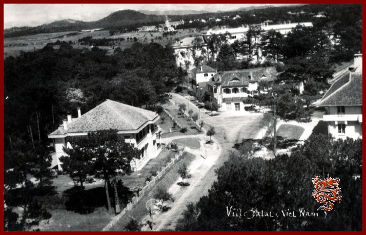
St. Nicholas Church in Dalat
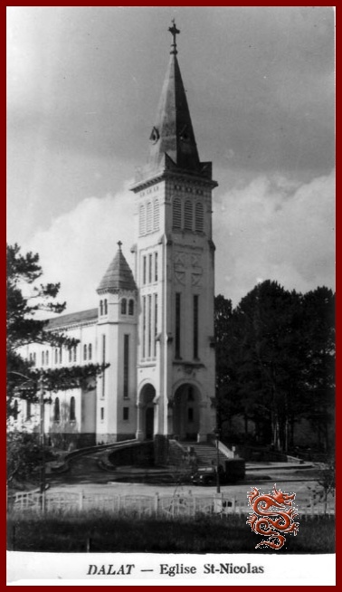
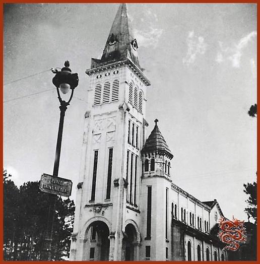
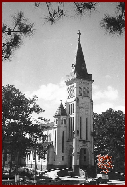
The St. Nicholas cathedral (also called the Rooster Church by the Vietnamese) is located on the square of the same name and was built between 1931 and 1942 thanks to the will of one man, Father Nicholas, and is the property of the foreign missions. The stained-glass windows, made in Grenoble, France, by Louis Balmet during the ‘40’s, show scenes of the Middle-Ages.
Pink in color, from its height of 47 meters it looks out over the parishioners of Dalat, the resident population as well as the French and Vietnamese families who, during the holiday months, would come to breathe the fresh mountain air.
The commemoration of the 1918 Armistice at the Dalat Market
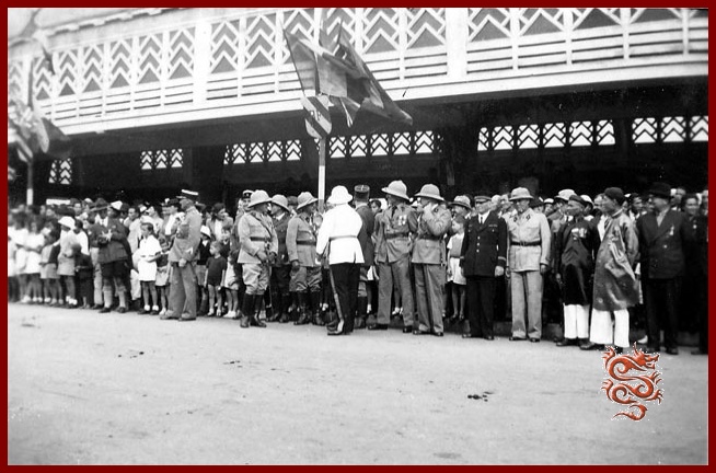

Saturday, November 11th, 1939, commemoration of the Armistice with French military personnel and Vietnamese dignitaries.
The Dalat old Market
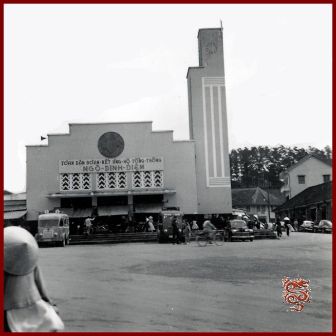
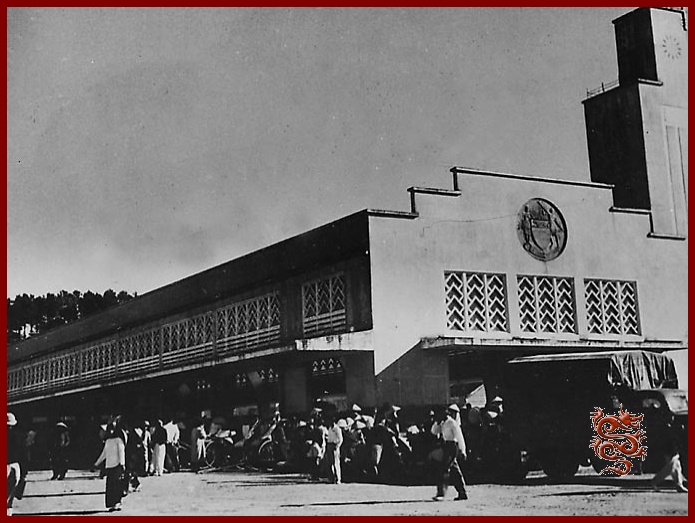
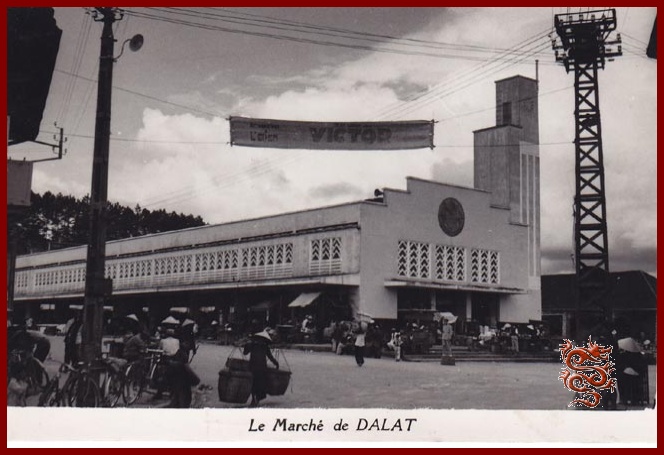
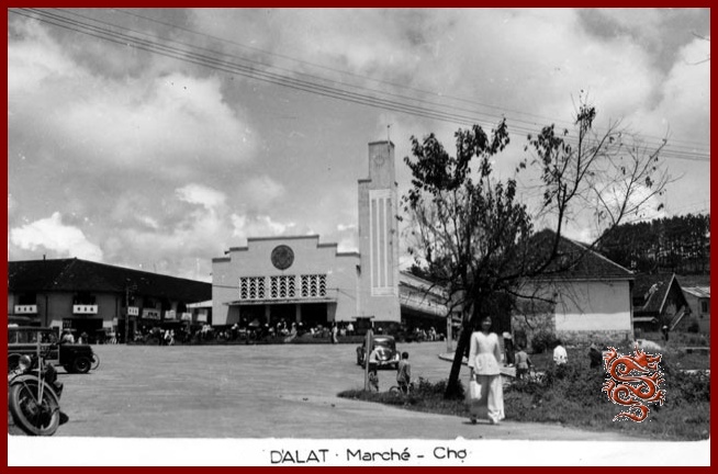
The old market-place was built in 1937 by the architect Louis-Georges-Anatole Pineau, and is characterized by its clock in the form of a minaret; today it has been remodeled into a cinema, “The 3rd of April”, (the date the North Vietnamese took control of the city).
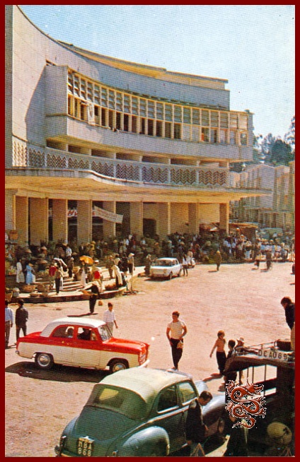
The Dalat Market was renovated in 1958, and is overflowing with gladiolus, artichokes, avocados, strawberries, cherries, mangoes, which are sold by ethnic minorities.


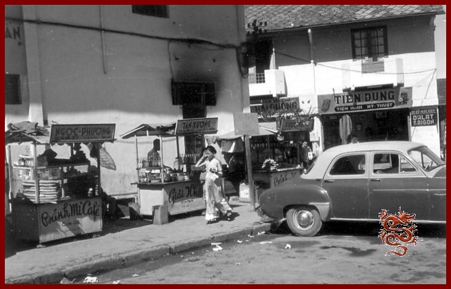
The merchants of the Dalat Market
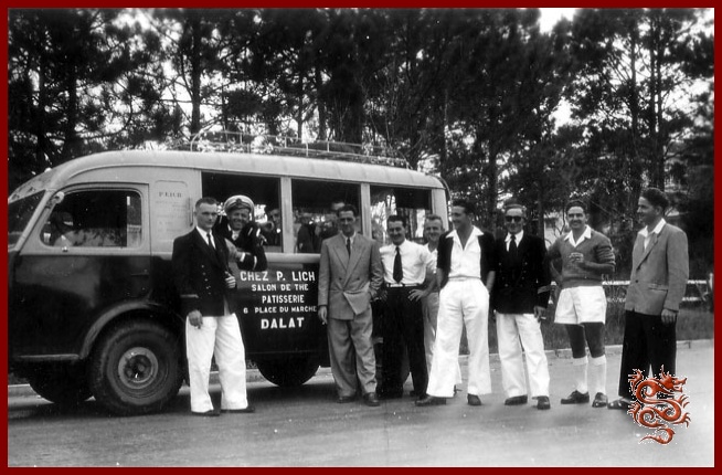
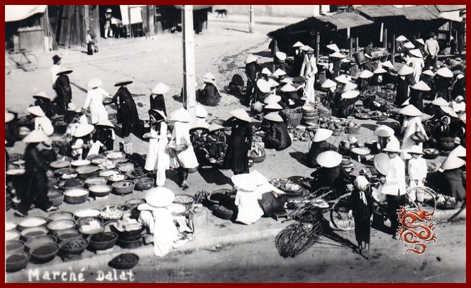
In the photo on the left, a Renault “Goelette” van belonging to Pierre Lich during an outing with French sailors:
- Pierre Lich
Tea-Room, pastry-shop: 6, Market Square
In the photo on the right, growers selling their products.
- Dauphinoise Pastry Shop, 2, Market Square
- The "Pleasures of France" fabric and novelties, 3 Market Square
- Aigle Azur Company 10 - 11, Market Square
- Bazar Saigonnais (Shell station-service) 20 Market Square
- Domart Pharmacy 32 Market Square
- "La Lune" (The Moon) Pastry shop 36 Market Square
- R. Fauconnier Grocery 41 Market Square
P.T.T. (Post Office)
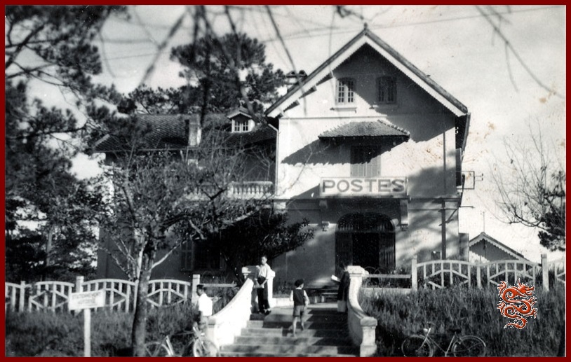
The Post Office is located at 18 Yersin Avenue - Tel : 51
- Counter Staff (information) - Tel : 12
The Alexandre Yersin High School
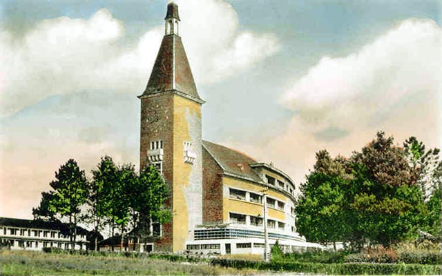


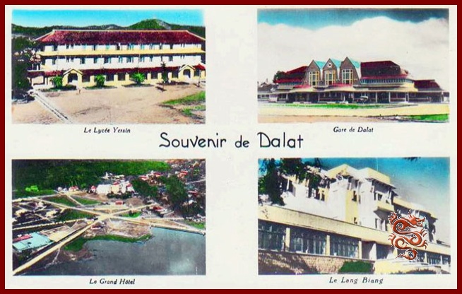
The Alexandre Yersin High School was founded in 1941
- (Large High School) 13, Albert Sarrault Street
- (Small High School) 1, Jean O’Neil Street
The Dalat High School, founded on July 16th, 1927, took the name “Yersin High School” on May 10th, 1935, in honor of the scholar, student of Pasteur who discovered the bacillus of the plague in 1894 and drew attention to the Langbian.
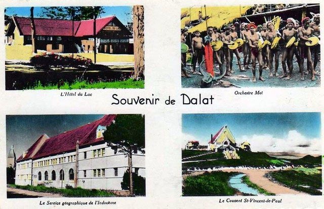
The establishment is divided into the Large and the Small High School. The Small High School includes all the primary grades and the girls’ boarding-school. The buildings stand on a plateau which on one side overlooks the Big Lake of Dalat, and on the other side overlooks the valley where the train station was built.
As much as possible, since 1945, the scholastic materials destroyed by the Japanese have been reconstituted. The laboratories were organized and the scope of the traditional library has been increased.
The curriculum includes all grades from nursery-school to philosophy and mathematics courses. The living languages taught are English, Spanish, and Vietnamese..
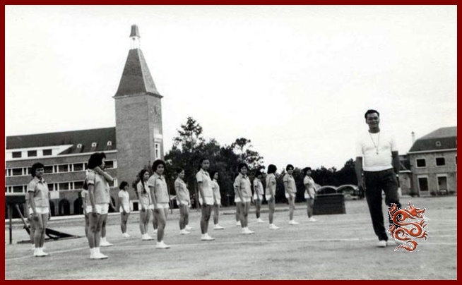
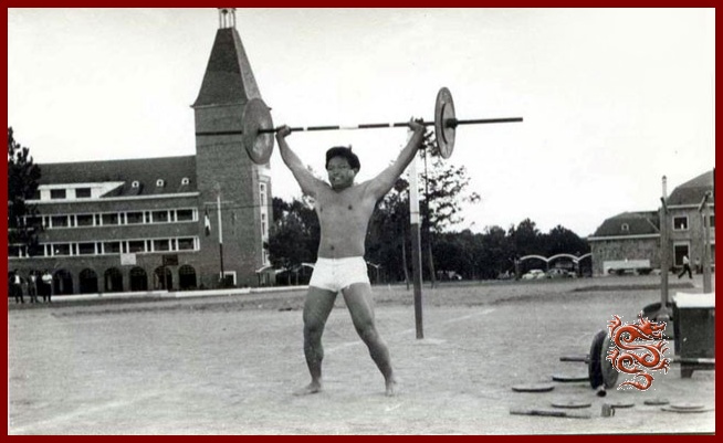
Yersin high school teachers
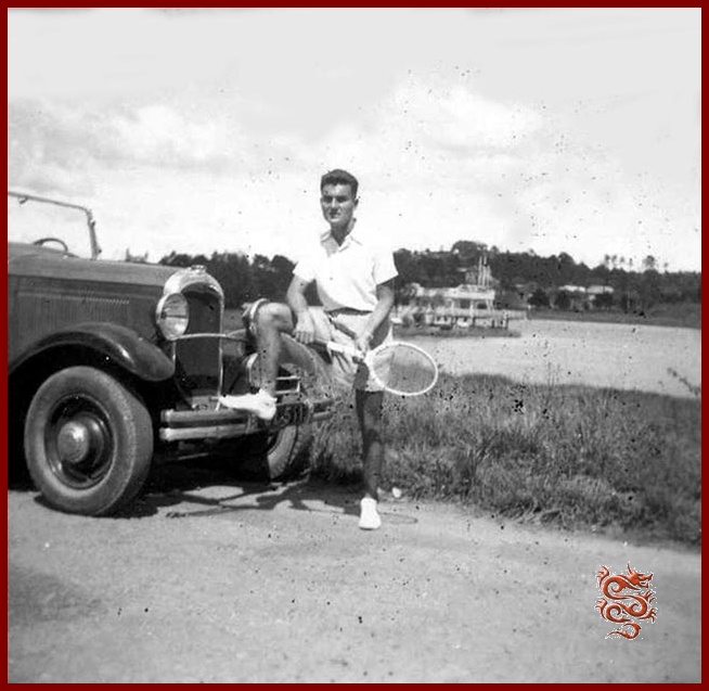
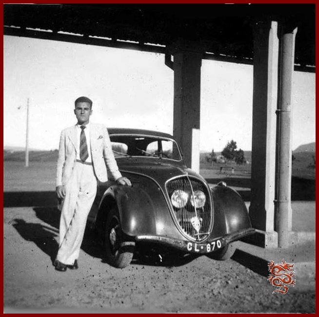
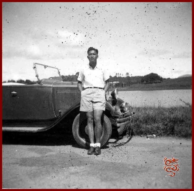
Dalat has many other institutions (public and private):
- the vietnamese High School
- the Bao-Long High School
- the troop children
- Inter-forces School
- Nazareth institution
- the "couvent des Oiseaux" or Notre-Dame Lang-Bian
- the Adran's School
- the chinese School
The government offices
- Postal Service 18, Yersin Avenue
- Court 10, Champoudry Street
Restaurants and Dance-Halls in Dalat in 1953
- L'Auberge Savoisienne, Prenn Road
- Bar Ambiance Dancing 5, Duc de Long My Street
- Au Cabaret Dancing 4, Général Leclerc Street
- Le Chat Botté 20-30, Market Square
- Night-Club 3, Saigonnais Street
- La Mascotte 5, Market Square
- "La Lune" Cabaret 36 Market Square
The Cinemas of Dalat

Eden (Indochina Film and Cinema Company): 42, Dong Khanh Boulevard
Langbian: 61, Cauqueo Road


The Bảo Đại's residence
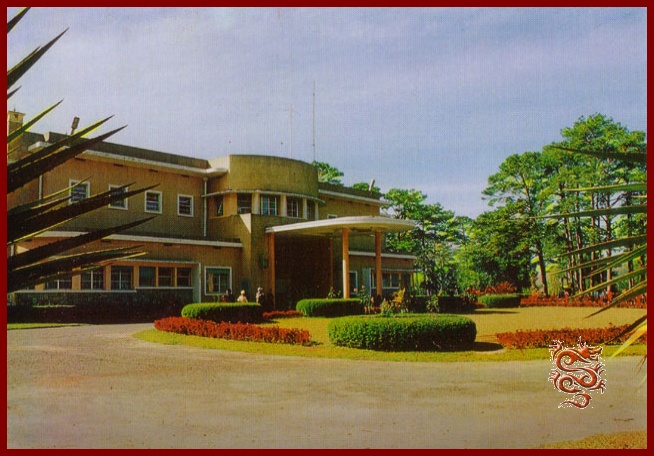
The construction of Emperor Bảo Đại summer palace began in 1933 under the direction of the architect Paul Veysseyre. After World War Two, on 28 April, 1949, H.M. Bảo Đại returned to Dalat. Dalat hosted "Bảo Đại", the "Last Emperor" several summers. (He died in Paris on July 31, 1997).
The residence was also lived in by the South Vietnamese President Ngô Ðình Diem who was assassinated in November of 1963.
Today it is the official residence of the Vietnamese Government.
The Governor-General’s residence in Dalat
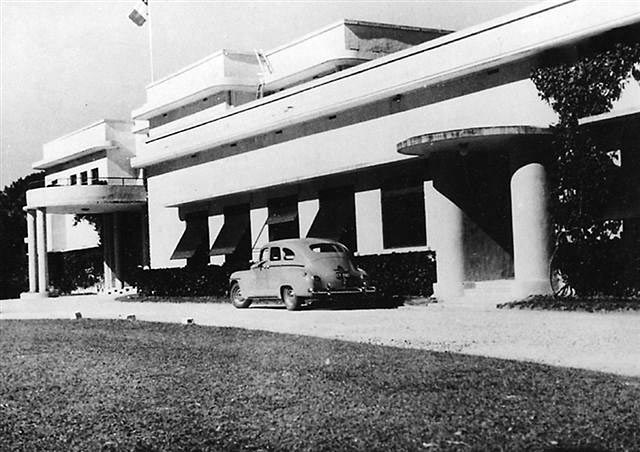

A few years later the same architect built the summer home of the Governor-General along a similar design and in the same Art Deco style as that of Bảo Đại.
The architect Paul Veysseyre of the firm of "Brossard & Mopin" was also the architect in Saigon: for the French Navy building on Norodom Boulevard, the Bank of Indochina on Quai de Belgique and also the Indochina Breweries and Ice Company (BGI) on Paul Blanchy Street.
During the Second World War, Dalat was the de facto capital of Indochina for the duration of the Japanese occupation of the peninsula. Admiral Jean Decoux stayed in Dalat several times, and his wife died there on January 6th, 1944.
Today the Governor-General’s residence has become a hotel!
The Dalat Railway Station
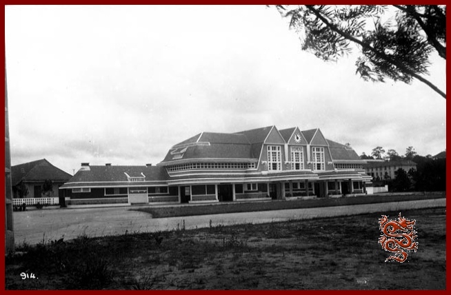
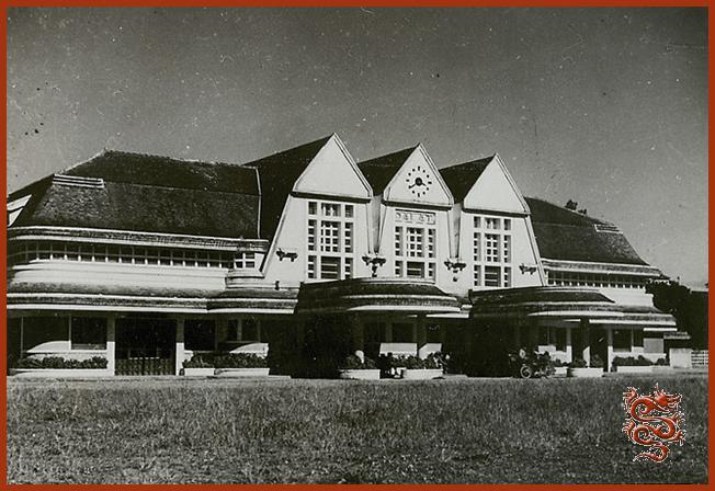
Work for the construction of the rail line began in 1901 and it was put into service in 1933 with a length of 84 kilometers, 30 of which were cog-rail, thus linking Dalat to Tourcham in the vicinity of Phan Rang, allowing the connection with the Trans-Indochina Line.
Dalat station, designed by two French architects, Moncet and Revéront, was built in 1938 and resembles that of Deauville. The railway has been out of service for decades, with only a part of the line still in use, was built in 1938 and resembles that of Deauville. The railway has been out of service for decades.
Studies are currently under way to reopen the line in 2016, and a tentative budget of 320 million dollars has been approved by the Vietnamese government.
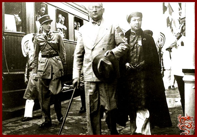

On the right, René Robin, Secretary General of the General Government of Indochina and Emperor Bao Dai inaugurating the line in 1936.
On the left, one of the locomotives of the “Chemin de Fer de l’Indochine” – The Indochina Railway – (CFI), built in Switzerland in Winterthur between 1923 and 1930, and then purchased by the French (after the Swiss line was electrified) to run the Dalat cog-wheel railway. In 1990, Swiss railfans bought two of the loccomotives back: the VHX 31-302 (at the Song Pha station), and the VHX 31-304 (at the Dalat station), to bring them back to their native land.
They were completely restored and are once again in service in Switzerland on the Furka cog-wheel railway in Oberwald in the canton of Valais (Wallis), at an elevation of 1366 meters (4480 ft.).
The Lake of Dalat
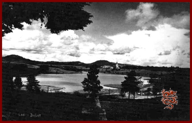
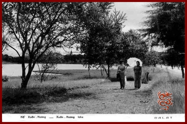
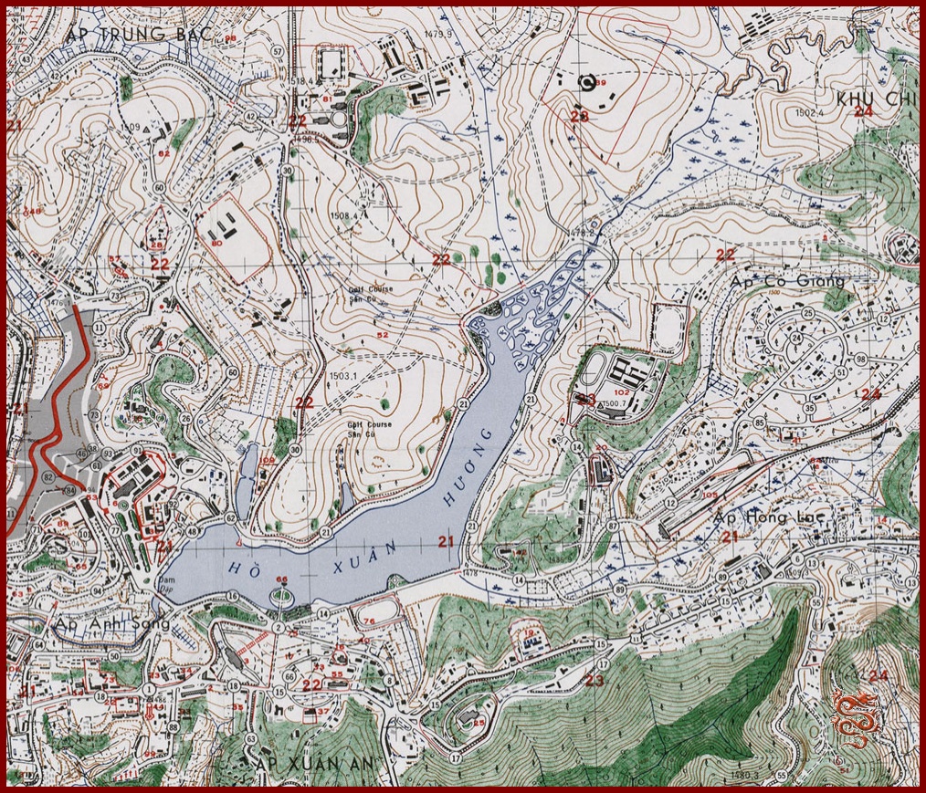
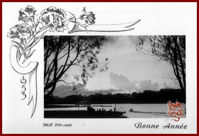
The artificial Lake of the Swans was created in the middle of town as a result of the construction of a dam by the French in 1919. Today it is called the Spring Fragrance (Hô Xuân Huong), a Vietnamese poetess of the 17th century.
La Grenouillère, headquarters of the yacht club.
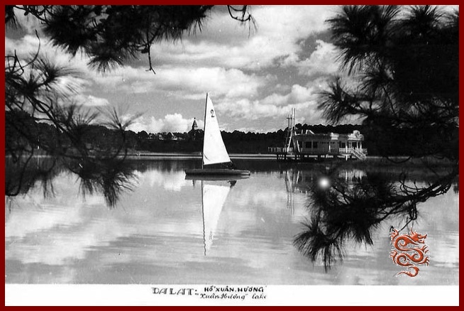
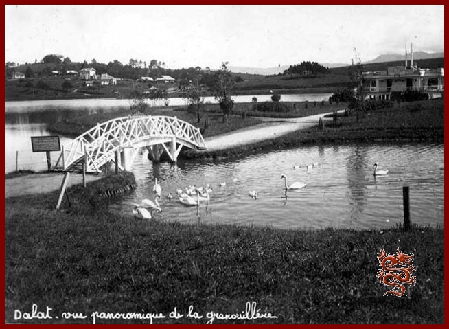
The Grenouillère, on the edge of the Lake of the Swans, was the headquarters of “The Dalat Yacht Club”, and is today the “Thy Ta” restaurant.

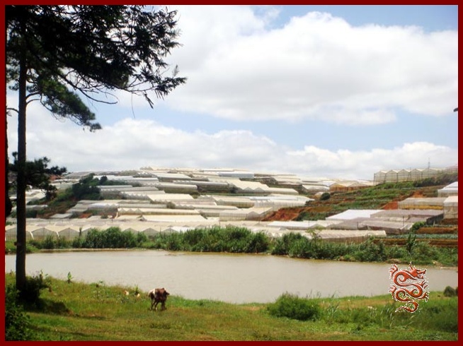
The Dalat Palace
From atop its hill, the majestic Dalat Palace overlooks the lake.
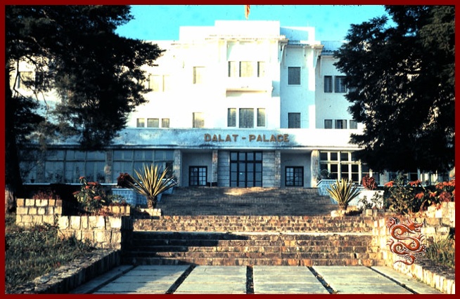
The Hotel Du Lac, located at 3, Pierre Pasquier Avenue, was built in 1922. It was later called the Dalat Palace and was renovated for the first time in 1943, and then Rebuilt by the French hotel group Sofitel.
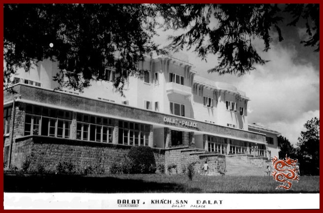
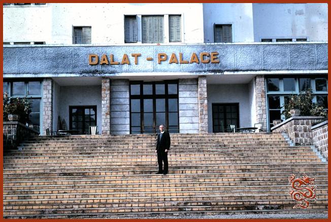
The Accor hotel group gave up the management of the establishment in 2010.
© The color slide was taken in November of 1963 in front of the Dalat Palace with the famous American doctor Irwin S. Leinbach from the American aide agency CARE.
The Hotel du Parc
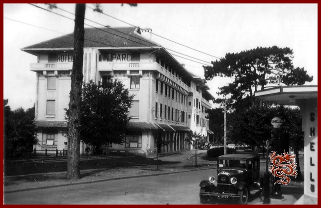
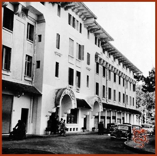
The Hotel du Parc (Park Hotel) is located at 7, Yersin Avenue.
The “Vietnam Broadcasting” offices and studios are also in this establishment.
The "Amiral Courbet" Navy Rest Center
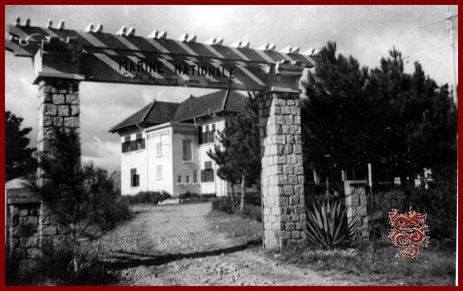

The "Amiral Courbet" convalescent hospital of the French Navy in Dalat.
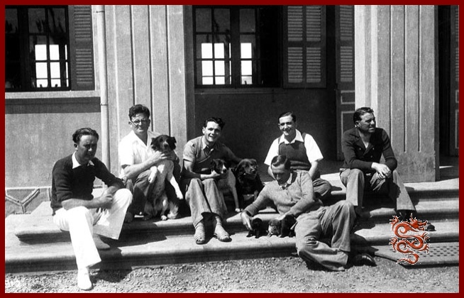

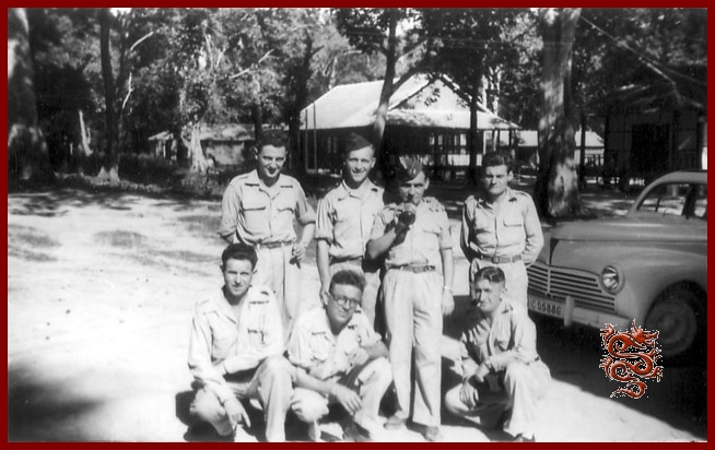
French soldiers at the "Amiral Courbet" convalescent hospital .
Catroux Military Hospital
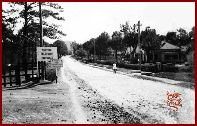
Memories of Dalat
Dalat in 1963
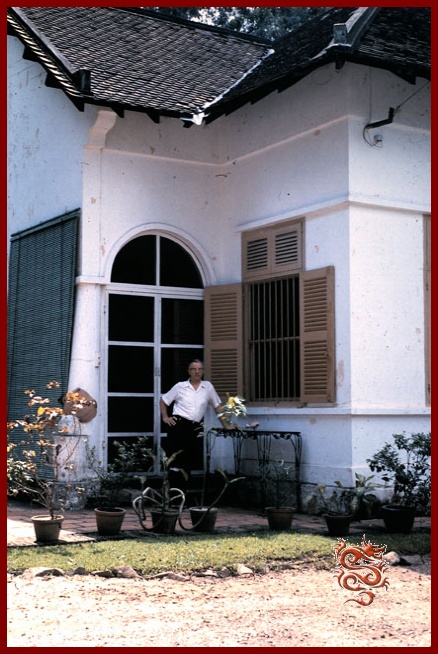
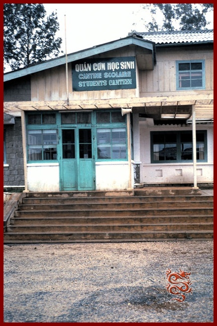
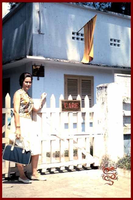
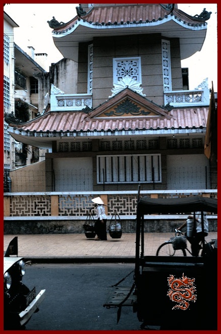

The American doctor Irwin. S. Leinbach is an orthopedic surgeon who spent time in Vietnam in November 1963 in the Cho-Ray hospital in Saigon during the coup against President Diem to care for amputation victims of the war actions in South Vietnam.
He then went to Dalat for humanitarian works for the CARE organization (an international, non-denominational, and apolitical organization). .
Dalat well before 1963 and the city seems quite empty.
© These photos are part of Mr. Irwin S. Leinbach’s private collection.
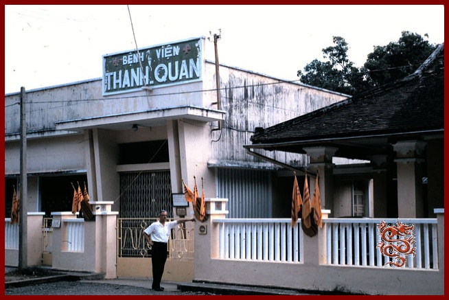
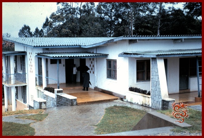

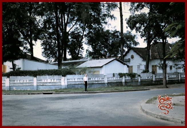
The roughly 1300 charming villas and chalets with character were built by the French during the ‘30’s and ‘40’s.
The Dalat Tomb
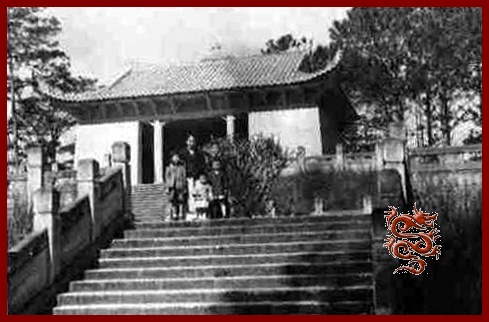
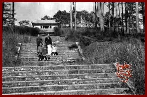
Dà Lat : a former tourist spot was the tomb of Pierre Nguyen Huu-Hào, father of the first wife of Emperor Bao-Da Bao Daï.
Pierre Nguyen Huu-Hào was catholic, and came from Gò Công in the Mekong Delta.
Today the tomb is abandoned, seemingly desperately awaiting a visitor behind its tall grass and majestic pines.

A wrecked Citroën in Dalat in 1950

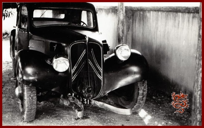
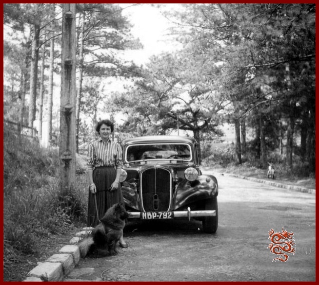
A Citroën Front Wheel Drive, before and after an accident in 1950 in Dalat.
A walk in the vicinity of Dalat
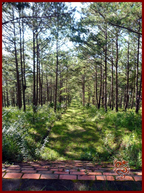
Dalat, located in the former province of Annam, occupies an area dotted with lakes, waterfalls, gardens, and pine forests.
The Gougah Falls thác Gougah
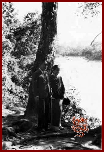
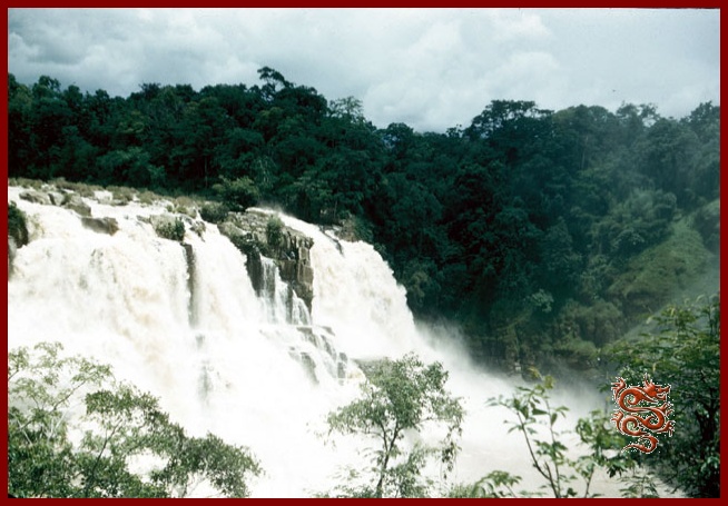
The Gougah Falls are located 38 Km. from Dalat.
© The color slides were taken by Mr. Emile Poizat in 1955.
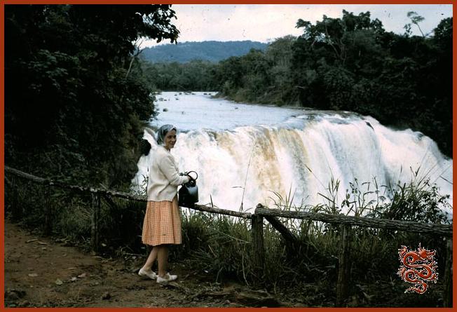
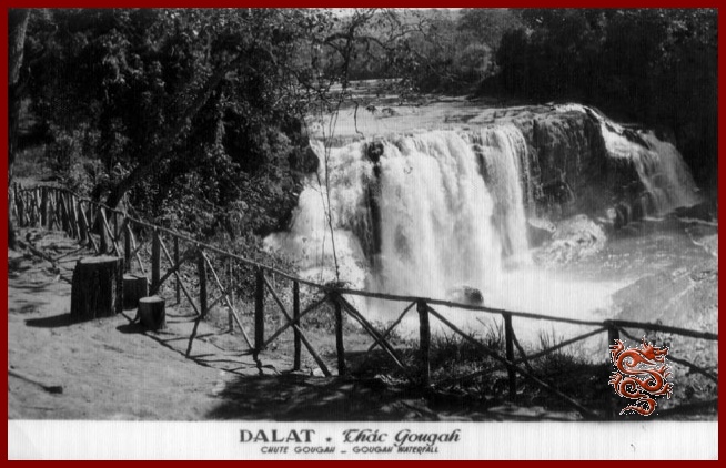
© The color slide ws taken by the American doctor Irwin S. Leinbach of the CARE humanitarian organization in 1963.
The Bagla Falls
The Pongour Falls
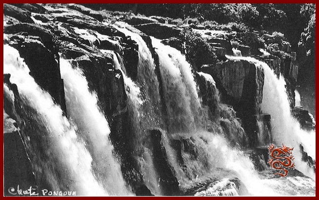
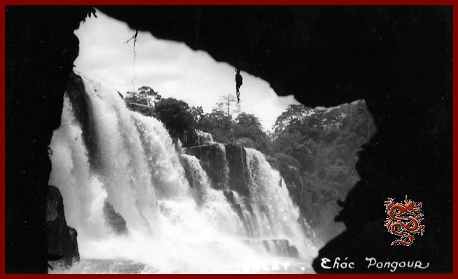
The Pongour Falls are the most spectacular but less visited because they are more inaccessable when it is raining.
A big thank-you to René Poizat for the photos from his personal collection.
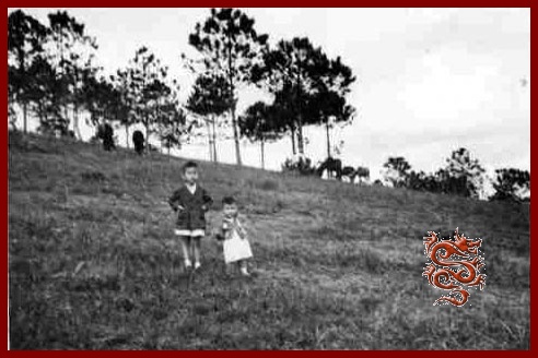
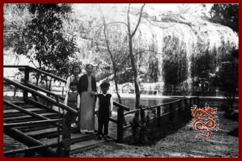
On the left, on the road to Ankroet...
On the right, the Liên Khang falls.
haut de page


Dalat (Đà Lạt)
The little Paris
Left: Spend the winet in Dalat.
Right: The Dalat Market in the mid-1950s.
It’s possible to leave Saigon toward National Road (R.N.) 20 by way of Albert the 1st Boulevard through Dakao.
The 30 Km. between Saigon and Bien Hoa, where traffic is heavy, are pretty slow-going.
The Binh Loi bridge over the Saigon River, and the two Bien Hoa bridges over the Donaï, which are one-way, slow traffic down considerably.
After Bien Hoa, between the rubber tree plantations, villages of North Vietnamese refugees have been established. We really can’t recommend driving through these towns because numerous children play along the side of the road.
If you drive at night, slow down when you meet an oncoming vehicle – many tractors transporting logs make the Saigon-Dinh Quan run and back, more often than not without any taillight.
At Dinh Quan there are some strange rounded rocks which erosion has rendered quite unstable.
Then the jungle reclaims its rights over dozens of kilometers.
During the rainy season, the road is flanked by swamps hidden by luxuriant vegetation quite close to that of equatorial regions.
The Blao Pass (10 Km. of winding road) is within earshot of springs coming right out of the side of the mountain.
The first tea and coffee plantations of the P.M.S. (Southern Mountain Region), start at Blao.
The Boble falls, generally unknown, are accessible by way of a small path where unfortunately leeches are numerous during the rainy season.
Djiring (Di Linh) is the town of Monsegnor Jean Cassaigne, the lepers’ priest.
After Djiring, Ban-Me-Thuot is the next most popular hunting area. Here is where the first pine-forests begin with clear streams running in sandy beds. It’s also where the first waterfalls, the Pangour Falls are located, 7 Km. from the R. N. 7, reachable by a vehicle track. The Gougah Falls are about 300 m. from the road.
Lien Khang is difficult to reach, but in going over the Prenn Pass one can enjoy a view which transports the tourist into a landscape in the south of France, toward a city, Dalat, designed for the relaxation of body and soul.
Savoisienne Inn on the Prenn Road, Dalat. Tel. 155.
Article published on September 12th, 1955, by the Publia-Asia Agency
which published all kinds of advertising, press releases, cinema, posters, calendars, window-displays – Creator of the “7 Days in Saigon” and of the “Planimeters of Saigon-Cholon”
Publisher of the official Phone Book
61/b Pierre Street, Tel : 21.481 Saigon
The airplane was a reliable connection in the war years
During the war only the airplane could link Saigon and Dalat in a reliable way, and it was for this reason that two airfields were built in this city:
- the Camly field, accessible to small aircrafts.
- and at Liên-Khang two airlines, "Cosara" and "Air Vietnam" provided regular connections, notably with Saigon.
Dinh Quán : Km 113
The village of Dinh Quán, located at Km 113, is known for its unusual rock formations. Also, unfortunately, for the bloody ambush on March 1st, 1948, when Lt. Col. Brunet de Sairigné, Companion of the Liberation and commander of the 13th DBLE was killed.
Today the rocks are barely visible from the road, as they are unfortunately hidden by houses.
© The color slides were taken by Mr. Emile Poizat in 1955.
The Moi People on the road to Dalat
(The Highlands)
Vietnam has about fifty indigenous peoples. They were pushed back into the mountains and forest regions. In Vietnam they were called the Moi, which means wild.
A little over 800,000 Mois lived in the Highlands in 1954, there would be only 200,000 in 1966.
© The color slides were taken by Mr. Emile Poizat in 1955.
Dalat
The city of eternal spring
Dat Aliis Laetitiam Aliis Temperiem
Its Latin motto is: "Dat Aliis Laetitiam Aliis Temperiem", (It forms the initials of the town), which means: “She gives joy to some and good times to others”. The site was discovered in 1893 by the famous French medical doctor Alexandre Yersin (French physician and biologist at the Pasteur Institute, of Swiss origin) during one of his first expeditions. Under his initiative a sanatorium was built, with the help of Governor Paul Doumer, thus allowing French officials to recover from the tropical climate and to enjoy the invigorating weather during the summer season.
Dalat the little Paris
Located at an elevation of nearly 1500 m, Dalat was a pretty “French” town of the mid- 20th century.
During the ‘40’s, Dalat became the summer capital of the French in Indochina, and at the time there were 1300 villas; it used to be called "The Little Paris".
"At the end of 1952 Dalat had 25,041 residents including 23,072 Vietnamese and natives belonging to the Lat tribe, 1215 Europeans (not counting military personnel) and 752 Chinese. Nevertheless, the total number is far less than reality. During the year 1953, following the economic development of the city and the simplification of the conditions of access and residence for the South Montagnard Country, the population of Dalat had increased significantly. A significant number of workers and members of the Regiment of the Imperial Guard are added which is an increase of at least 5,000 people."
Nguyên Thiêu Nguyên
Indochine Sud Est Asiatique (Southeast Asian Indochina) June 1954
St. Nicholas Church in Dalat
The St. Nicholas cathedral (also called the Rooster Church by the Vietnamese) is located on the square of the same name and was built between 1931 and 1942 thanks to the will of one man, Father Nicholas, and is the property of the foreign missions. The stained-glass windows, made in Grenoble, France, by Louis Balmet during the ‘40’s, show scenes of the Middle-Ages.
Pink in color, from its height of 47 meters it looks out over the parishioners of Dalat, the resident population as well as the French and Vietnamese families who, during the holiday months, would come to breathe the fresh mountain air.
The commemoration of the 1918 Armistice at the Dalat Market
Saturday, November 11th, 1939, commemoration of the Armistice with French military personnel and Vietnamese dignitaries.
The Dalat old Market
The old market-place was built in 1937 by the architect Louis-Georges-Anatole Pineau, and is characterized by its clock in the form of a minaret; today it has been remodeled into a cinema, “The 3rd of April”, (the date the North Vietnamese took control of the city).
The Dalat Market was renovated in 1958, and is overflowing with gladiolus, artichokes, avocados, strawberries, cherries, mangoes, which are sold by ethnic minorities.
The merchants of the Dalat Market
In the photo on the left, a Renault “Goelette” van belonging to Pierre Lich during an outing with French sailors:
- Pierre Lich
Tea-Room, pastry-shop: 6, Market Square
In the photo on the right, growers selling their products.
- Dauphinoise Pastry Shop, 2, Market Square
- The "Pleasures of France" fabric and novelties, 3 Market Square
- Aigle Azur Company 10 - 11, Market Square
- Bazar Saigonnais (Shell station-service) 20 Market Square
- Domart Pharmacy 32 Market Square
- "La Lune" (The Moon) Pastry shop 36 Market Square
- R. Fauconnier Grocery 41 Market Square
P.T.T. (Post Office)
The Post Office is located at 18 Yersin Avenue - Tel : 51
- Counter Staff (information) - Tel : 12
The Alexandre Yersin High School
The Alexandre Yersin High School was founded in 1941
- (Large High School) 13, Albert Sarrault Street
- (Small High School) 1, Jean O’Neil Street
The Dalat High School, founded on July 16th, 1927, took the name “Yersin High School” on May 10th, 1935, in honor of the scholar, student of Pasteur who discovered the bacillus of the plague in 1894 and drew attention to the Langbian.
The establishment is divided into the Large and the Small High School. The Small High School includes all the primary grades and the girls’ boarding-school. The buildings stand on a plateau which on one side overlooks the Big Lake of Dalat, and on the other side overlooks the valley where the train station was built.
As much as possible, since 1945, the scholastic materials destroyed by the Japanese have been reconstituted. The laboratories were organized and the scope of the traditional library has been increased.
The curriculum includes all grades from nursery-school to philosophy and mathematics courses. The living languages taught are English, Spanish, and Vietnamese..
Yersin high school teachers
Dalat has many other institutions (public and private):
- the vietnamese High School
- the Bao-Long High School
- the troop children
- Inter-forces School
- Nazareth institution
- the "couvent des Oiseaux" or Notre-Dame Lang-Bian
- the Adran's School
- the chinese School
The government offices
- Postal Service 18, Yersin Avenue
- Court 10, Champoudry Street
Restaurants and Dance-Halls in Dalat in 1953
- L'Auberge Savoisienne, Prenn Road
- Bar Ambiance Dancing 5, Duc de Long My Street
- Au Cabaret Dancing 4, Général Leclerc Street
- Le Chat Botté 20-30, Market Square
- Night-Club 3, Saigonnais Street
- La Mascotte 5, Market Square
- "La Lune" Cabaret 36 Market Square
The Cinemas of Dalat
Eden (Indochina Film and Cinema Company): 42, Dong Khanh Boulevard
Langbian: 61, Cauqueo Road
The Bảo Đại's residence
The construction of Emperor Bảo Đại summer palace began in 1933 under the direction of the architect Paul Veysseyre. After World War Two, on 28 April, 1949, H.M. Bảo Đại returned to Dalat. Dalat hosted "Bảo Đại", the "Last Emperor" several summers. (He died in Paris on July 31, 1997).
The residence was also lived in by the South Vietnamese President Ngô Ðình Diem who was assassinated in November of 1963.
Today it is the official residence of the Vietnamese Government.
The Governor-General’s residence in Dalat
A few years later the same architect built the summer home of the Governor-General along a similar design and in the same Art Deco style as that of Bảo Đại.
The architect Paul Veysseyre of the firm of "Brossard & Mopin" was also the architect in Saigon: for the French Navy building on Norodom Boulevard, the Bank of Indochina on Quai de Belgique and also the Indochina Breweries and Ice Company (BGI) on Paul Blanchy Street.
During the Second World War, Dalat was the de facto capital of Indochina for the duration of the Japanese occupation of the peninsula. Admiral Jean Decoux stayed in Dalat several times, and his wife died there on January 6th, 1944.
Today the Governor-General’s residence has become a hotel!
The Dalat Railway Station
Work for the construction of the rail line began in 1901 and it was put into service in 1933 with a length of 84 kilometers, 30 of which were cog-rail, thus linking Dalat to Tourcham in the vicinity of Phan Rang, allowing the connection with the Trans-Indochina Line.
Dalat station, designed by two French architects, Moncet and Revéront, was built in 1938 and resembles that of Deauville. The railway has been out of service for decades, with only a part of the line still in use,
Studies are currently under way to reopen the line in 2016, and a tentative budget of 320 million dollars has been approved by the Vietnamese government.
On the right, René Robin, Secretary General of the General Government of Indochina and Emperor Bao Dai inaugurating the line in 1936.
On the left, one of the locomotives of the “Chemin de Fer de l’Indochine” – The Indochina Railway – (CFI), built in Switzerland in Winterthur between 1923 and 1930, and then purchased by the French (after the Swiss line was electrified) to run the Dalat cog-wheel railway. In 1990, Swiss railfans bought two of the loccomotives back: the VHX 31-302 (at the Song Pha station), and the VHX 31-304 (at the Dalat station), to bring them back to their native land.
They were completely restored and are once again in service in Switzerland on the Furka cog-wheel railway in Oberwald in the canton of Valais (Wallis), at an elevation of 1366 meters (4480 ft.).
The Lake of Dalat
The artificial Lake of the Swans was created in the middle of town as a result of the construction of a dam by the French in 1919. Today it is called the Spring Fragrance (Hô Xuân Huong), a Vietnamese poetess of the 17th century.
La Grenouillère, headquarters of the yacht club.
The Grenouillère, on the edge of the Lake of the Swans, was the headquarters of “The Dalat Yacht Club”, and is today the “Thuy Ta” restaurant.
The Dalat Palace
From atop its hill, the majestic Dalat Palace overlooks the lake.
The Hotel Du Lac, located at 3, Pierre Pasquier Avenue, was built in 1922. It was later called the Dalat Palace and was renovated for the first time in 1943, and then Rebuilt by the French hotel group Sofitel.
The Accor hotel group gave up the management of the establishment in 2010.
© The color slide was taken in November of 1963 in front of the Dalat Palace with the famous American doctor Irwin S. Leinbach from the American aide agency CARE.
The Hotel du Parc
The Hotel du Parc (Park Hotel) is located at 7, Yersin Avenue.
The “Vietnam Broadcasting” offices and studios are also in this establishment.
The "Amiral Courbet" Navy Rest Center
The "Amiral Courbet" convalescent hospital of the French Navy in Dalat.
French soldiers at the "Amiral Courbet" convalescent hospital .
Catroux Military Hospital
Memories of Dalat
Dalat in 1963
The American doctor Irwin. S. Leinbach is an orthopedic surgeon who spent time in Vietnam in November 1963 in the Cho-Ray hospital in Saigon during the coup against President Diem to care for amputation victims of the war actions in South Vietnam.
He then went to Dalat for humanitarian works for the CARE organization (an international, non-denominational, and apolitical organization). .
Dalat well before 1963 and the city seems quite empty.
© These photos are part of Mr. Irwin S. Leinbach’s private collection.
The roughly 1300 charming villas and chalets with character were built by the French during the ‘30’s and ‘40’s.
The Dalat Tomb
Dà Lat : a former tourist spot was the tomb of Pierre Nguyen Huu-Hào, father of the first wife of Emperor Bao-Da Bao Daï.
Pierre Nguyen Huu-Hào was catholic, and came from Gò Công in the Mekong Delta.
Today the tomb is abandoned, seemingly desperately awaiting a visitor behind its tall grass and majestic pines.
A wrecked Citroën in Dalat in 1950
A Citroën Front Wheel Drive, before and after an accident in 1950 in Dalat.
A walk in the vicinity of Dalat
Dalat, located in the former province of Annam, occupies an area dotted with lakes, waterfalls, gardens, and pine forests.
The Gougah Falls thác Gougah
The Gougah Falls are located 38 Km. from Dalat.
© The color slides were taken by Mr. Emile Poizat in 1955.
© The color slide ws taken by the American doctor Irwin S. Leinbach of the CARE humanitarian organization in 1963.
The Bobla Falls
The Pongour Falls
The Pongour Falls are the most spectacular but less visited because they are more inaccessable when it is raining.
A big thank-you to René Poizat for the photos from his personal collection.
On the left, on the road to Ankroet...
On the right, the Liên Khang falls.
haut de page
The Dalat old Market
The old market-place was built in 1937 by the architect Louis-Georges-Anatole Pineau, and is characterized by its clock in the form of a minaret; today it has been remodeled into a cinema, “The 3rd of April”, (the date the North Vietnamese took control of the city).
The Dalat Market was renovated in 1958, and is overflowing with gladiolus, artichokes, avocados, strawberries, cherries, mangoes, which are sold by ethnic minorities.
The merchants of the Dalat Market