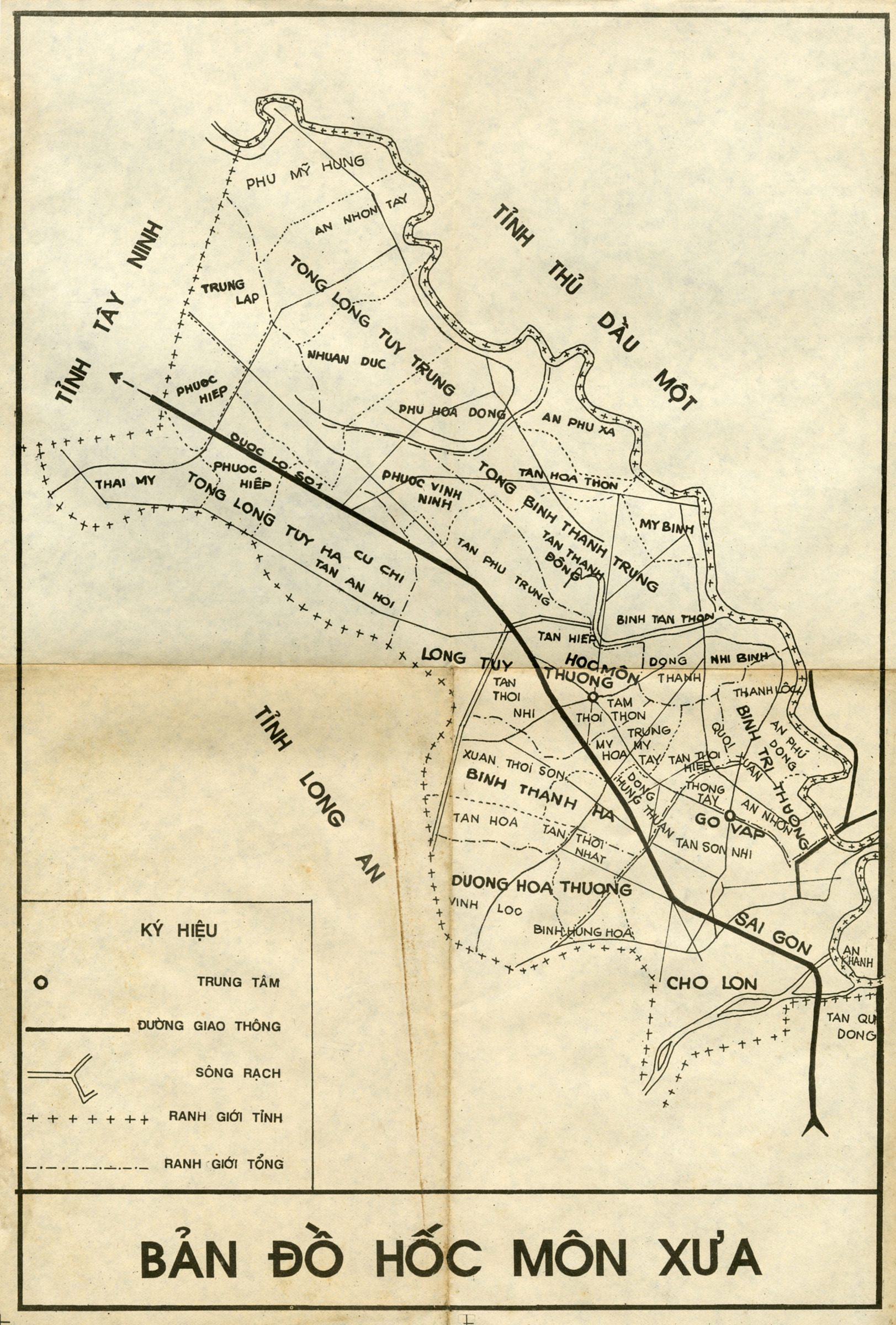
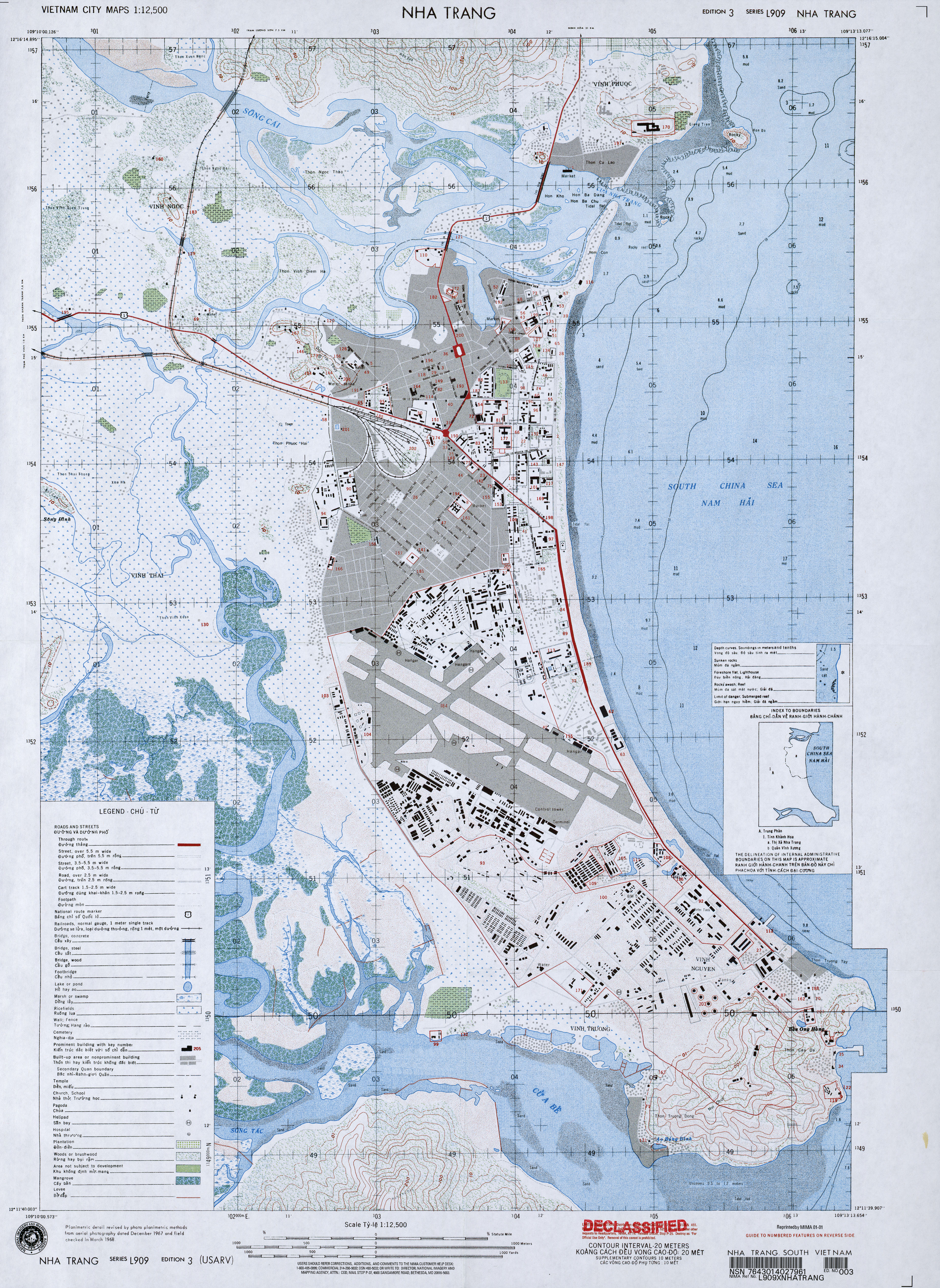
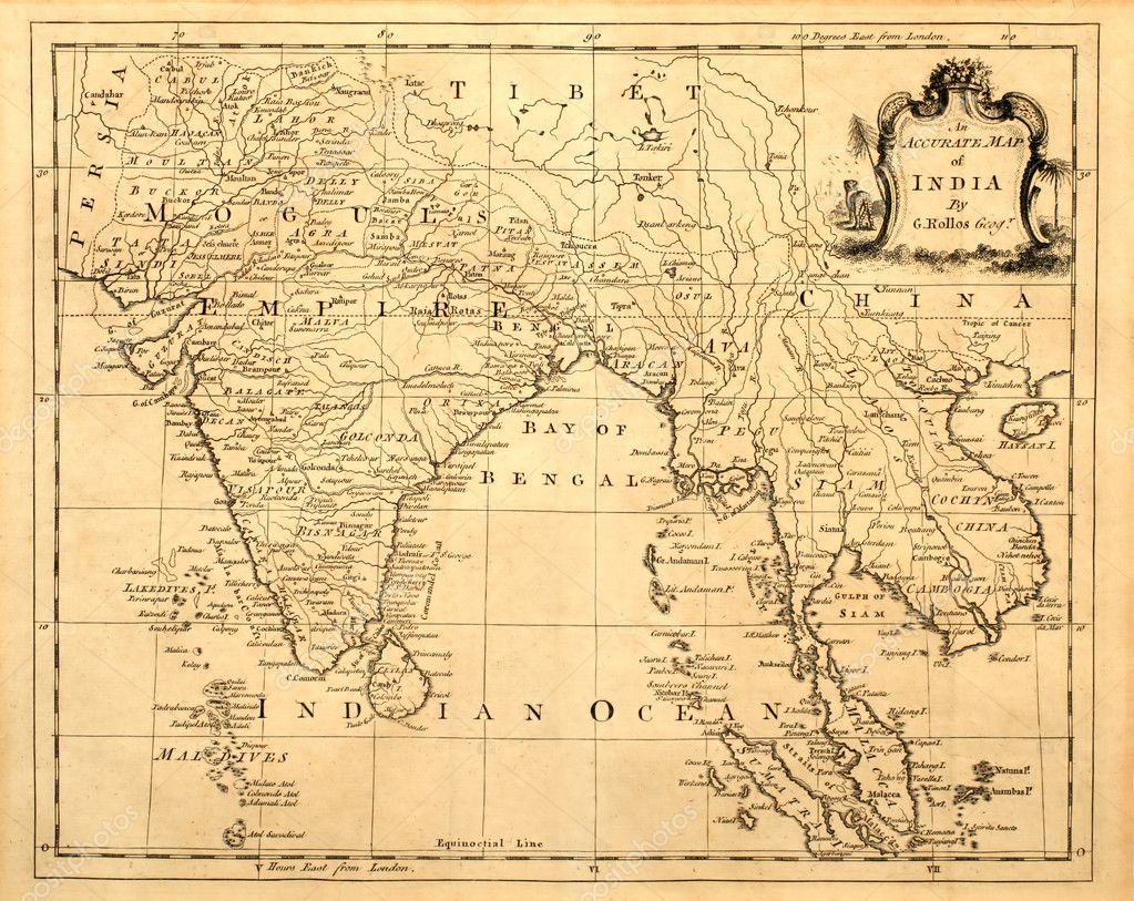
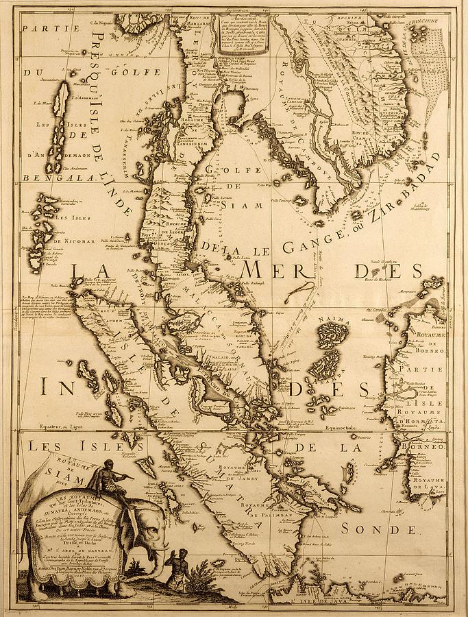
Bản đồ Việt nam xưa
1535
1574

1576

1598
1598


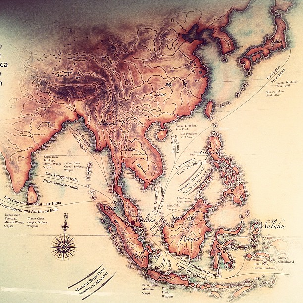
Portuguesee map of SouthEast Asia in the 17th century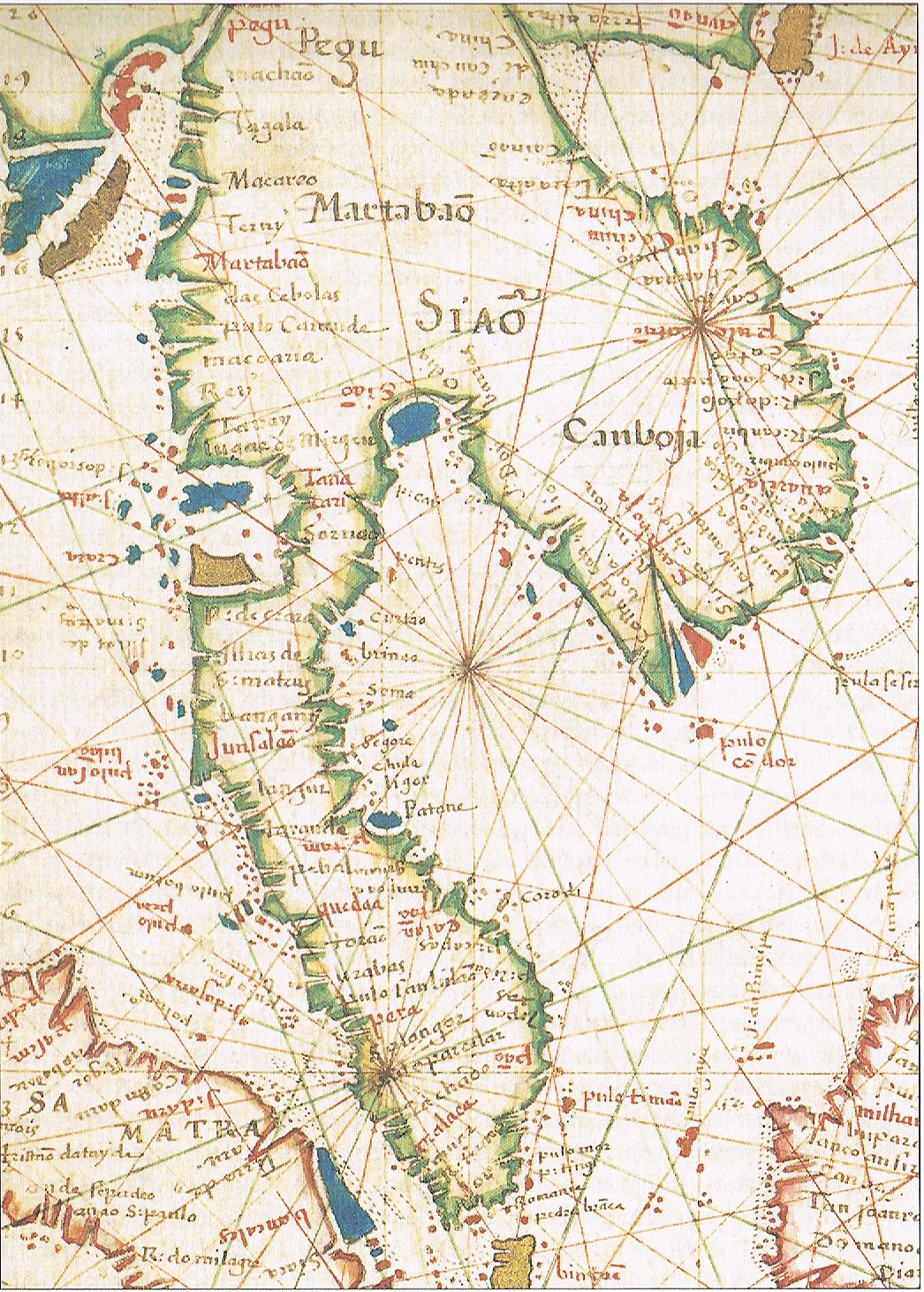


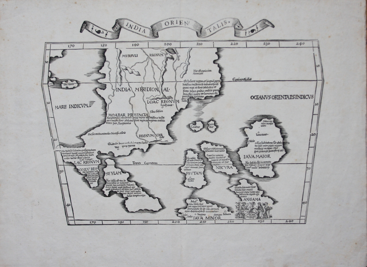
1603

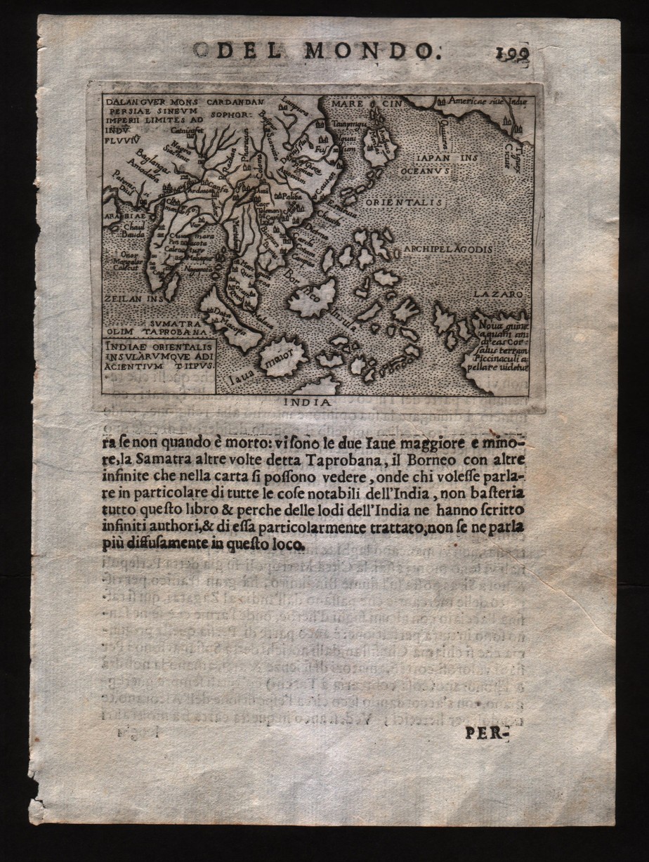
1Jodocus, Hondius “Insular Southeast Asia”, Mainland Southeast Asia orientals, 1606, p 196
Remarks: Cofta de Pracel belongs to Cochinchina.


Map by Jodocus Hondius in 1613
![[IMG]](http://www.quocphonganninh.edu.vn/Portals/0/Pictures/Gallery/Lichsuvn/phathien56bando1.jpg)
Remarks: Cofta de Pracel has belonged to Cochinchina
2 Indes, Petrus Placius, 1594. This example was published by J. Vischer, 1617
Thomas Suarez “Early Mapping of Southeast Asia” Periplus Editions (HK),Ltd., Hongkong, 1999, p.174

1632

1633

1635

Map by W. Blaeu in 1645
![[IMG]](http://www.quocphonganninh.edu.vn/Portals/0/Pictures/Gallery/Lichsuvn/phathien56bando2.jpg)
1649
Map of Annam drafted by Alexandre de Rhodes. "Cua han" appears along the coast (upside-down, left of centre). in 1650

1654

Map by Visscher in 1680
![[IMG]](http://www.quocphonganninh.edu.vn/Portals/0/Pictures/Gallery/Lichsuvn/phathien56bando5.jpg)
1683

1685

1686

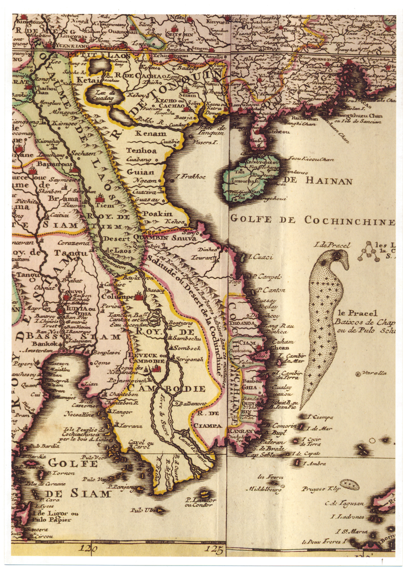
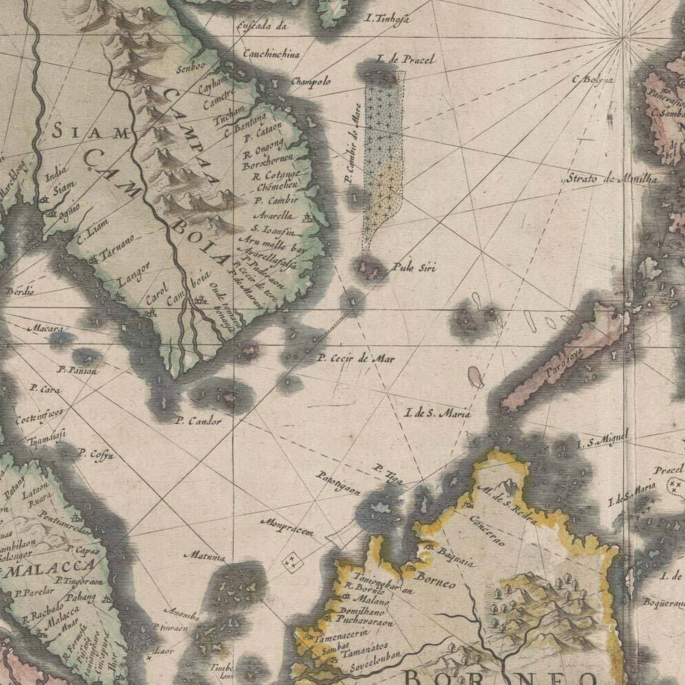
Quần đảo Hoàng Sa (Paracel), với tên gọi "Baixos de Chapar ou de Pulls Scir", tức là Bãi cát Chămpa (bãi đá ngầm), nằm trong Vịnh Cochinchine (Golfe de la Cochin Chine), phần phía đông bắc của bản đồ khu vực Đông Nam Á do Jean-Baptiste Nolin (1657-1708) vẽ xong năm 1687.

1689

1706

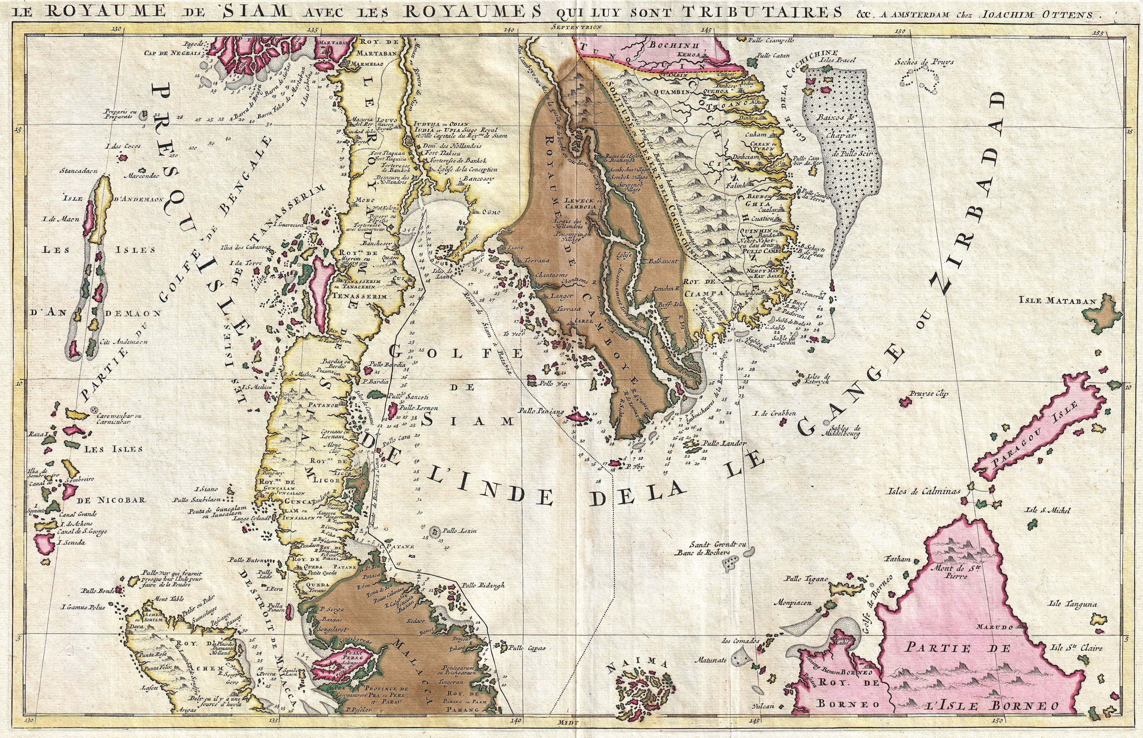
This one by Joachim Ottens in 1710
1717


1730

1734
1740
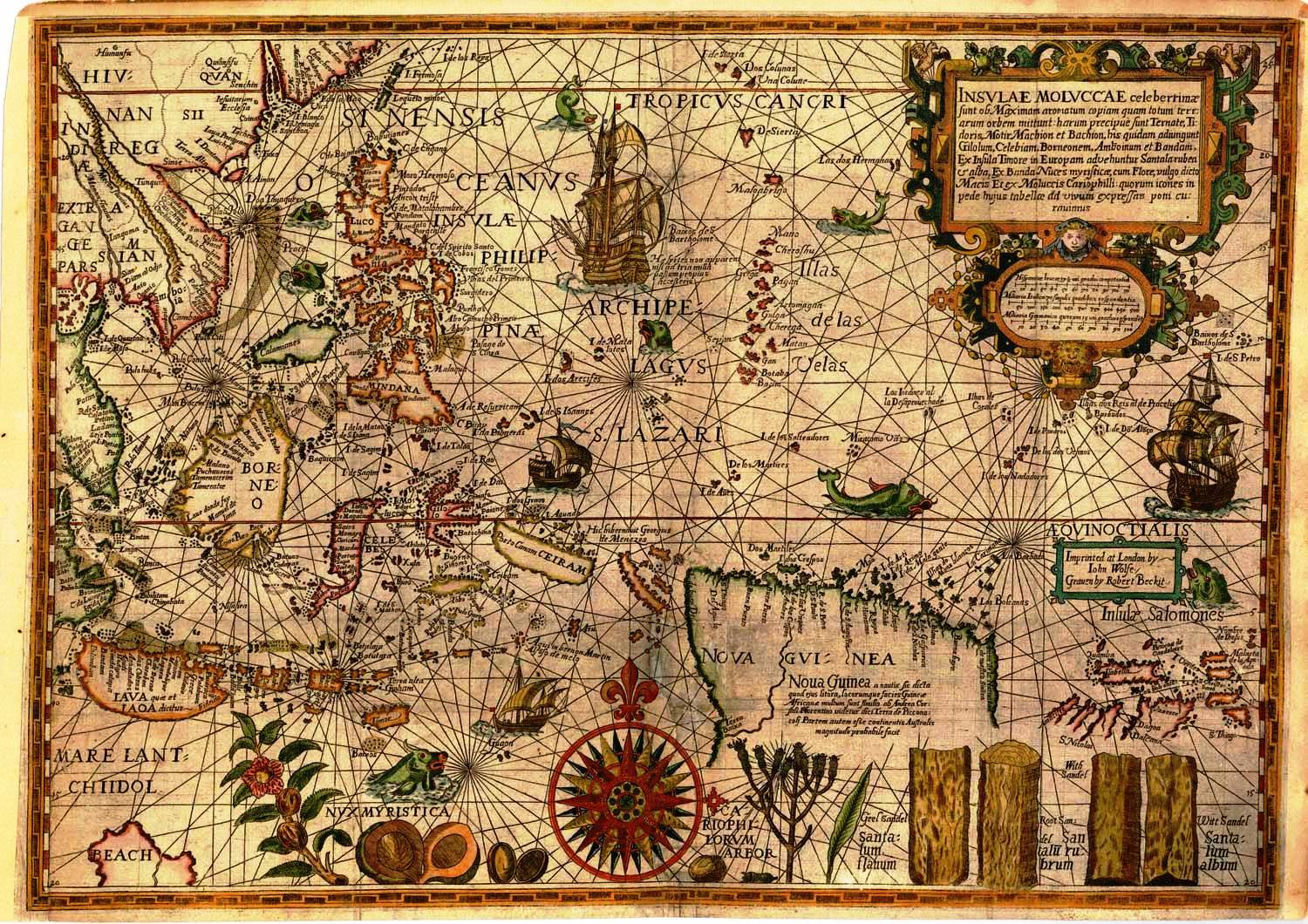
Map by Homann Heirs in 1744
![[IMG]](http://www.quocphonganninh.edu.vn/Portals/0/Pictures/Gallery/Lichsuvn/phathien56bando3.jpg)
1744

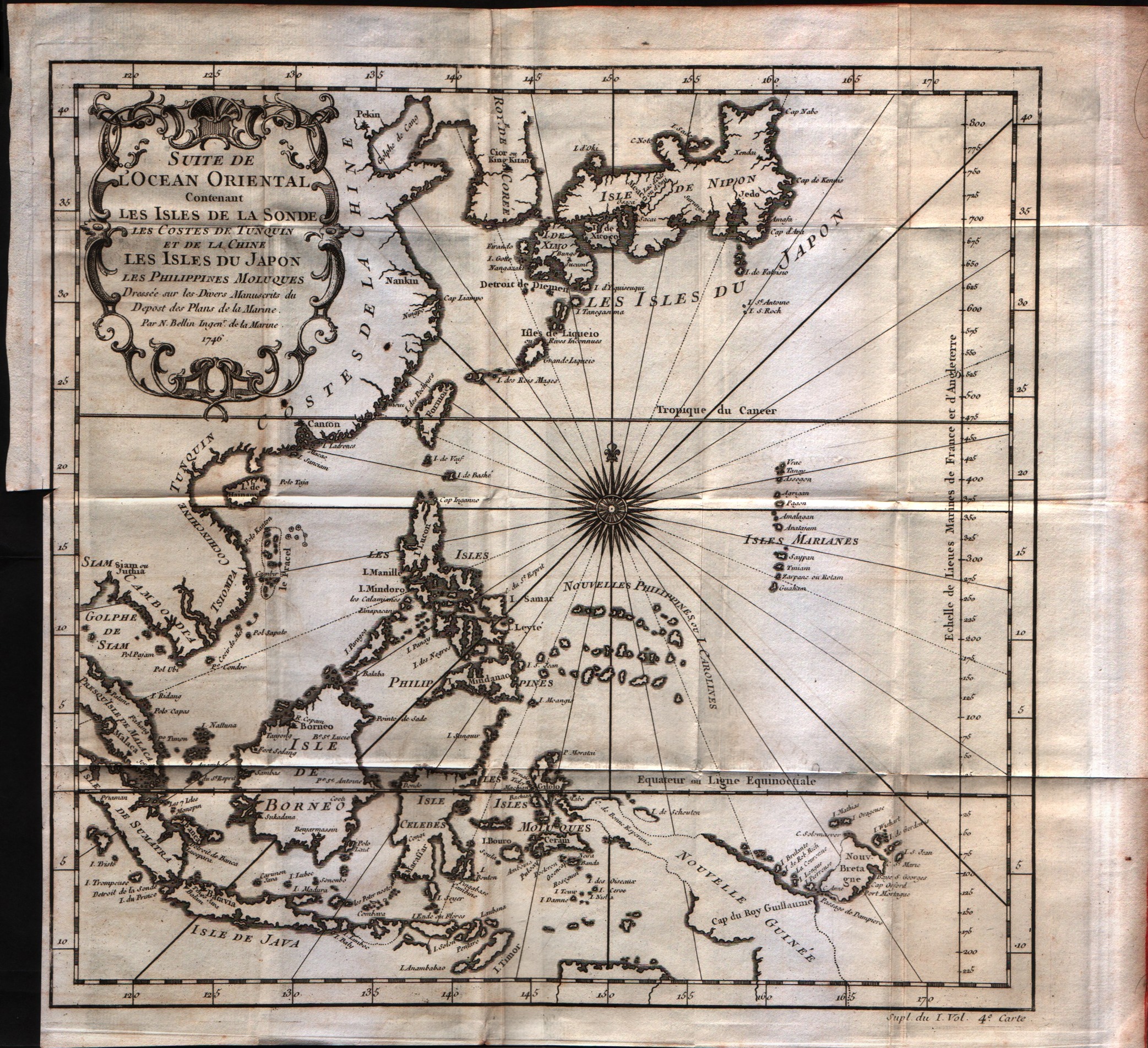
1746


1746

1748

1753

1757
1757

And this pretty boy drawn by Amsterdam's firm Covens and Mortier around 1760
![[IMG]](http://upload.wikimedia.org/wikipedia/commons/6/66/Vietnam_1760.jpg)
1760

1763

1764

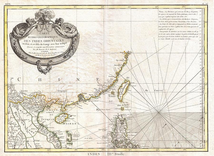
1771
1772
1772

1773
1774
1780
1784

1785

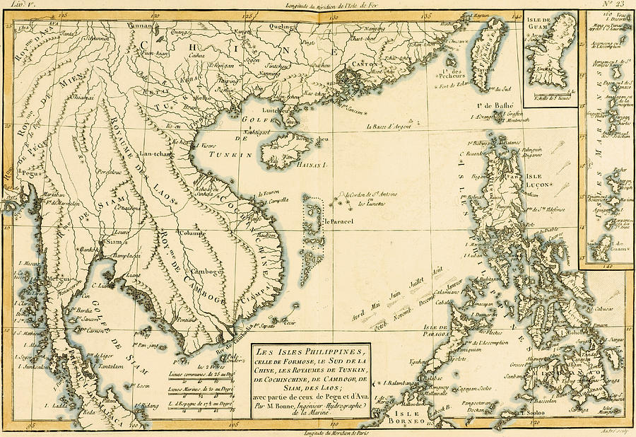
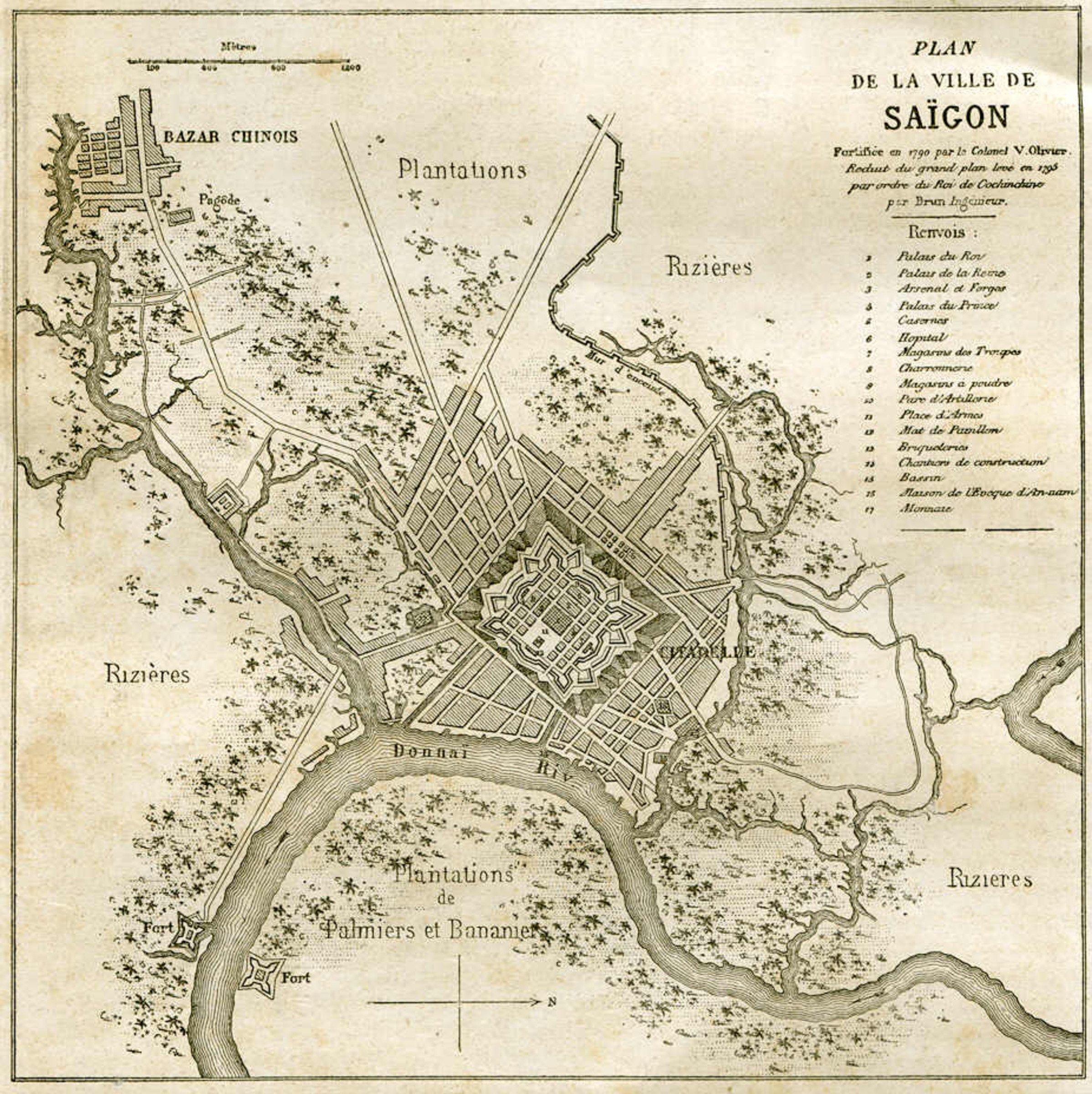
Map by Mariette in 1790
![[IMG]](http://www.quocphonganninh.edu.vn/Portals/0/Pictures/Gallery/Lichsuvn/phathien56bando6.jpg)
1790
Map of the River of Don-Nai from Cape St-James to the City of Saigon-1791

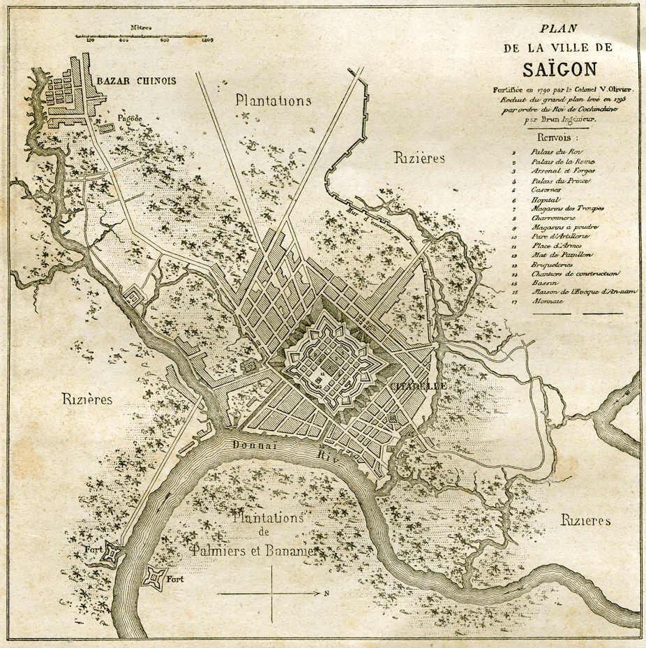
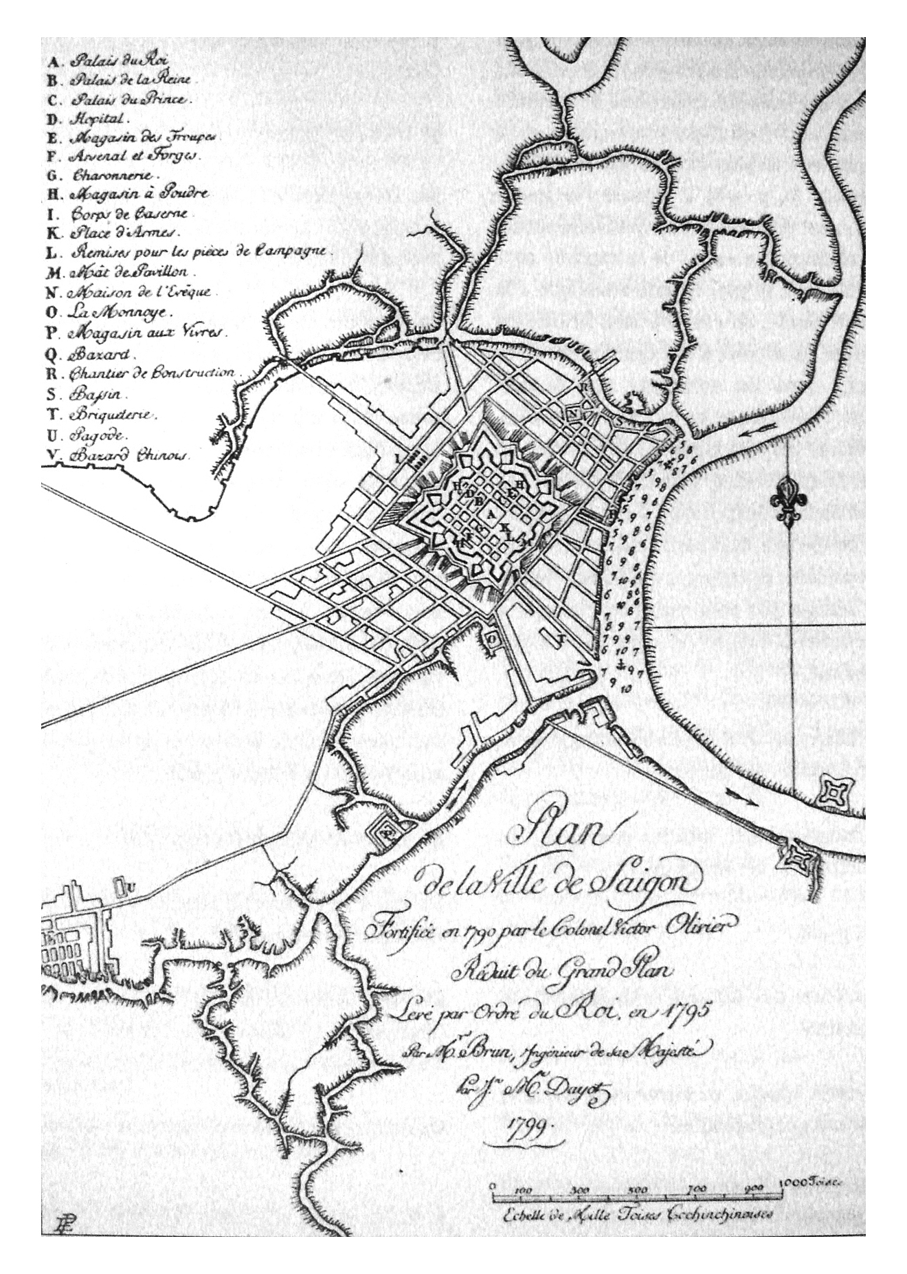
1795
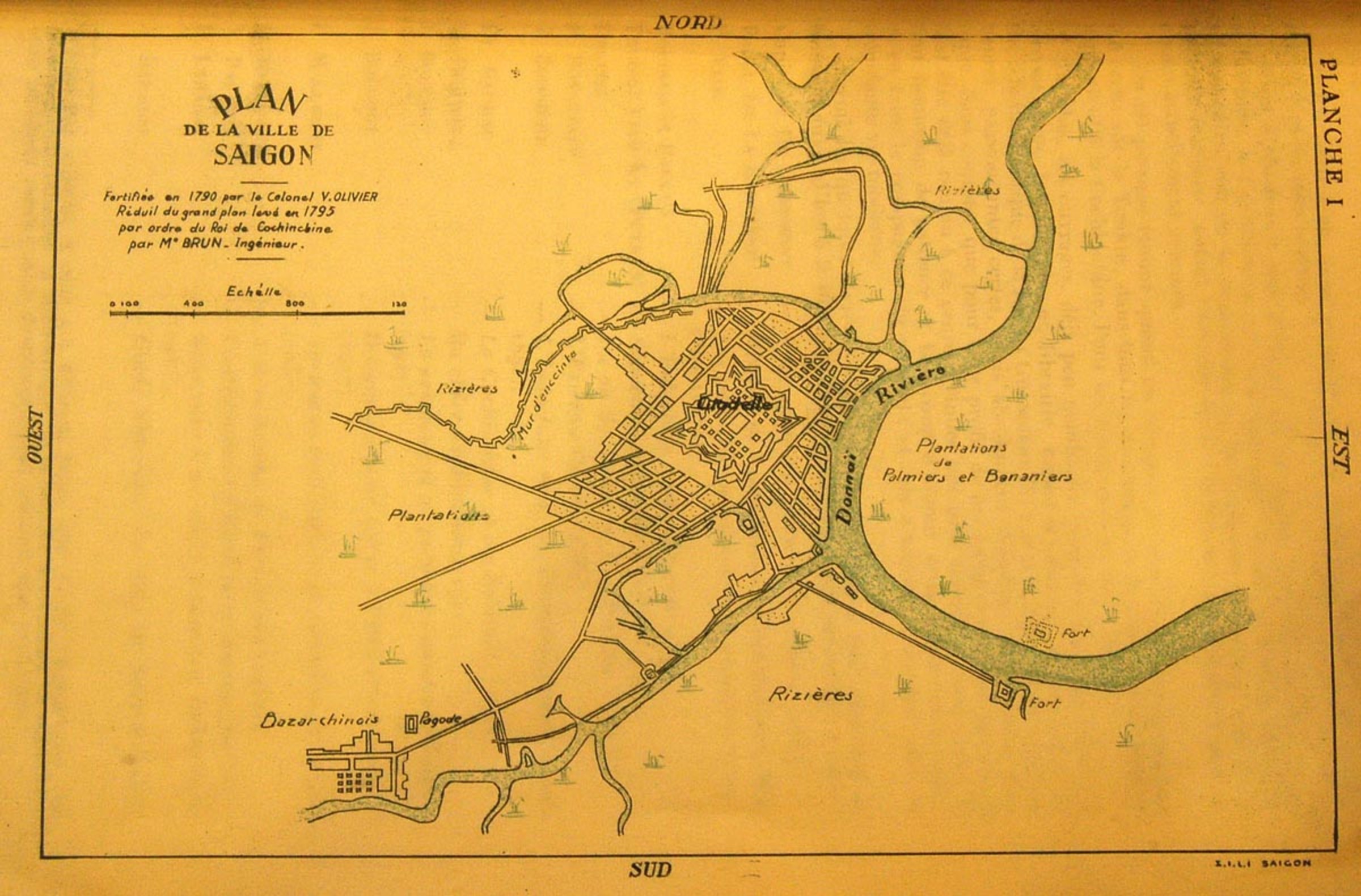
1799
1804

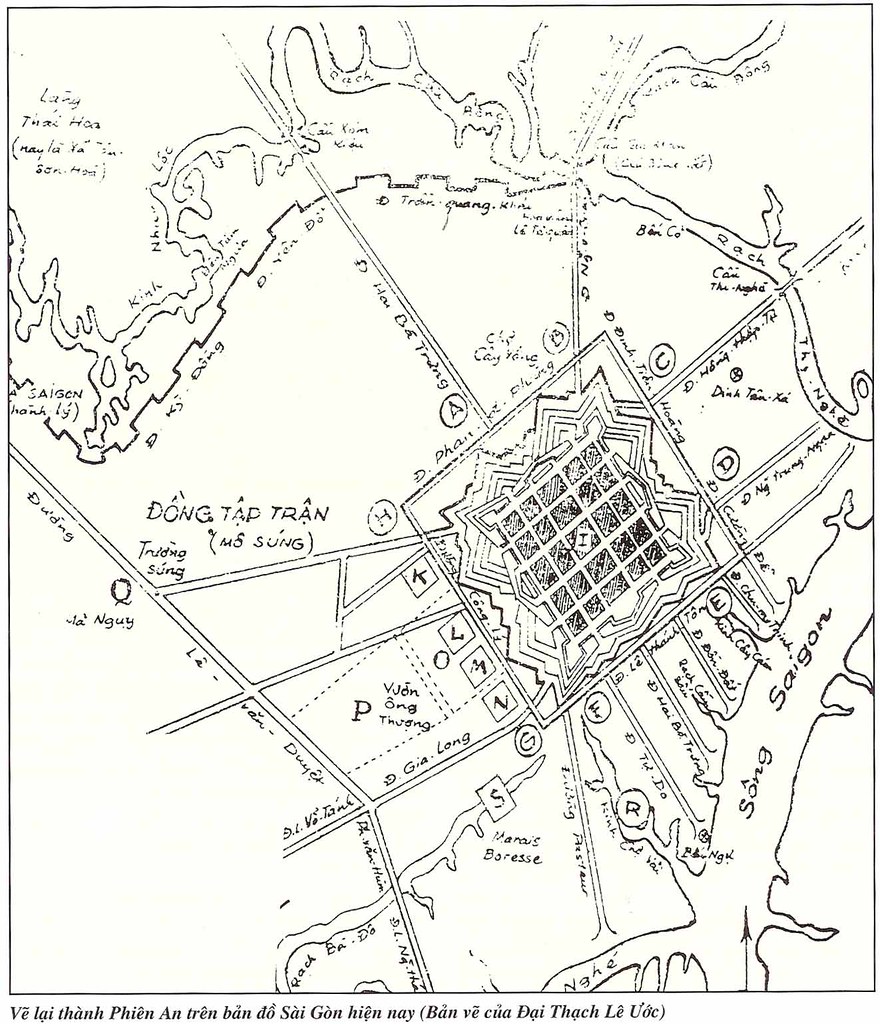
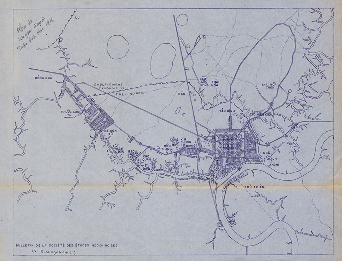
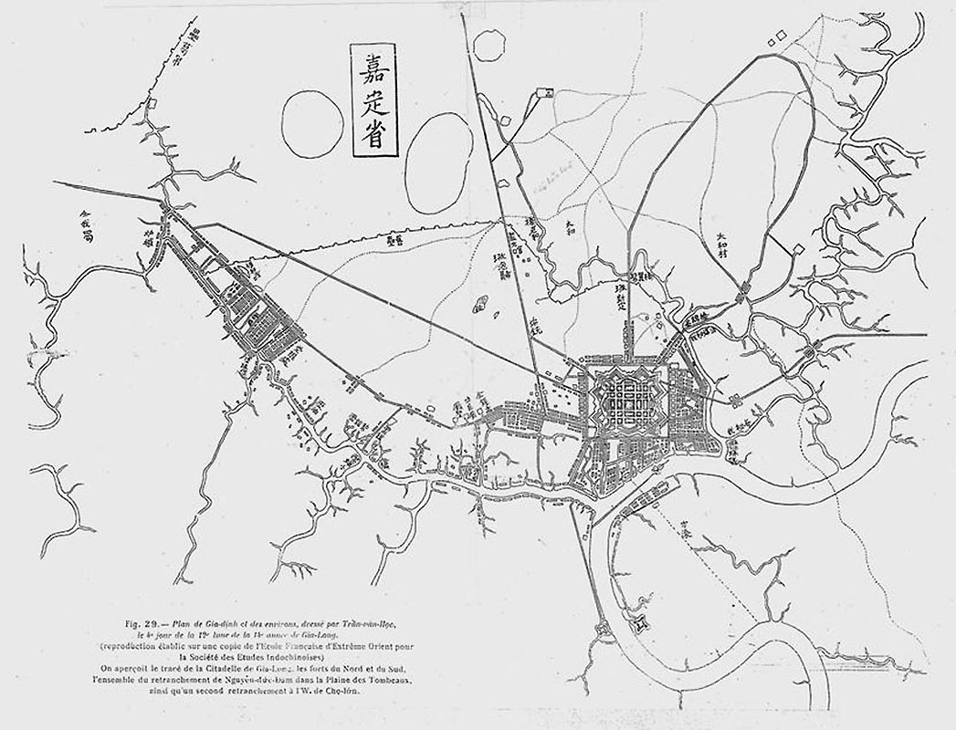
[Plan de Cholon d'après Trần Văn Học, 1815]

Plan de Gia-định et des environs, dressé par Trần-văn-Học, le 4e jour de la 12e lune de la 14e année de Gia-Long-1815

1816
1817
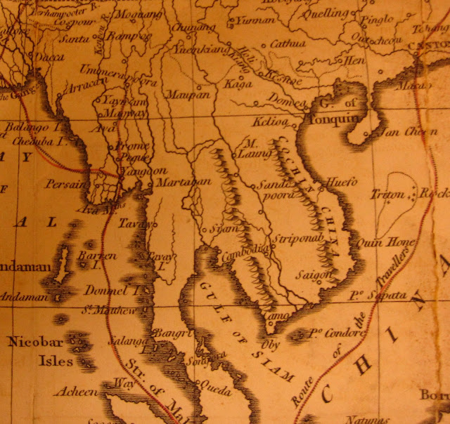
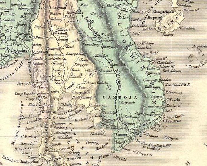
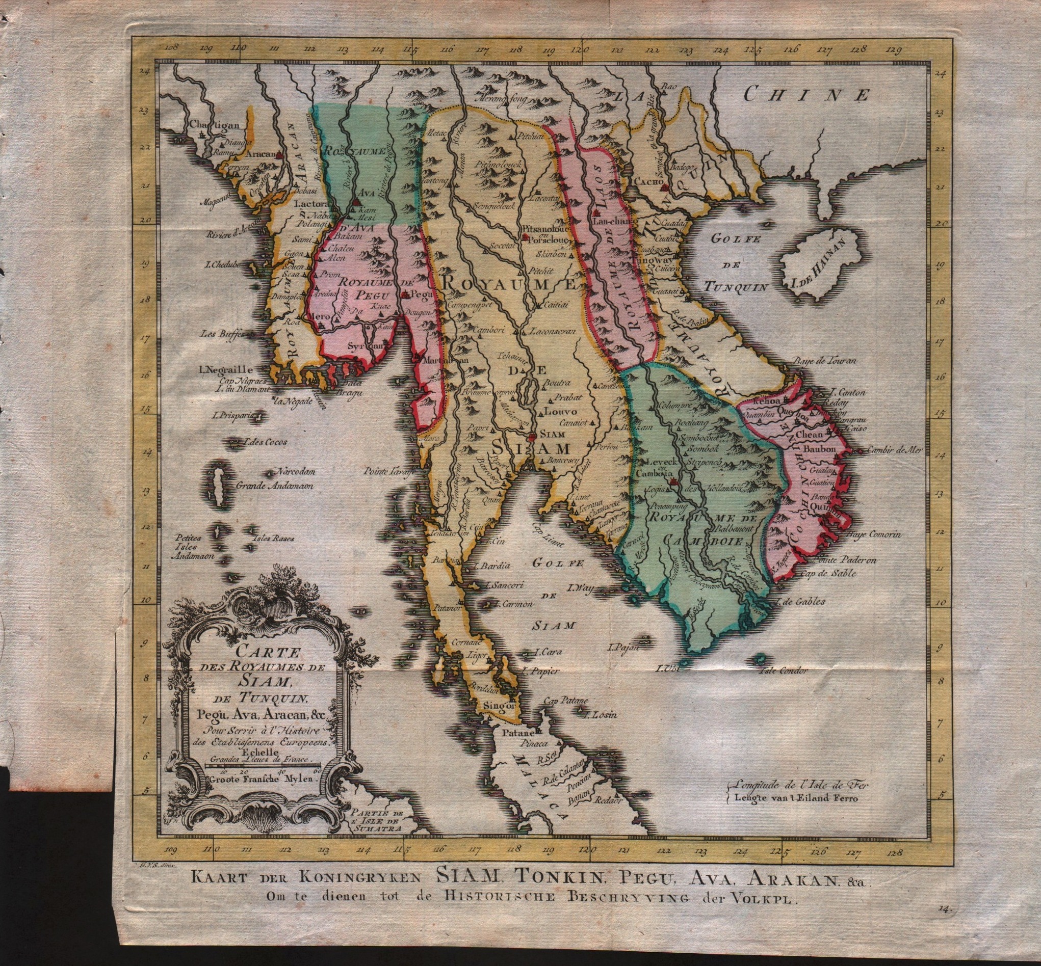
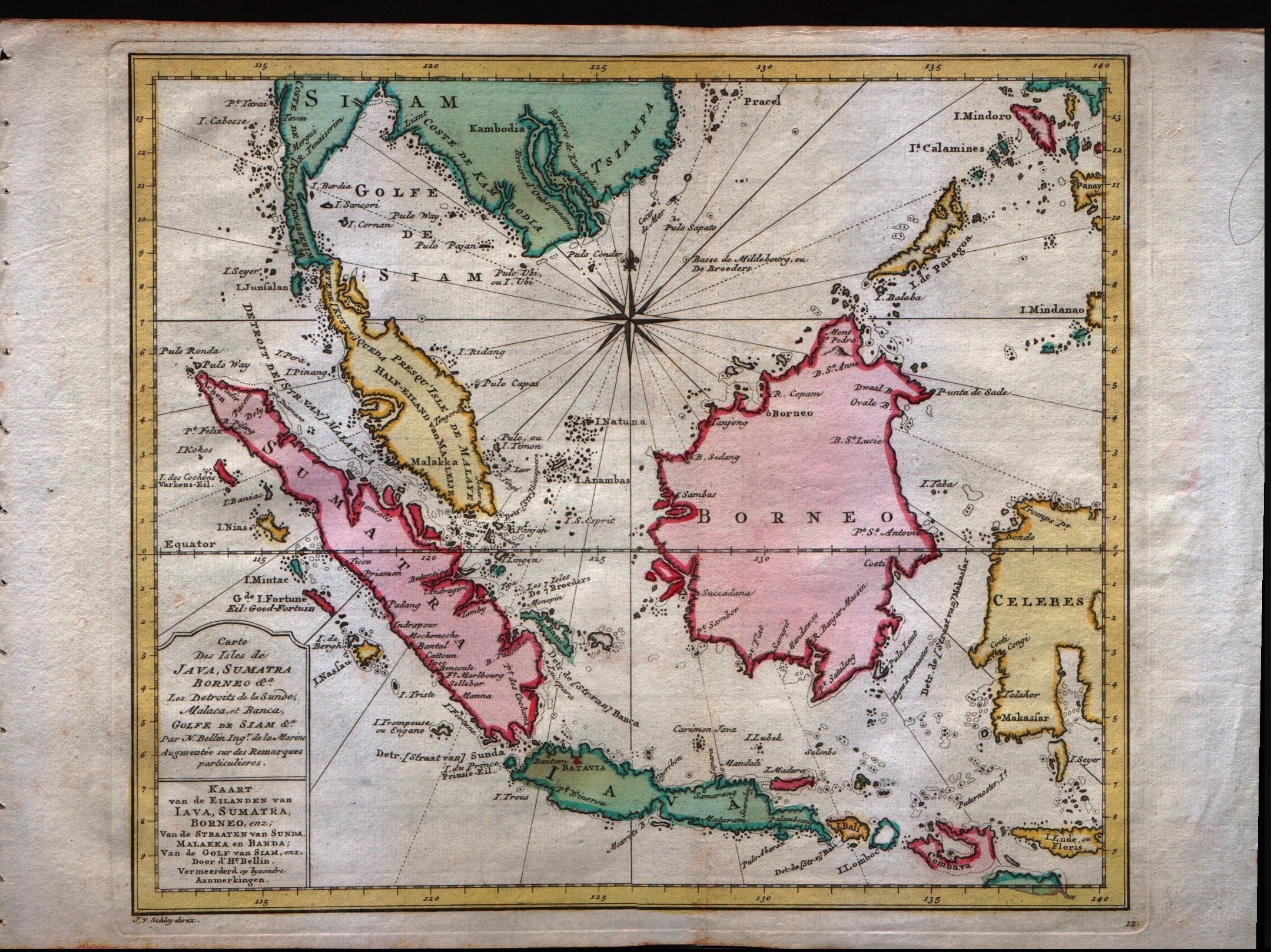
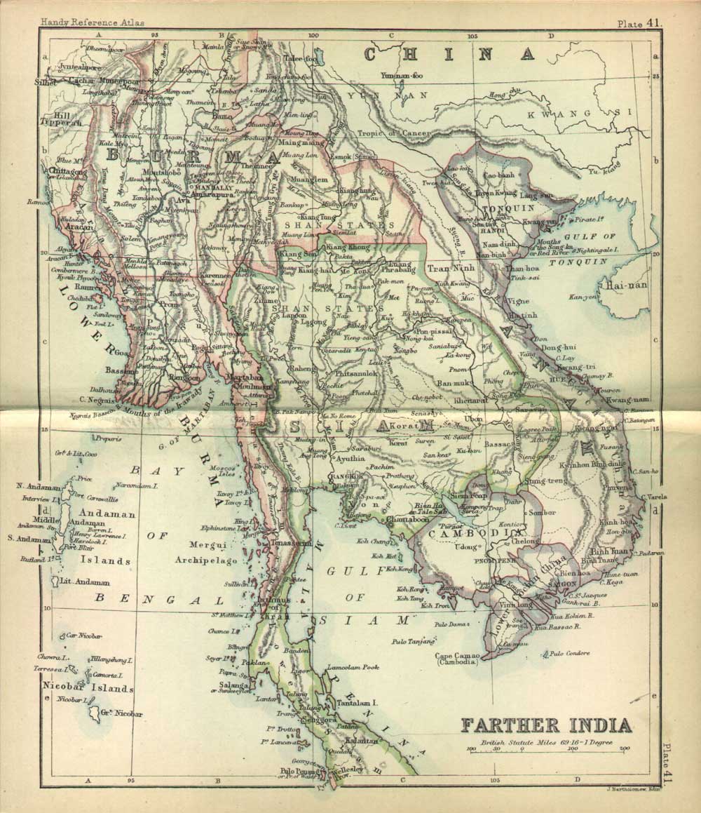
Birmah, Siam, and Anam (1826)

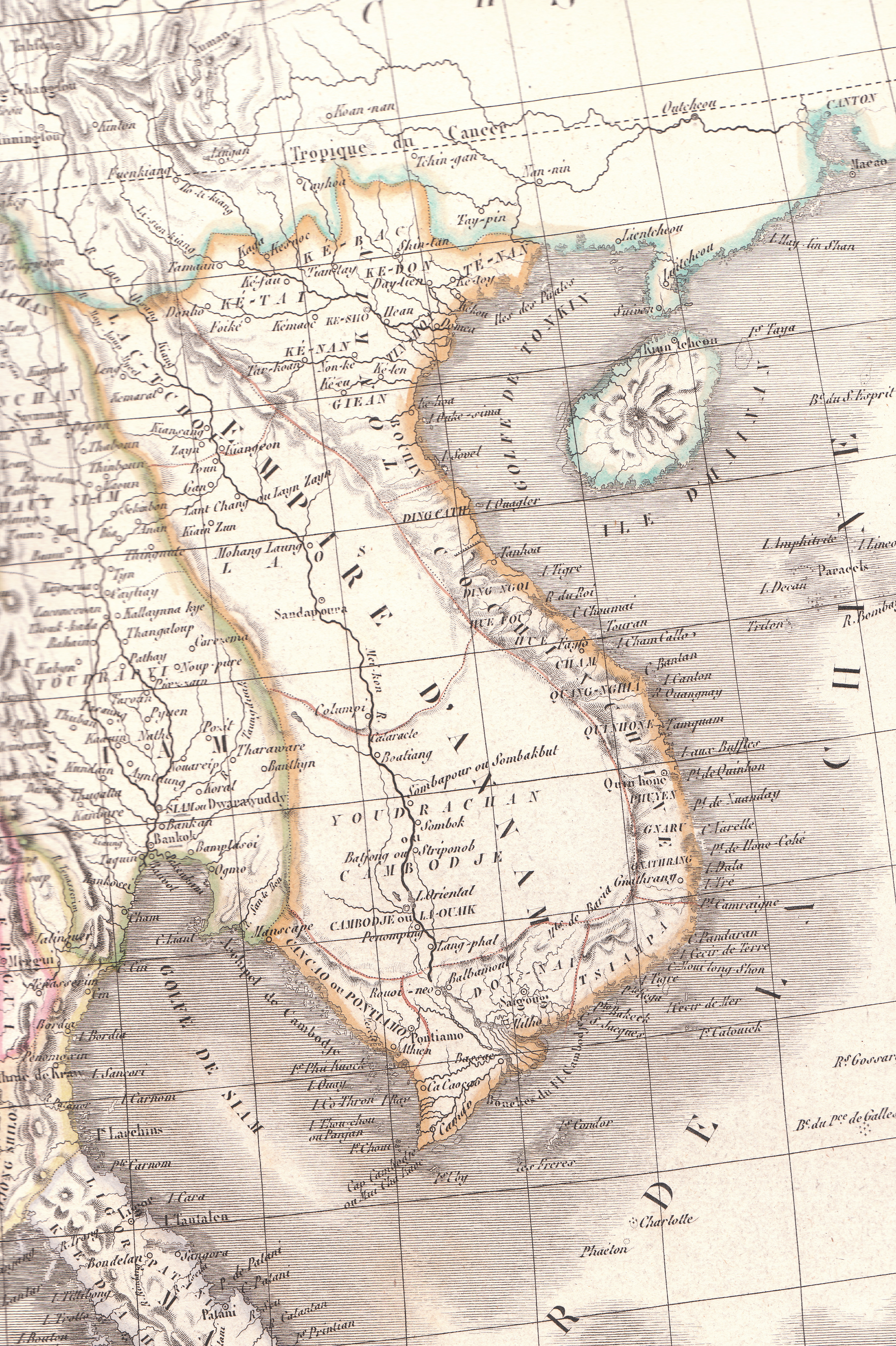
Bản đồ cương vực Việt Nam năm 1829
Empire d'Annam (Đại Nam map)
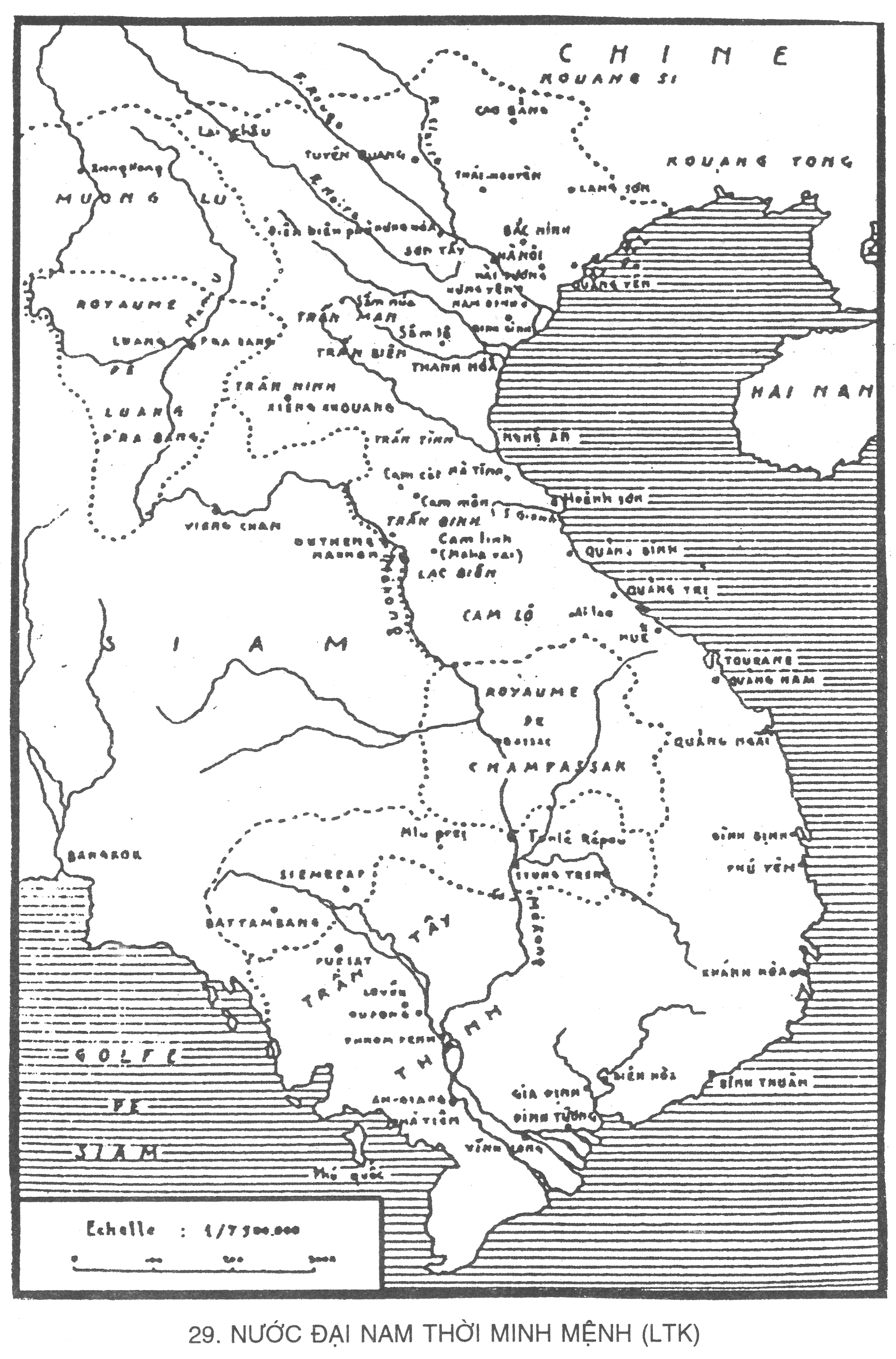
Việt Nam dưới thời Minh Mạng (Bảnđồ Lê Thành Khôi)
1831

Đại Nam Nhất thống toàn đồ 1834

1838

"An Nam Đại Quốc Họa Đồ" do giáo sĩ Jean-Louis Taberd vẽ vào triều vua Minh Mạng, in lại trong sách Dictionarium Latino-Annamiticum completum et novo ordine dispositum (Từ điển Việt-La) năm 1838.


1843

1843
1850

1852

1853

1853

1855

1855
1855

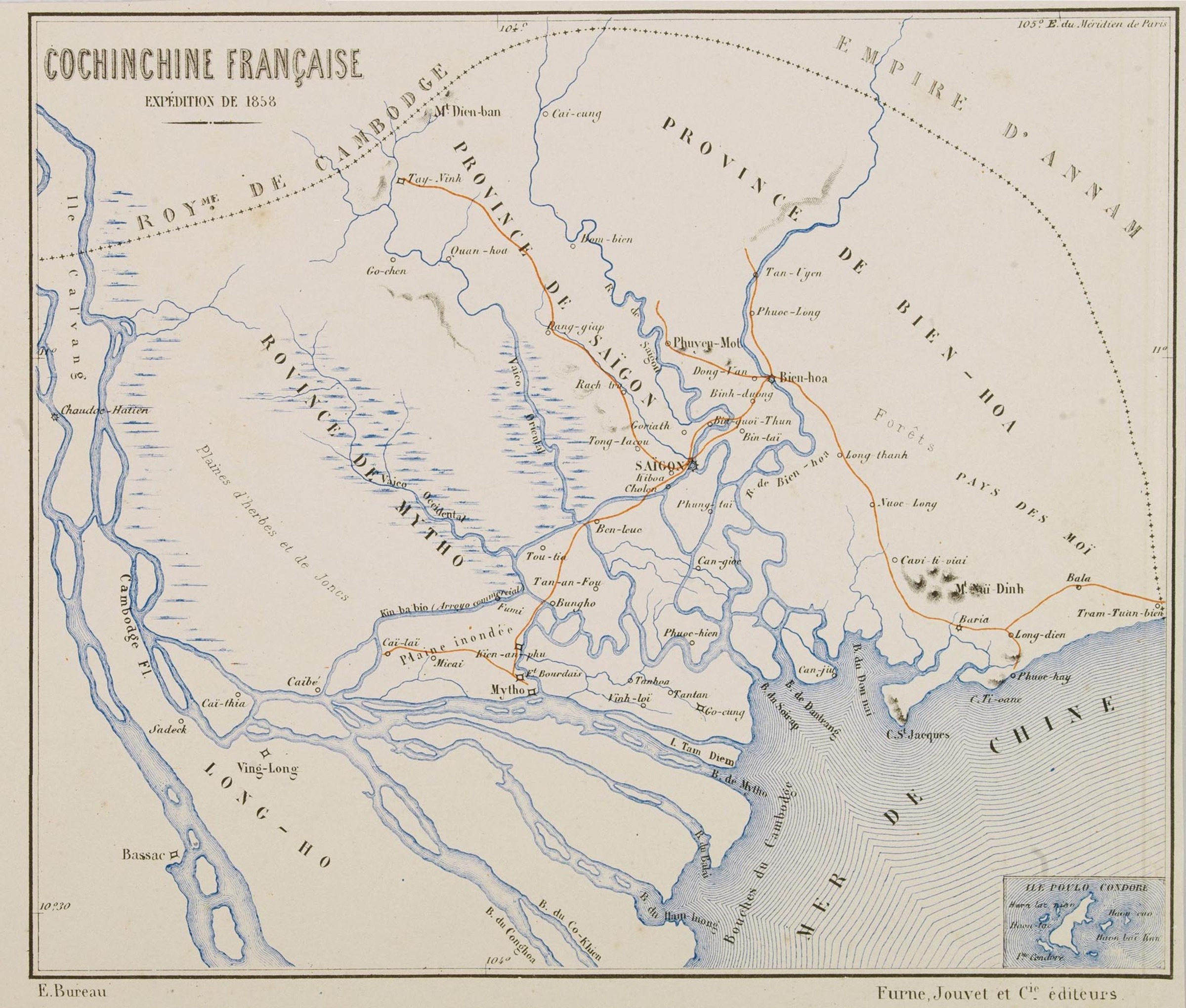
Cochinchine française. Expédition de 1858
1960
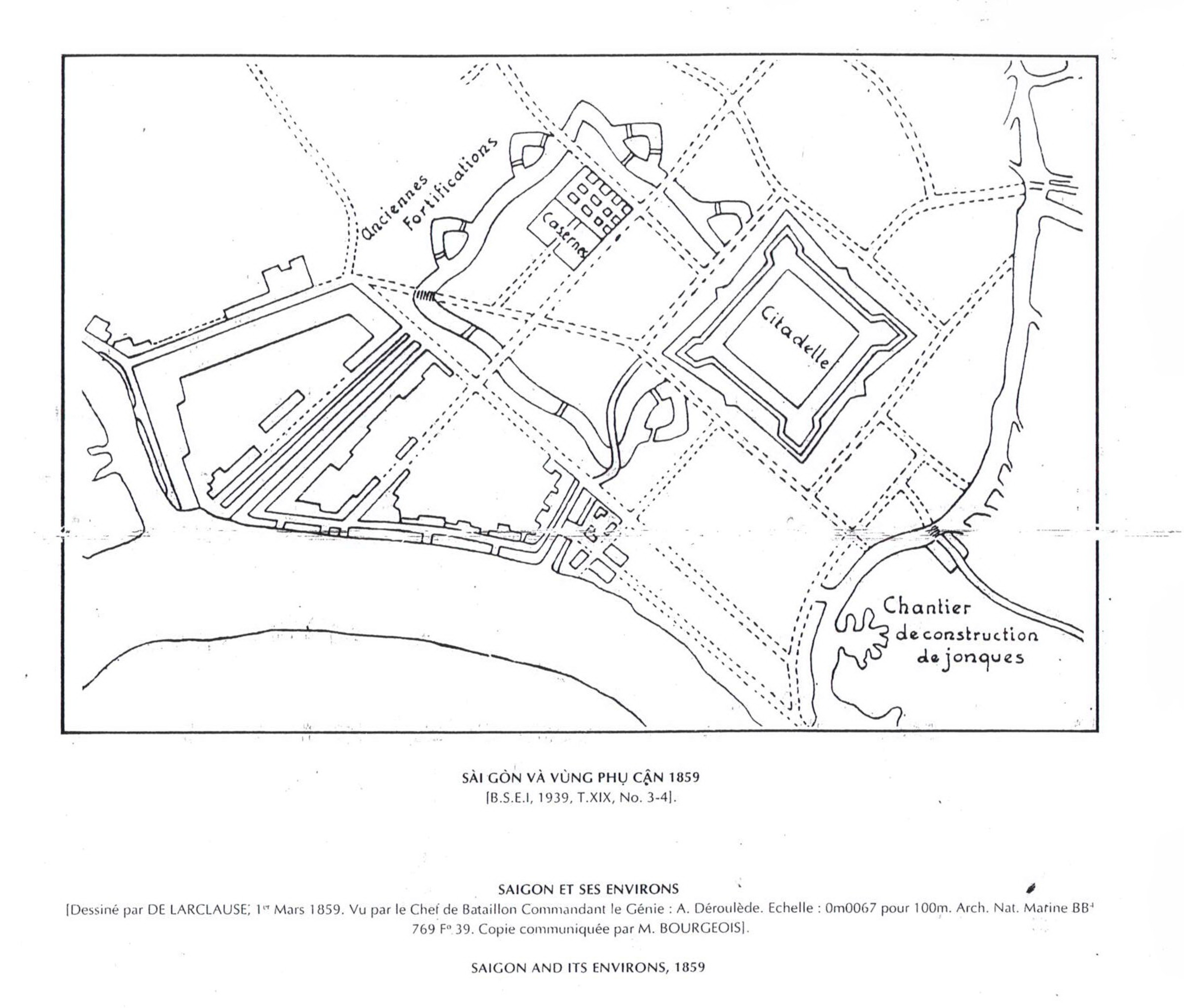
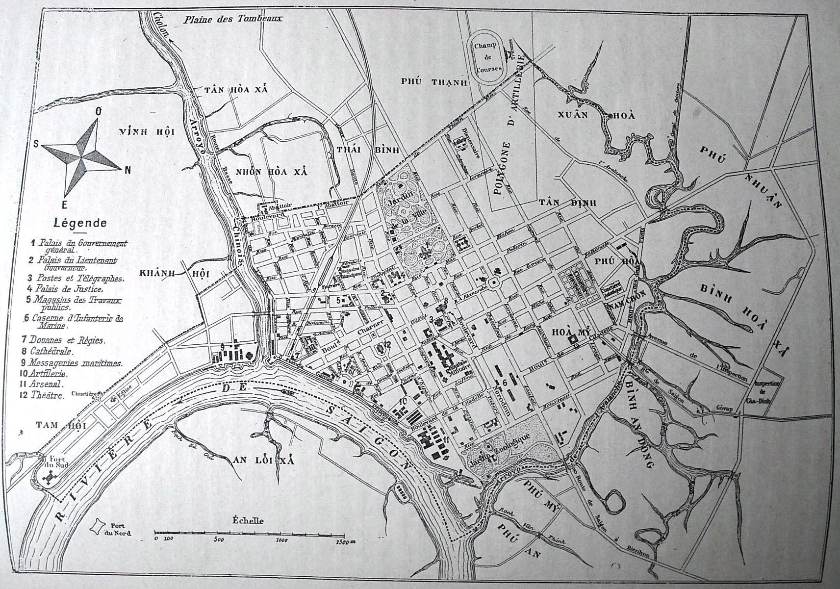
Plan de la ville de Saïgon-1860
Projet pour une ville de 500 000 âmes-1862

1864

1865

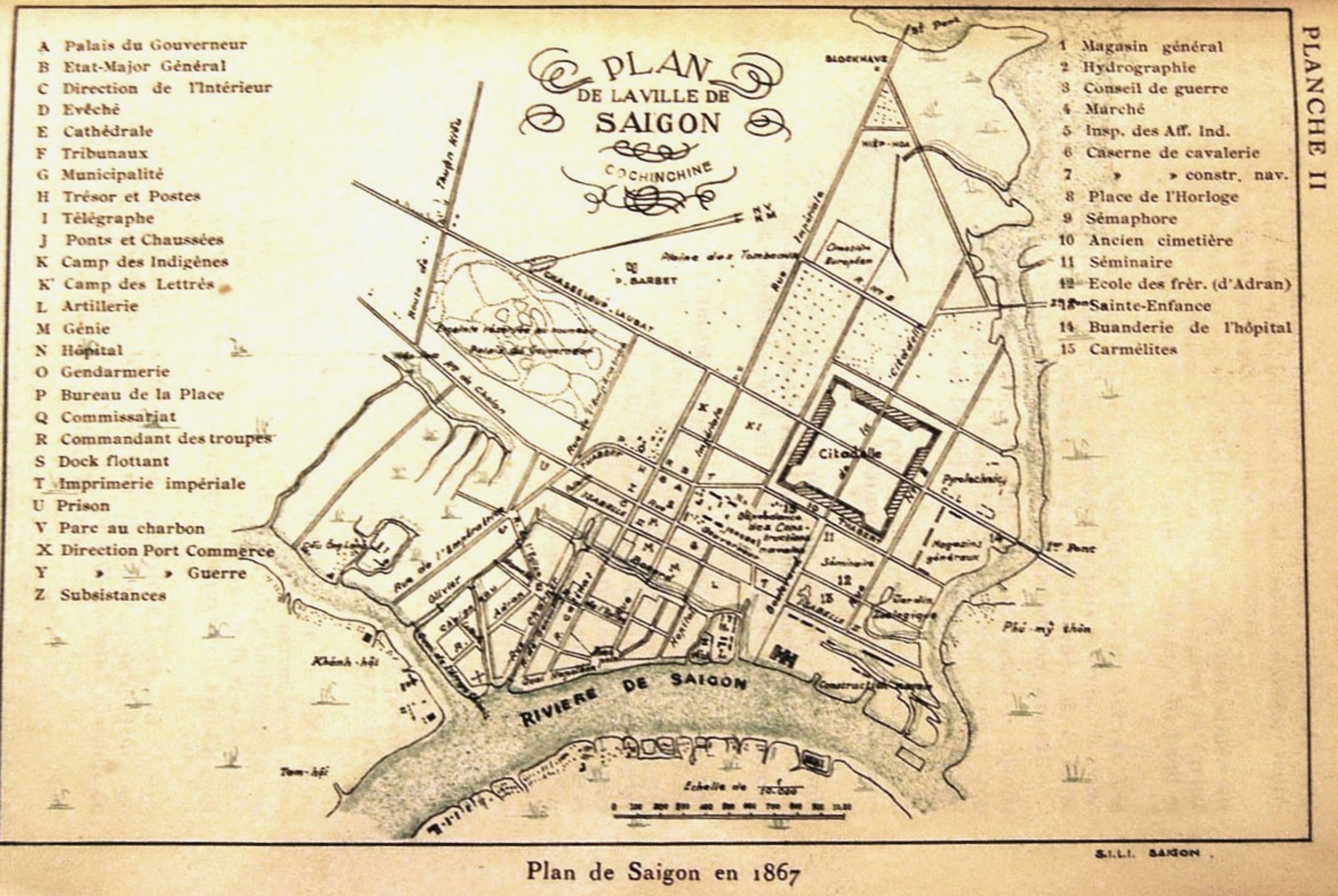
1867

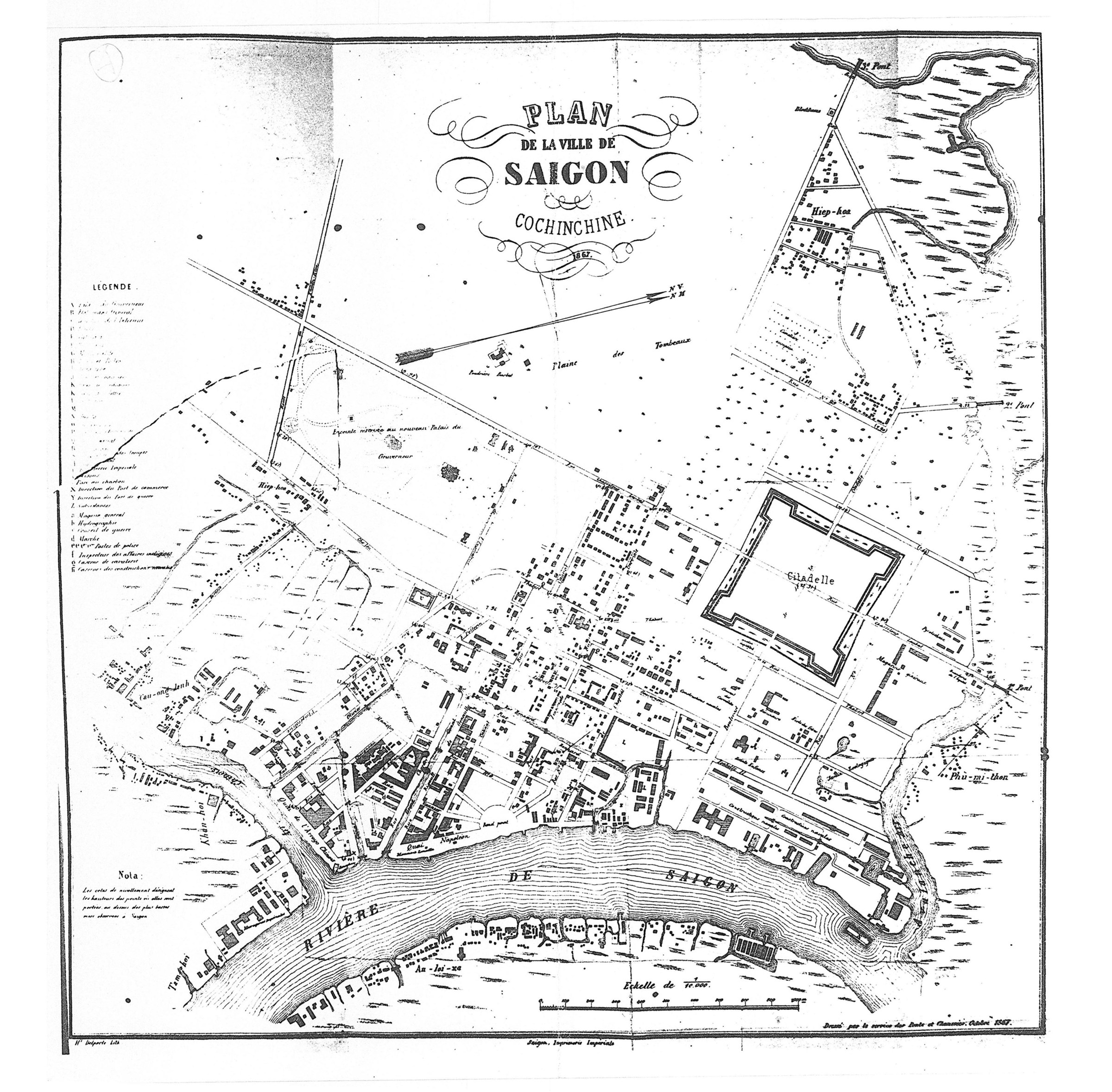
Plan de la ville de Saigon. Cochinchine 1867 - Publisher: Imprimerie impériale Dressée par le service des Ponts et Chaussées, octobre 1867
1870
1872

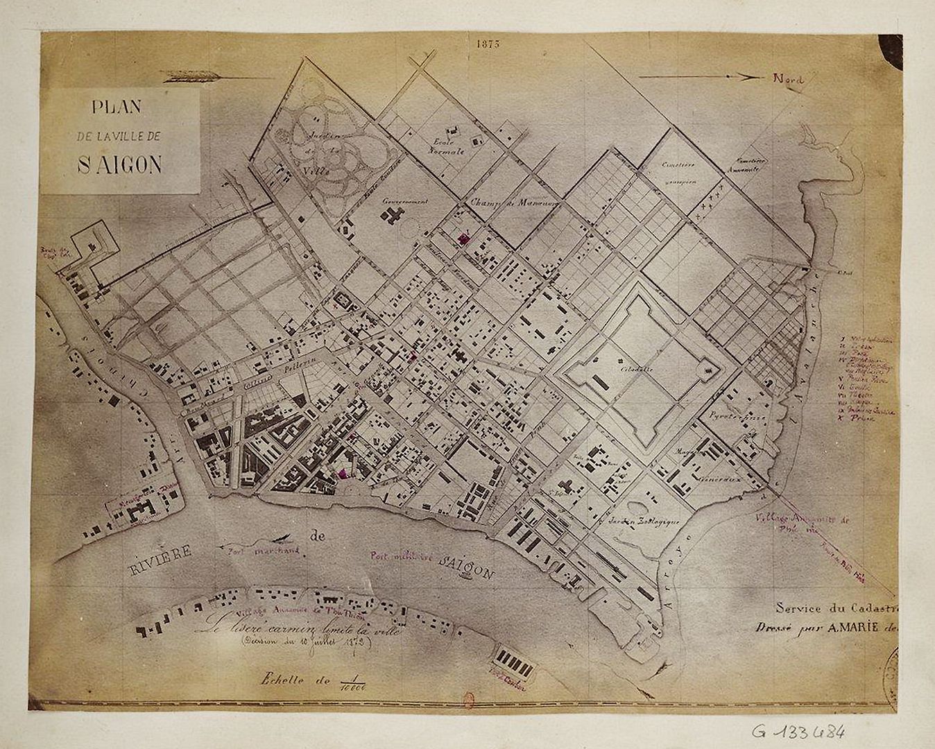
1873
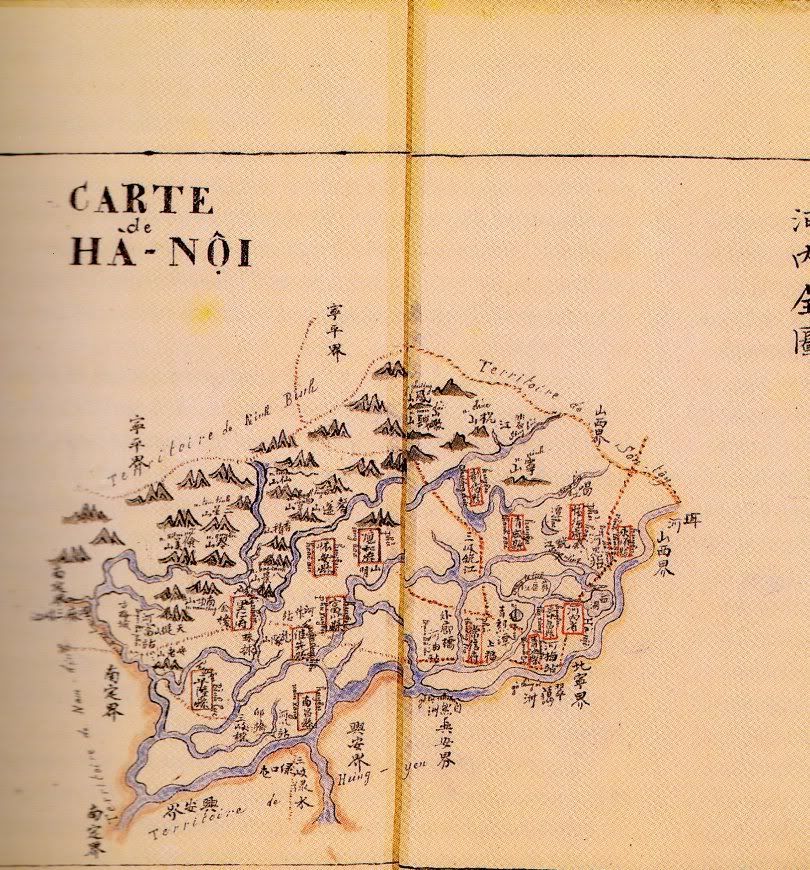
Plan de Hanoi Plan de 1875, collection Pineau, Cité de l'architecture, Paris
1875

1878
1885
1885
1885
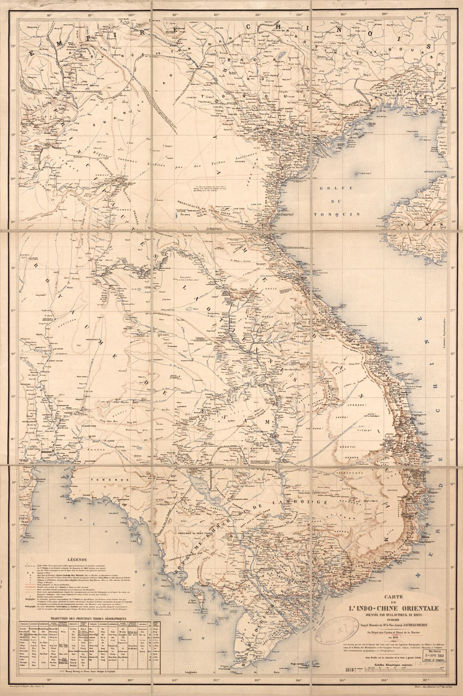
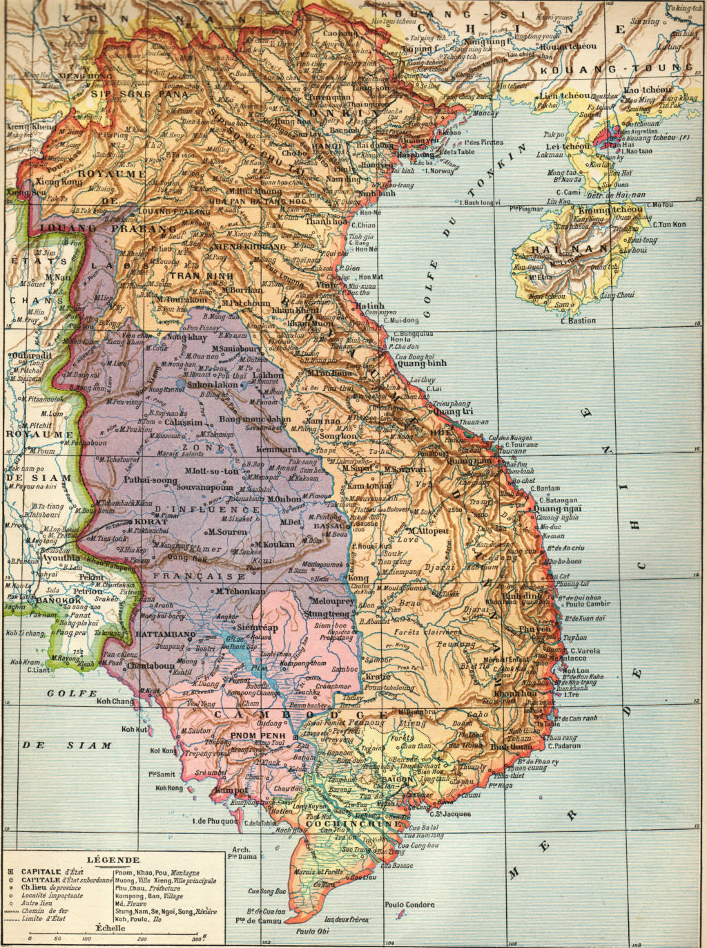
Carte de l'Indo-Chine Orientale (détail, Sud Vietnam)-1881
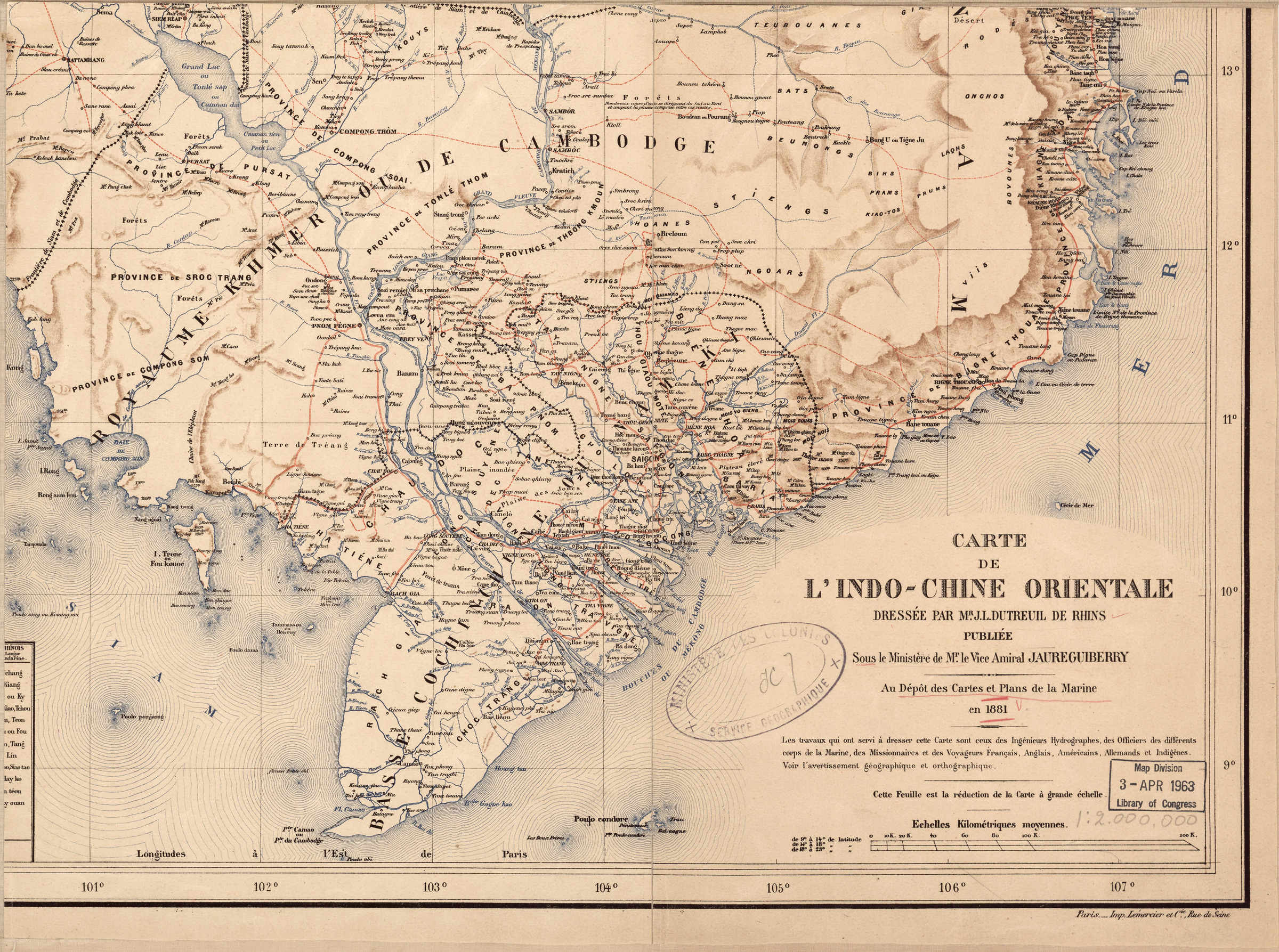
Carte de l'Indo-Chine Orientale-1881
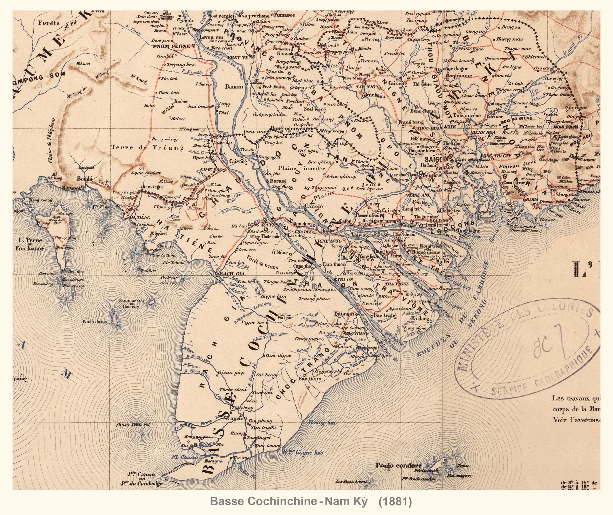
Carte de l'Indo-Chine Orientale (détail, Basse Cochinchine)-1881
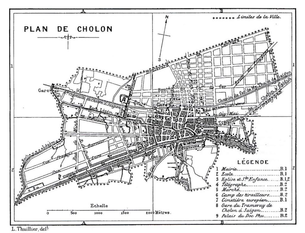
Cochinchine française. Plan topographique de l'arrondissement de Cholon-1882

Cochinchine française. Plan topographique. 20eme arrondissement et ses environs-1882

Cochinchine française. Plan cadastral de la ville de Saigon-1882

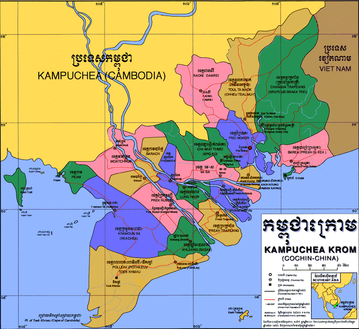
Kampuchea Krom or Cochinchina becomes part of French Indochina on October 17, B.E.2431, A.D.1887.
1887

English intercourse with Siam in the seventeenth century (1890)

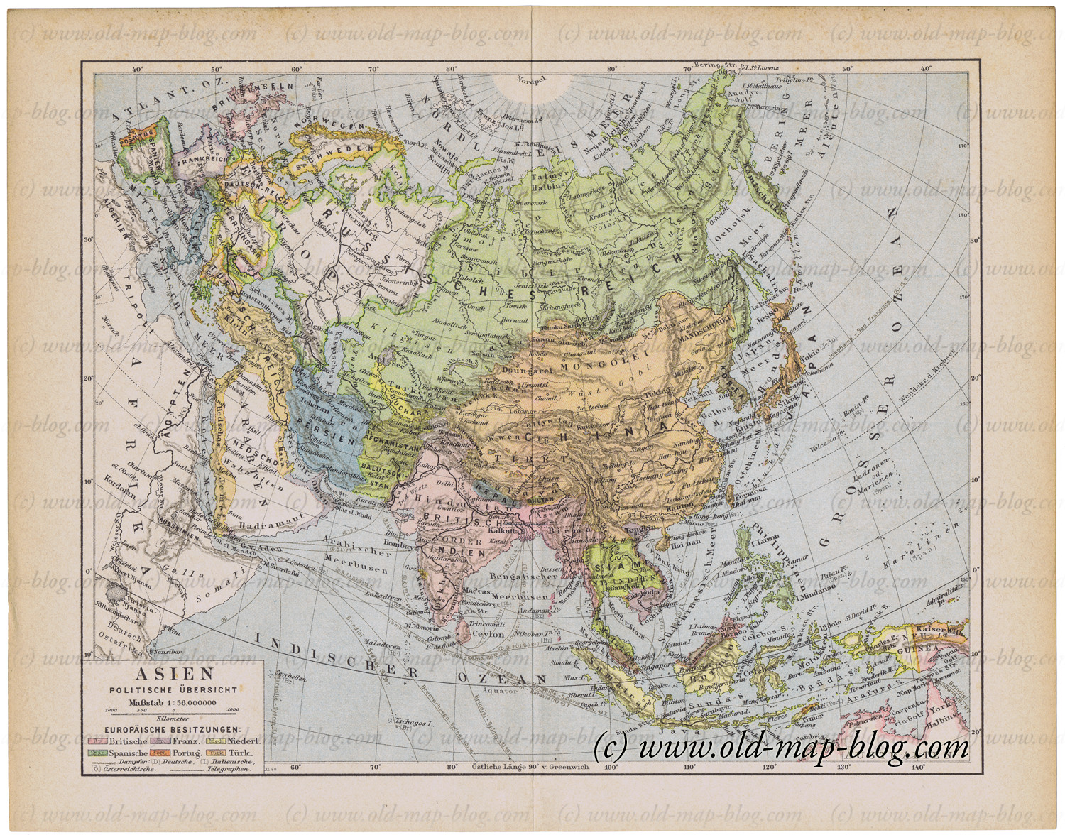
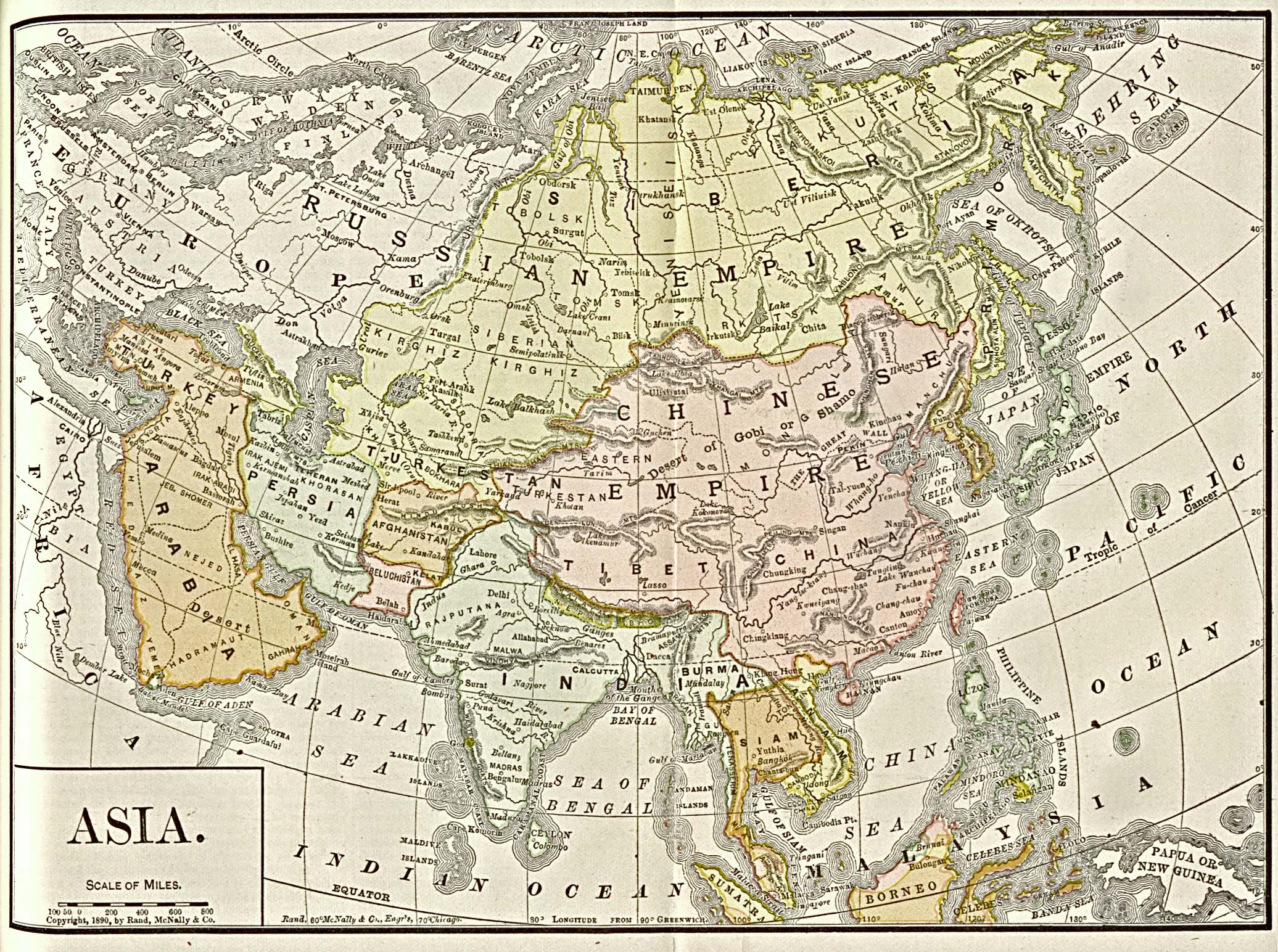
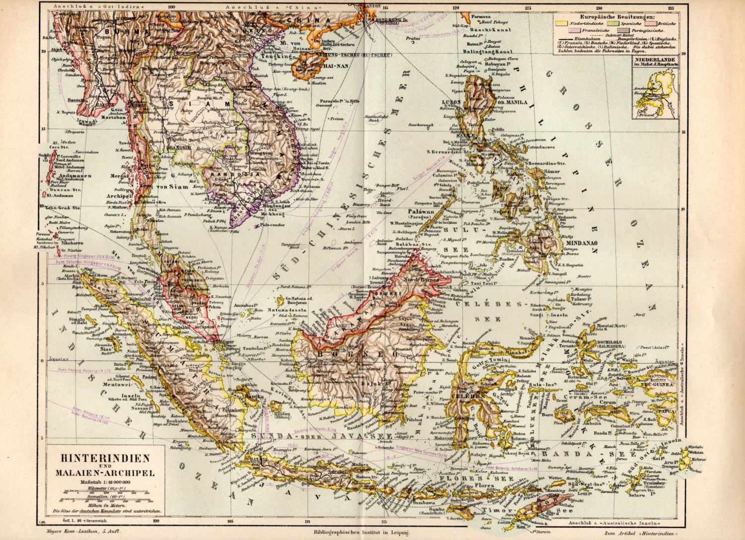
asia_1892
1893
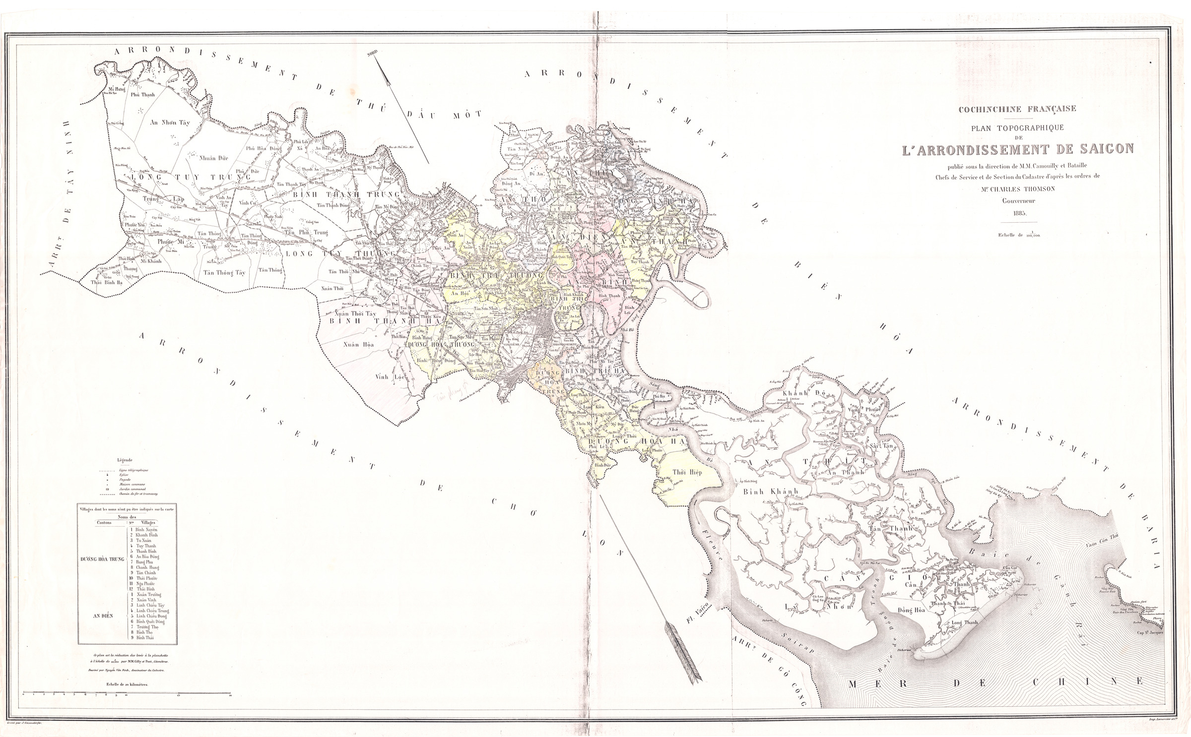
Cochinchine française. Plan topographique de l'arrondissement de Saigon-1885
1886

1892
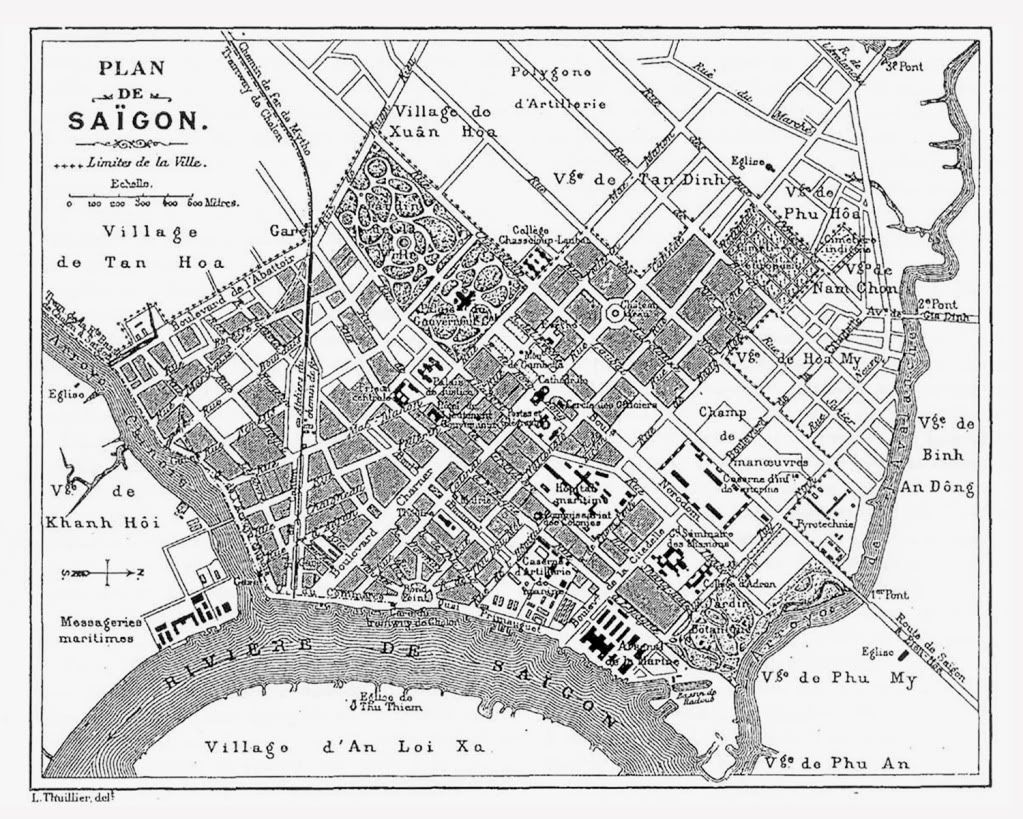
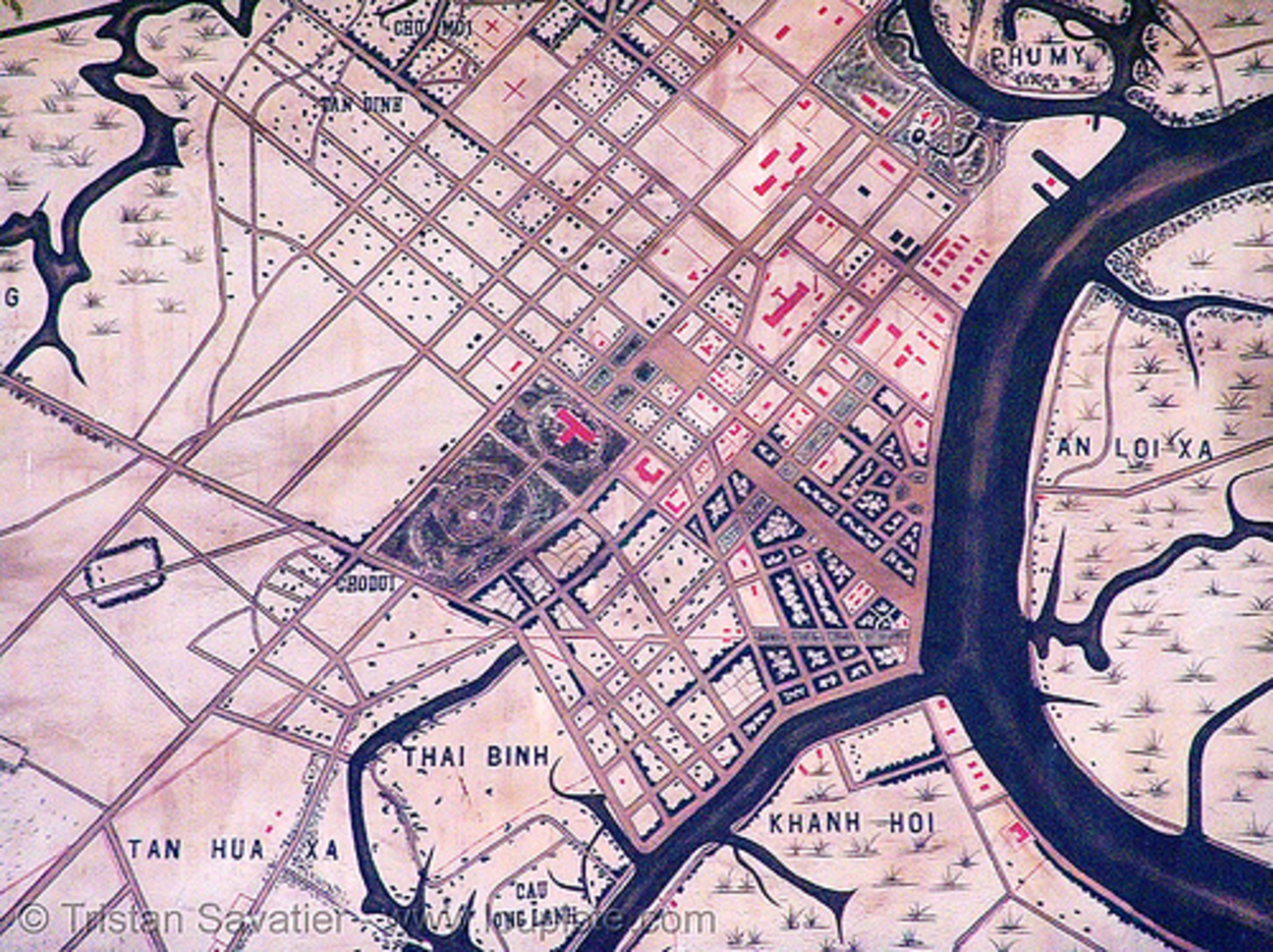
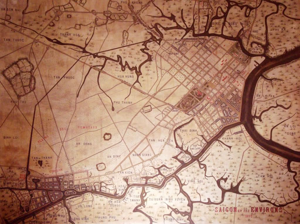
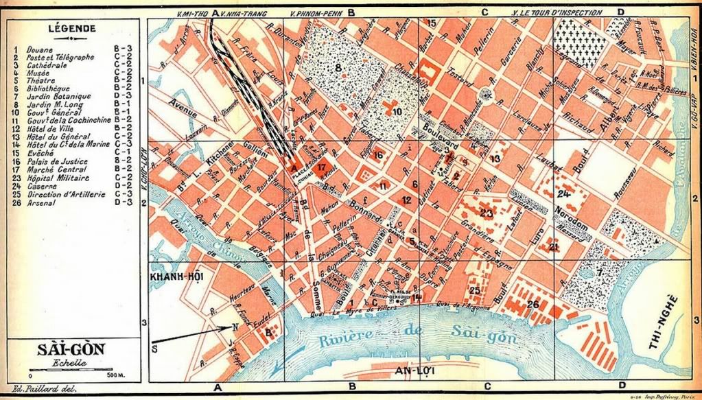
Saigon et ses Environs - 1892
Bản đồ Sài Gòn năm 1893
cl1893
1895
1895

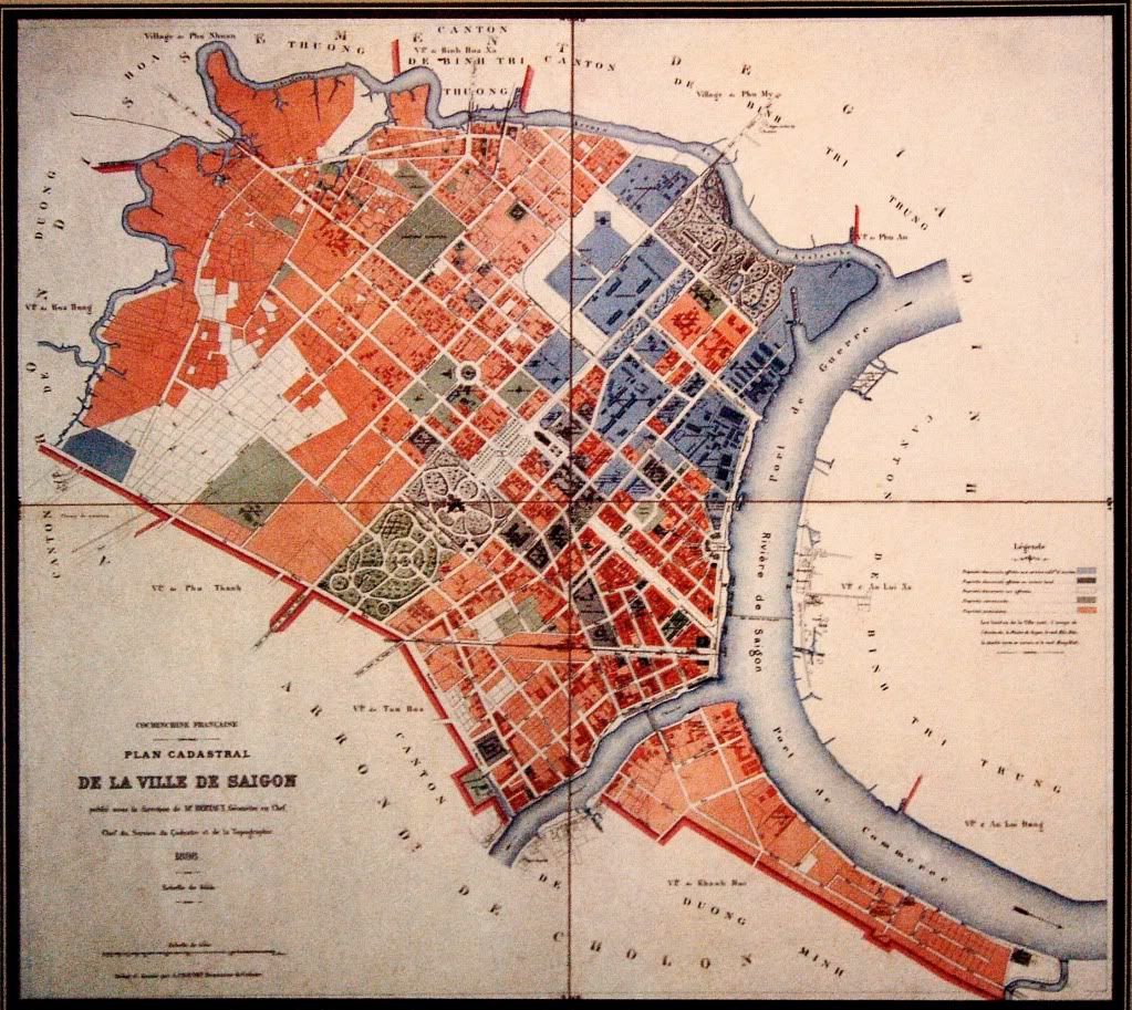
Plan Cadastral de la Ville de Saigon - 1896
1899
Plan de Saigon en 1903, in mémoires de Paul Doumer
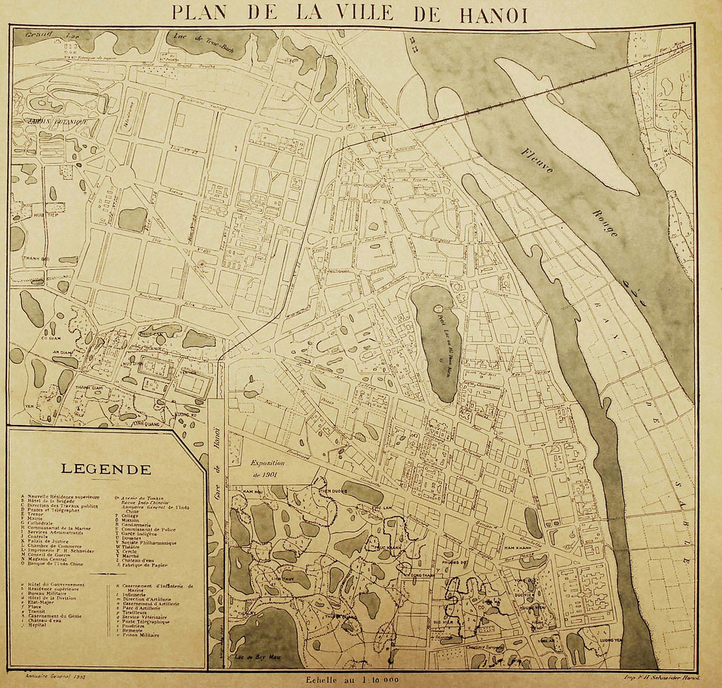
1901
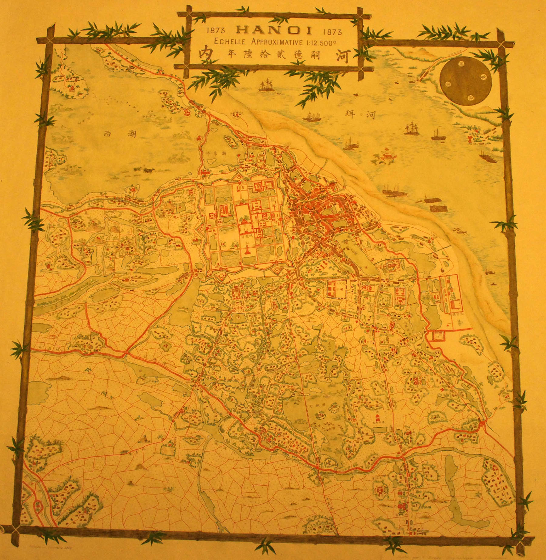
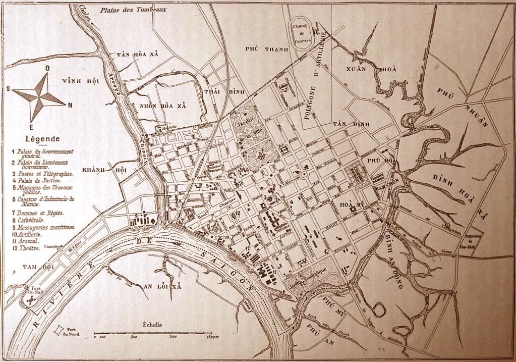
VILLE DE HANOI - Plan de 1905
1905
1905

Hanoi1909

1920

[Saigon Cholon]-1923

Cochinchine française. Plan de la ville de Saigon. Ensemble-1926

Bản đồ Sài Gòn 1928 (màu)
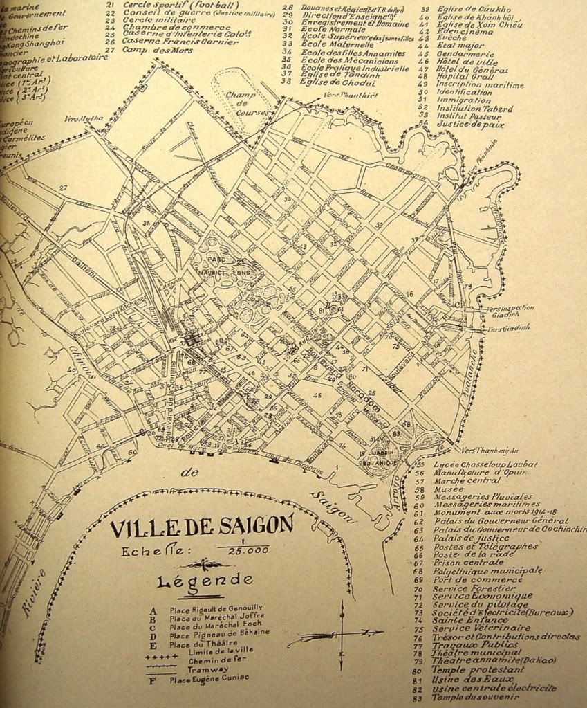
Bản đồ Sài Gòn năm 1931
Plan de Saigon - Atlas des colonies françaises, Grandier, 1934
1942
Plan des villes de Saigon et Cholon-1900-1940
Bản đồ vị trí quân Nhật ở Sài gòn-Chợ Lớn năm 1944-1945 được phân tích từ không ảnh do quân Đồng Minh chụp

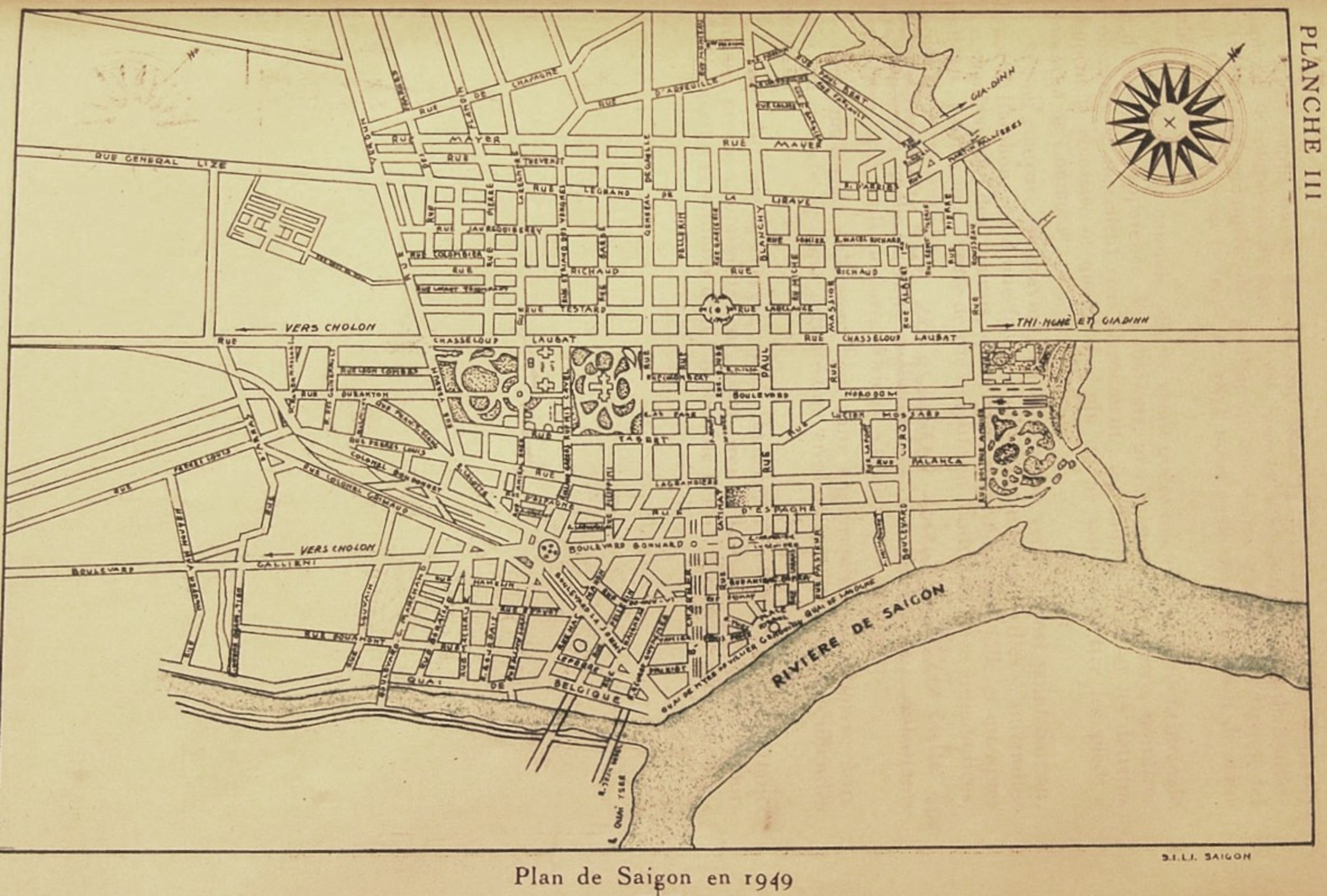
Plan de Saigon en 1949
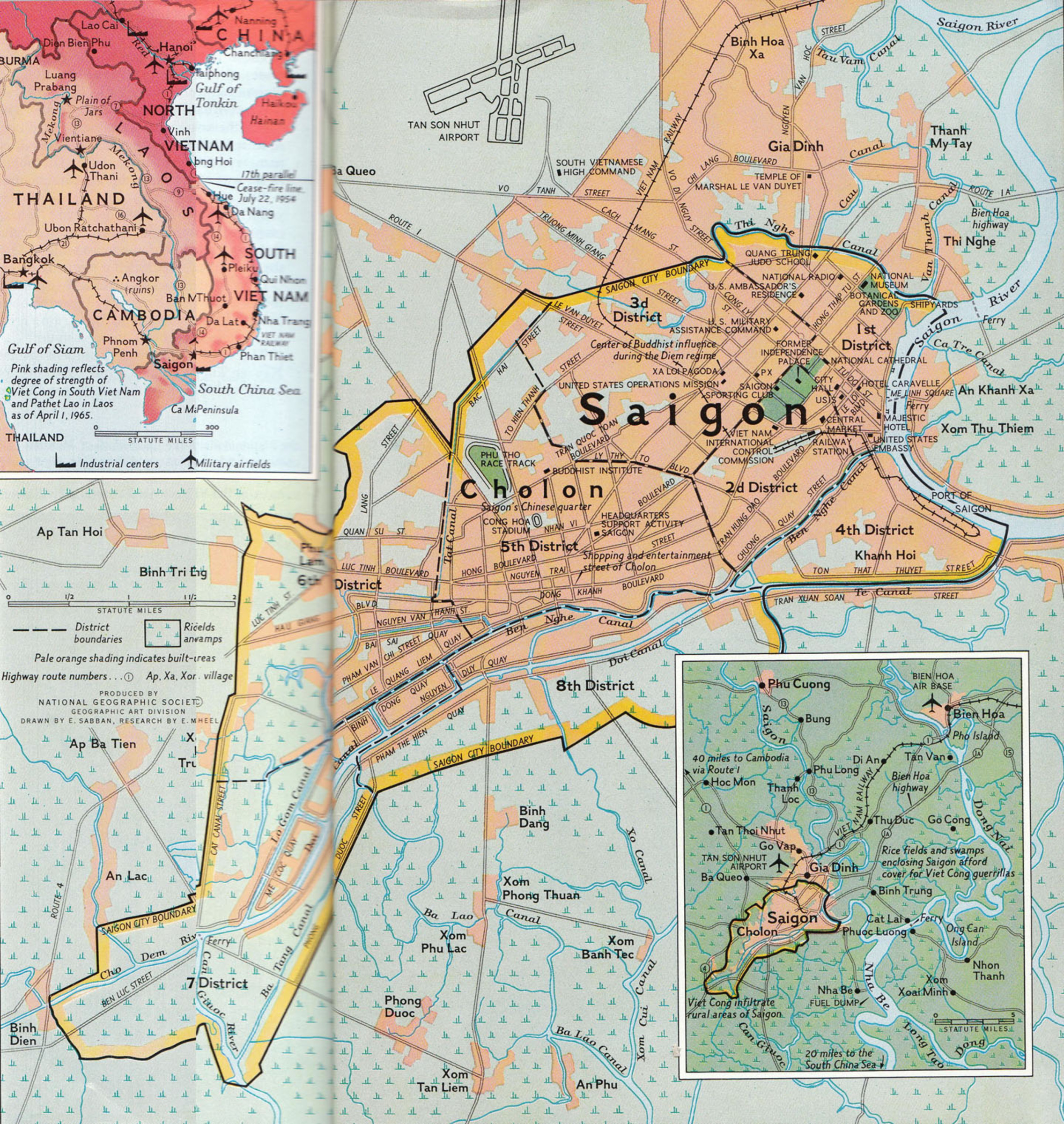
Bản đồ Saigon 1965
1966

1968
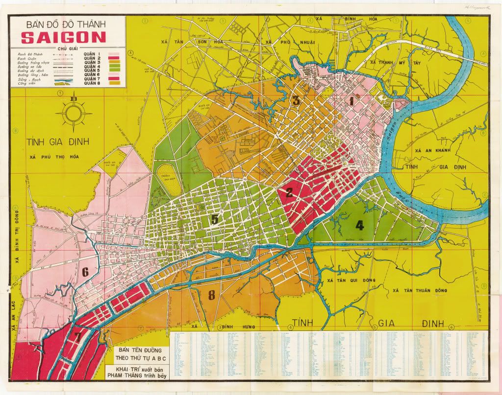
Bản đồ Saigon 1975


Không có nhận xét nào:
Đăng nhận xét
Lưu ý: Chỉ thành viên của blog này mới được đăng nhận xét.